Collections, Knowledge and Engagement
- BC Place Stadium
- Canada Place – the cruise ship terminal
- Skytrain
- Redevelopment of False Creek – the Expo 86 site
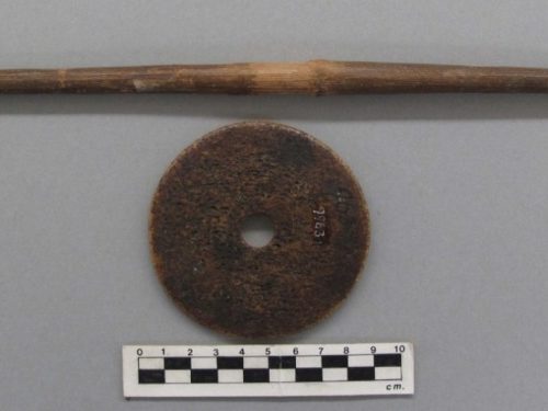
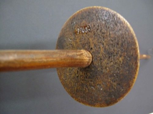
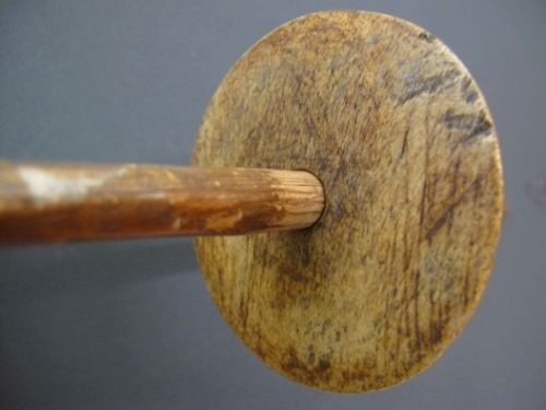
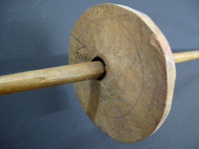
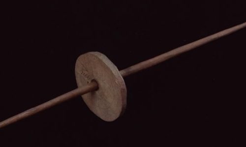
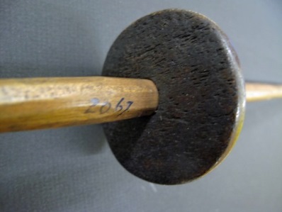
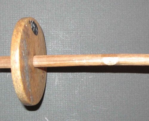
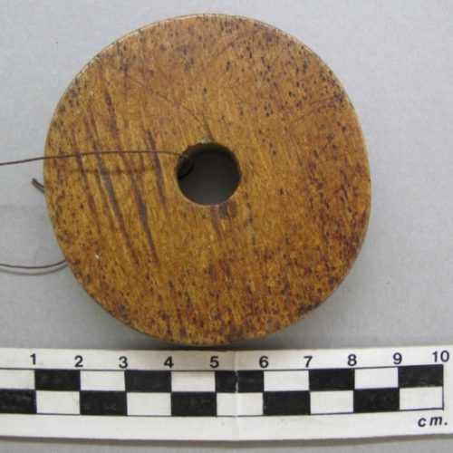
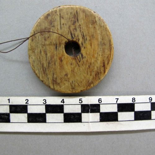
Small Spindle Whorls in the Ethnology Collection of the Royal BC Museum

Figure 1. Small Spindle Whorls in the Ethnology Collection.
Much of the attention in the literature has focused on the large spindle whorls used by speakers of languages in the Salish linguistic family on the south-eastern coast of British Columbia. In the 19th and early 20th centuries, small spindle whorls were found among peoples belonging to several of the larger linguistic families. The lack of iconography on most of these smaller spindles likely contributed to their being of less concern to researchers than the study of the larger whorls – many of which have geometric, anthropomorphic or zoomorphic design patterns.
The resurgence of indigenous weaving with the use of large spindle whorls in recent times has focused primarily on the use of animal wool. It earlier times the small whorls were primarily used for producing finer and longer threat made from stinging nettle. Stinging nettle thread would have been mass produced for the making of fish and bird nets as well as for a general tying string. Given that small whorls were introduced before the larger whorls, suggests that the earliest introduction of whorls into this region of North America was primarily related to the procurement of fish and birds. Although other plant fibres, such as fireweed, were likely used in earlier times, the use of animal hair and sinew along with plant fibres and bird down for clothing was probably a feature that developed later in time among some populations.
Morphology and Function
Most spindle whorls fall into two distinct sizes with a limited size range that we can refer to simply as large and small. The 20 smaller whorls in the RBCM ethnology collection range in diameter from 48mm–94.4mm. However, the upper range is biased by the three wooden whorls that range from 67-94mm. The diameter of the 17 sea mammal bone whorls ranged from 48mm-79mm. Wooden whorls are lighter than bone whorls and need to be larger to be of equivalent weight. The size of the hole in the whorl is related to the size of the whorl. Although the diameter of the central hole of the whorls ranges from 8mm-13mm, the smaller 48-65mm whorls have holes with a smaller range of 8-9mm.
The weight of the whorls in the RBCM collection can only be measured on ten whorls that are removed from their spindles or do not have associated spindles. The weight range of the 10 whorls is 16.6 – 45.9 grams. Where whorls were attached to the spindle, weights were taken of the combined elements of whorl and spindle. The range of the latter was 43.9-64 grams. The length and weights of the spindles used with small whorls was much less than those used with the larger whorls.
Regional samples are not large enough for any definitive comparisons, but comparing the more common sea mammal bone whorls, the three from the northern coastal regions are the larger in diameter range from 69.5-89mm. The five Heiltsuk examples range from 59-77mm, the three Nuxalk examples from 49-68mm, and the Kwakwala speakers six examples have a range of 48-69mm.
As a comparison, the seven bone whorls from Kwakwala speakers in the American Museum of Natural History have a similar diameter range as those in the RBCM of 40mm–80mm in diameter. Of the eight examples of Nuxalk small whorls in the Canadian Museum of History, three bone ones range from 50-64mm and five cedar ones range from 71-90mm. The five cedar Gitksan examples range from 59-95mm and two Tsimshian ones from 62-67mm. The one bone Nisga’a example conforms to the smaller size at 53mm. Two “central coast Salish” bone whorls in the Burke Museum range from 63-72mm, with a single stone Cowichan example being 50mm.
Sometimes the ethnographic literature is unclear about whether the smaller or large whorls are being referred to. Museum records may also have incorrect information added long after the whorls were collected – confusing the uses of small and larger whorls. Some small whorls were occasionally placed in ethnographic collections when, in fact, they were found in shell middens. In museum settings one needs to be aware that wool may have been added to museum spindle whorls for display purposes that were not part of the original purchase.
The size of spindle whorls differs according to the size and weight of the required thread. Most spindle whorls cluster into a standard small size and another grouping of larger varieties. The use of a small spindle whorl imparts a higher degree of twist and produces a finer and stronger thread than can be made with the larger spindle. It is for the latter reason that small whorls were primarily use for producing the finer threat made from stinging nettle. Stinging nettle thread was mass produced for the making of fish and bird nets.
The important considerations in the functioning of a spindle whorl are its weight or mass and its radius. The shape of the whorl and how its mass is distributed is also important. A spindle whorl with a lenticular cross section is thinner at the edges and will therefore have less inertia in its spin. A whorl must move at a constant speed in order to produce the best uniformity in the material being spun. The radius of the whorl and size of the spindle shaft will determine the size and weight of the fibre ball that accumulates on the whorl. For a technical functional analysis of spindle whorls see Barber (1991) and Loughran-Delahunt (1996).
In using the small spindle whorl, the yarn was fastened to the longer end of the spindle. A person sitting on the ground drew out the yarn with one hand as it was twisted and with their other hand rolled the spindle shaft below the whorl rapidly down the thigh or shin.
Ethnographic collections of small spindle whorls are found among the Nisga’a, Haida, Haisla, Heiltsuk (Bella Bella), some Tsimshian speakers, Nuxalk (Bella Coola), Kwakwala speaking peoples and Nuu-chan-nulth peoples. There are no examples of small whorls in the RBCM ethnology collection from First Nations
that belong to the Coast Salish linguistic family. Larger spindles from the latter region will be dealt with in Part 3 of this series. The RBCM collection does have archaeological examples of small spindle whorls from the latter area (see Part 1).
Practices & Materials Used
The ethnologist Franz Boas documented information on spinning and spindle whorls in the 1886 to 1897 period. He focused his attention on the Kwakwala speaking peoples of North-Eastern Vancouver Island and the Nuu-chan-nulth peoples of the West Coast of Vancouver Island, who he saw as being less affected by European culture at the time.
Boas’s First Nation consultants described four different sizes of spun thread that were used for different purposes. The method of free-dangling of the whorl was not practiced in British Columbia in the historic period.
Small spindle whorls are mostly made of sea mammal bone. Boas describes most spindle whorls from the west coast of Vancouver Island as being made of whale bone, with a few of wood and stone. Small spindle whorls in the Berlin Museum from the west coast of Vancouver Island have geometric and realistic designs. Among the “Kwakuitl”, Boas did not observe any with designs (Boas 1909:373-374).
Boas (1909:372-373), describes in detail the making of twisted stinging nettle string which is coiled up in a basket and then spun. His figure 67 shows a 34cm long, quarter section maple wood spindle shank with a small whorl attached near the thicker middle. He notes:
“The spindle-whorl is made of bone of whale, the anterior part of the skull-bone being preferred. It is ground down on a gritstone. Then it is polished, and finally rubbed with deer-tallow. The size of the spindle-whorl differs somewhat, according to the size of the thread to be made. The sizes of those in the Museum [Berlin] collection range from 7cm to 8cm. in diameter. They are not decorated. Many of the spindle-whorls from the west coast of Vancouver Island (Fig. 68) are decorated with geometrical and realistic designs. Most of these are also made of bone of whale, while a few are made of wood and of stone.”
Boas notes that his figure 68a “corresponds in style to other decorated tools of the Nootka”. He states that: “it is remarkable that the spindle-whorls from this whole region are all small, while spindles used by the tribes of the Fraser River region are very large”.
Carved figures of humans and animals are rare on small spindle whorls. Boas’s figure 68, is reproduced here as Figure 2. His figure 68a shows a squatting human with the central hole for the spindle through the centre of the figures chest. The figure is cut out within a solid ring forming the outer portion of the whorl. This figure is reminiscent of some of the later larger whorls from south-eastern Vancouver Island with human figures around a central hole. Three of the top row images and one of the bottom images show the designs that Boas refers to, while the plain ones on the bottom row are typical of the Kwakwala speakers of North-eastern Vancouver Island. These same whorls are incorrectly referred to as being from the “Lower Fraser River” in a later Boas publication (1955:371; fig. 296, p.283).

Figure 2. Small Spindle whorls from the west coast of Vancouver Island collected by Franz Boas for the Berlin Museum in the late 19th century (After Boas 1909, fig.68).
Washington State. Uses of the Spindle Whorl.
In reference to the southern coast, James Swan notes that the women “spin the thread and twine for making nets. This operation is performed in a very simple and primitive manner by twisting the strands between the palm of the hand and the bare leg …these cords, when spun, are tied up in hanks of thirty or forty fathoms each, and carefully stowed away for future use. The men make the nets” (Swan 1969:163-164).
The nets “are made of a twine spun by themselves from the fibres of spruce roots prepared for the purpose, or from a species of grass brought from the north by the Indians. It is very strong, and answers the purpose admirably. …The nets vary in size from a hundred feet long to a hundred fathoms, or six hundred feet, and from seven to sixteen feet deep” (Swan 1969:104).
Newcombe notes: “String is made by joining strands of nettle fibre by rubbing them on the thigh and then twinning them together by means of a small spindle-whorl. Sometimes these are carved with a crest of the owner” (Newcombe 1909:37). Unfortunately, Newcombe does not give any specific examples of whorls with iconography that represents an owner’s crest.
Ethnologist Wayne Suttles noted, from information collected in the 1950s, that among the Central Coast Salish speakers:
“Weavers also made a fabric of yarn produced by mixing waterfowl down with nettle fibers, and they made pack straps by twinning on suspended warps, incorporating some of the design elements seen in the blankets” (Suttles 1990:462). There is no mention here of the size of the spindle.
Suttle’s First Nations consultant Julius Charles (born about 1865. Father Semiahmoo and mother Lummi) noted that during winter hunting men wore a buckskin jacket over a bird down and nettle fibre undershirt (Suttles 1974:262-265).
During his field research in Washington State in 1925-27, Olson interviewed five Quinault First Nation consultants that were all over 60 years old, with one, Bob Pope, being over 90. Olson was informed that there were four sizes of nettle thread. Netting was made from two of these threads spun together. The same method was used for the Mt. goat and yellow cedar (Olson 1936).
“The familiar rabbit skin blanket of western North America was also made. The skins were cut into strips and these twisted hair side out, a spindle being sometimes employed. The strips were either woven as a simple cross weave or, probably more usually, used only as the warp, the weft consisting of elk sinew threads twined in at intervals. The skins of ducks were sometimes cut into strips, which were twisted and woven in the same fashion as the strips of rabbit fur” (Olson 1936:82). No mention is made if different sizes of whorls were used for the production of different materials.
Olson refers to the sheared dog hair being placed into “a cleft stick to keep the hairs aligned”. Here he clearly describes the use of the larger whorls:
“Twisting of this hair into yarn was done simply with the fingers (Pope) or by means of a spindle which was rolled down the thigh. The spindle was eight inches or so in diameter (210-220mm). A third informant stated that a spindle (without whorl) which had a hook at its tip was used to pick up the tufts of hair out of the split stick, the spindle being merely twisted by the fingers of the right hand. The yarn was then rolled into balls. Few (or none?) blankets were woven with both the warp and weft of this yarn, twisted elk sinew being woven or twined in as the other element” (Olson 1936:82).
Nuu-Chan-nulth of the West Coast of Vancouver Island
It is unclear whether small spindles were being used among some Nuu-Chan-nuth peoples in 1792. Don Francisco Mosino observed the women at Yuquot “are mainly engaged in the sedentary occupations of spinning and weaving”. But he then suggests that they do not have spindles in his reference to “distaffs”. He points out that: “They have no distaffs except their teeth and fingers, with which they bind together cypress [cedar] fibre and otter hair in order to form a thick plait. This they then make thinner and longer, until they have a skein about a foot long. They use the most simple looms, making a warp out of a cane set horizontally at a height of four and a half feet from the ground; they move their fingers along it rapidly in different directions and with extraordinary skill, making up in this way for the lack of tools which would in any other case be necessary and indispensable for this work.” (Jane 1971:107).
Drucker, working among the Nuu-Chan-nulth (1951:94), notes that after beating cedar: “A part of the strands were woven into thin cord to be used in weaving the robes, rain capes, and women’s aprons. Spinning of this, and all other cordage, was done by hand, on the bare thigh. Spindles have not been used within the reach of modern folk-memory. Several informants recalled having seen Nitinat women spinning with large wooden spindle whorls, apparently like those of the Coast Salish. Presumably the practice of spinning with small bone and stone spindle whorls went out of use very early.”
The observations of Nitinat women using large spindle whorls is interesting in light of the suggestion that the Nitinat, or at least some of them, once spoke a Salish language (Drucker 1951:94). In 1861, a settlement of “Cowichan” were recorded as living “near San Juan harbor”. The British Colonist reported that: “Some years ago this tribe was a very numerous one, but through wars and disease it has been reduced to only twenty men and women” (The British Colonist, March 9, 1861:3). Chief Charlie Jones told the story of how people from Cape Flattery “took over Nitinat Lake for a period” before the coming of Europeans (Arima 1983:105).
The Iconography on Small Spindle Whorls
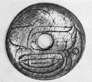
Figure 3. Small carved bone whorl (after Miles 1969:186 fig. 7.146).
There are few small spindle whorls in ethnographic collections with designs of any kind. Unique examples include one collected in 1893, by Adrian Jacobsen at Bella Bella (old RBCM #454). It has a frog on one side and what is described as a “mountain spirit” on other side. The “mountain spirit” has a human-like face with round eyes, heavy eye brows and raised cheeks. A Nuu-chan-nulth example (figure 2) collected by Boas in 1886-1897 shows a squatting whole human figure, but no interpretation of the image is given. Like some later images on large whorls of speakers of Salish languages of Vancouver Island, the hole for the insertion of the latter spindle is centered in the body of the human figure. A unique design can be found on a whale bone specimen (on a short spindle) from a private collection pictured in Miles (1963:102 & 186). It is a more stylized modernistic image (figure 3) that may represent a bird head with the hole representing an eye, or it is a combination of symbols. Miles describes this “Northwest Coast nettle fibre spindle” as having a “design Haida in character”.
It is interesting that geometric designs exist on small pre-contact stone and bone whorls from locations on the south coast and into the southern Interior but are not found as ethnographic examples.
The Ethnology Collection
Nisga’a
RBCM 1692 A,B – (with spindle A); (old #480). Nisga’a. Gitkateen. Lakalsap. Whorl: Wood. Flat. Diameter: 79-81mm; th. 9-9.3mm; hole dia, 12mm. Weight: 16.6 grams. Flat edge irregularly cut. There are two small nails in the edge on opposite sides of the whorl used for the purpose of strengthening the crack across the centre of the whorl. Purchased by Charles Newcombe in 1912. Newcombe notes: “Spinning wheel Lagiauks, spindle turned by right hand on right leg. Rest stick Watuqs”. Spindle: L: 377mm; Thickness: 10mm near center; Weight: 14.5 grams. Whorl is removed from spindle but originally near center.
RBCM 1693. Nisga’a. Stone. Large hole. Four carved oval eyes on one side. Weight: (not available). On artifact “1088”; “26 (?) 13”. Lakal? “Mark Tait, Skimmer for (BD?) GR Equals Hadaq 2.00, whirl of stone equals Hagia KS 2.00 NTBK 29A. Purchased by Charles Newcombe in 1913 from Mark Tait. Lakalzap. Greenville, Naas River”. Transfer to Nisga’a First Nation (No image).
RBCM 15908 B – (with spindle A), Nisga’a. Lakalsap. Gitkateen. Sea Mammal bone. Flat edge. Whorl: dia. 69.5-71mm; th. 9.5-13.5mm (thicker toward middle); hole dia. 11mm; Whorl Weight: 32.3 grams. Whorl positioned 21cm from one end. Spindle L: 478mm; Weight: 29.5 grams. Purchased in 1977 from Queensway Trading in Terrace, B.C., who purchased it earlier from Mr. Sam Green of Greenville.
Haida
RBCM 9963a&b. (with spindle) (old #963). Bone. Near flat disc. Slightly concave on both sides. Weight: 45.9 grams. Diameter: 83 by 84mm; hole diameter 13mm. Thickness: 4mm on outer rim to 7mm near inner hole. Spindle, wood. Length: 430mm. Thickness: maximum 13mm. Collected by Charles Newcombe in Masset, Oct. 1, 1913. (Newcombe Family papers. Add. Mss. 1077. Vol. 40, Folder 7. Subject Files, Series B: Collections. Photo by Newcombe, Nov. 1917, EC575 glass plate). Collected in 1913. From estate of William Newcombe 1961.
Haisla
RBCM 2066a,b. (with spindle); “Kitimat”. Wooden whorl. Maple? Diameter: 88.2X94.4mm; pencil line circle inside 73X77mm; th. 11.8X16.5mm (thicker near middle), whorl centered toward one end on spindle; hole dia. 11mm (slight burned area in hole). Edges flat and roughly carved. Spindle of Cedar. Length: 530mm; Thickness: 112.5mm. Weight: 64 grams. Whorl located 18cm from one end and fixed on spindle. Weight of spindle and whorl: 64 grams. Collected by Charles F. Newcombe in 1911 from Mrs Robinson of Kitamaat.
RBCM 2067a,b. (fixed on spindle) (KW) “Kitamaat”. Sea mamal bone. dia. 59.5mmX65mm; th. 80-89mm; hole dia. 12mm. Spindle of cedar: L: 523mm. Thickness: 13.5mm. Whorl 230mm from one end, near center. Combined weight of whorl and spindle: 57.8 grams. Charles F. Newcombe 1911.
Heiltsuk (Bella Bella)
RBCM 449a & b – (with spindle) Bella Bella. Sea mammal bone. (1893, F. Jacobsen) diameter 62.7X65mm across hole. Broken. Whorl position off centre. th. 8mm; hole dia. 9mm. Whorl fixed on cedar spindle, combined weight 49.8 grams. Spindle L: 32.4 (small portion of end broken); Width: 8.6mm. Preliminary Catalogue 1898: “Wooden spindle, with bone whorl and native wool”.
RBCM 450a & b – (with spindle) Bella Bella. (1893, F. Jacobsen); Sea mammal bone. Flat body and edge. dia 71-77mm; th. 8.3-8.8mm; hole dia. 11mm; Spindle L: 550mm; Th: 10.3mm. Whorl fixed on spindle. Combined weight: 62.3 grams. [Recorded in 1898 catalogue, p. 164].

Bella Bella spindle and whorl. RBCM 450&450b.
RBCM 451 (with spindle). Bella Bella. (1893, F. Jacobsen); sea mammal bone. Flat whorl; Edges flat with rounded corners; dia. 60X63mm; th. 5.9 – 6.4mm; hole dia. 11mm. Spindle: L 545mm; Th: 11.2. Whorl centered at 280mm. Combined weight of whorl and spindle: 51.8 grams.
RBCM 452a & b. – (fixed on spindle). Bella Bella. Sea mammal bone; dia. 58.8X59mm; th. 95mm; hole 11mm. Cedar Spindle: L: 410mm; Th: 10mm. Whorl 160mm from one end. Combined weight of whorl and Spindle: 48.9 grams. Whorl fixed on spindle. Collected in1893 by F. Jacobsen.

Bella Bella Spindle and whorl. Ethnology RBCM 452a&b.
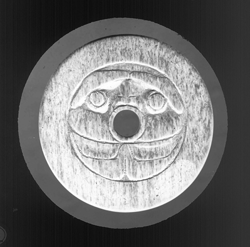
Bella Bella spindle whorl. Mountain Spirit design. RBCM 454.
RBCM 454 – Listed in Old Catalogue as “Kwakuitl”. “Carved bone whorl. “Frog on one side, mountain spirit on other”. “A. Jacobsen 1893, Bella Bella.” Acquired April 1909. The 1909, Guide to Anthropology Collection in the Provincial Museum repeats this information on page 37: “No. 454 has a frog on one side and a mountain spirit on the other”. The label of Newcombe’s Lantern Slide, EC374, has “Bella Bella Spindle whorl” on it. This artifact was stolen when on loan for an exhibit in Vancouver in 1936. A poor quality caste is located in the archaeology collection as Y-806 (75-7). The connection with this and #454 had been lost until now. The cast is nearly flat: Diameter: 67-68mm. Thick: 7.0mm at center and 6.5mm at the edges. Hole diameter: 10mm. Black and white photograph #22603. The “mountain spirit” has a human-like face with round eyes, heavy eye brows and raised cheeks. Newcombe EC374 “glass plate”, 1909 – copied as PN 1337 – shows the same image. Photograph 721 shows the frog design from Newcombe’s 374-IX/69, 1909, and a different version of the same frog image in photograph 721-A – listed as EC 374 – IX/69, 1909.
Nuxalk (Bella Coola)
RBCM 2978 – (fixed to spindle) Bella Coola. Wooden whorl. Dia. 76X82mm; Th. 12-19mm (thickens toward middle); hole 10mm; Hardwood Spindle. L: 440mm; Th: 10mm. Whorl near middle of spindle. Combined weight of spindle & whorl: 59.5 grams. (purchased from Capt. Schooner, 1917); (in image PN11455).

Bella Coola Spindle and Whorl. RBCM 2978.
RBCM 9986 – (moveable on spindle); Bella Coola; sea mammal bone, flat. Dia. 66X68mm; th. 12-14.5mm; hole 10mmm; Flat edge with 3mm inset low area; Weight: 26.5 grams. [1914, ex Gibson coll. “Bought at Van. Canadian Handicraft Guild 6/8/14”, then into Newcombe collection; old # 986]. Spindle: L. c400mm; Whorl positioned mid-way, c, 200-210. Spindle weight: 16.2 grams. Old #986. Pencilled at center of spindle: “Spindle Ex… Gibson. 1914”.

Bella Coola RBCM 9986.
RBCM 10112 – (fixed on spindle) Nuxalk; Flat sea mammal bone. Dia. 49-51mm (squarish); th. 11.0-12mm; hole dia. 9mm. “Bella Coola” in ink on one side. Old # 1112. Cedar spindle. L: 515mm; Th: 9mm. Positioned between 260mm and 270mm on spindle. Combined weight of spindle and whorl: 43.0 grams. Newcombe, June 1917. Newcombe photo EC575. Nov. 1917.

Spindle and Whorl RBCM 10112.
RBCM 10113 – (no spindle) Bella Coola; Flat sea mammal bone. Flat edge with rounded corners. Weight: 33.8 grams; dia. 65-65.9mm; th. 6.5; hole dia. 12mm; Slightly burnt. Newcombe collection, old # 1113, glass plate photo, Nov. 1917, EC575.
Kwakwala Speakers
RBCM 2068 – (no spindle); Alert Bay. Sea mammal bone. Weight: 71 grams; dia. 67.1X69mm; th. 14.1-14.4mm; hole dia. 13mm. (old C.F. Newcombe #359. Collected in 1912).
RBCM 2069 (no spindle); (KW); Sea mammal bone. Weight: 25.4 grams. dia 55mm; th. 6.6-7mm; hole dia. 11mm; (19-21mm radius shift from edge of hole). Flat with flat edges. (old C.F. Newcombe #360 collected in 1912).
RBCM 2070 – (no spindle); Alert Bay; Sea mammal bone. Weight: 19.7 grams. Diameter: 47X48mm; th. 6.1-6.3mm; hole dia. 9mm; Flat with flat edges. (old C.F. Newcombe #361, collected in 1912).
RBCM 6530 – (with spindle) (KW); Sea mammal bone. Diameter: 58X62mm; th. 8X8.2mm; hole dia. 8mm. Combined whorl and spindle: 48 grams. Fixed Whorl, located 15cm from one end of spindle. Spindle: L. 406mm; Th: 8.2mm. Acquired 1947. “Spindle with whale bone whorl for nettle fibre plain”. “Canon A. J. Beanlands Coll. Per Mrs. Alyson N. Beanlands. Collected about 1884-1909”.

Kwakwala. RBCM 6530.
RBCM 10090a, b. (with spindle) (KW); Sea mammal bone. Diameter: 63.4X65.2mm; th. 6.1- 6.6mm. Hole dia.: 11mm, Whorl weight: 8.9 grams. Slightly burnt by design. Cedar spindle. Whorl centered on Spindle. Spindle: L. 343mm; Th: 11mm. Kingcome Inlet. Old # 1090 written on center spindle under hole and on flat of whorl.
RBCM 10448 – (no spindle) “Fort Rupert, Tsaxis”. Sea mammal bone. Diameter: 59mmX61mm; th. 6-6.5mm; hole dia. 11mm. Weight: 22.9 grams. [old #1448].

RBCM 10448. Kwakwala.
Nuu-chan-nulth

Stone Whorl. RBCM 12691.
RBCM 12691 – (no spindle); Quatsino. Grey Slate. dia. 72mmX73.8mm: th. 6.9-7mm; hole dia. 10mm. Painted red, green and black. Made with steel file. Two incised circle grooves on painted side. Whorl off center. Weight: 59.7 grams. No design on one side. Modern non-traditional whorl. It was likely made as a model for sale.
Comments on some Ethnographic and Historic Accounts
There are many references to spinning that can refer to spinning by twisting fibre by hand on the knee or references that do not specify the size of the spindle whorl. In a prospecting tour of the north coast James McKenzie notes that going up the Nass River he passed five villages during which he observed the spinning of “goat hair garments for women” without mentioning the use of a whorl (McKenzie 1864:3).
Morice observed in 1892-93 that: “rabbit skin blankets were originally the only genuine textile fabric manufactured among “the Carriers, the Tsekehne or the Tsilkohtin”. Strips of rabbit skin were tied together and twisted on the thigh, and used as both warp & weft stands on a frame, but he notes that the Carrier did not use a spindle and whorl. He does illustrate a spindle with a whorl used by the Chilcotin, but does not indicate if it is small or large one (Morice1892:156).
Further south along the Columbia River-Upper Arrow Lakes region on May 7, 1814, Gabriel Franchere observed: “Natives camped on the bank of the river” – “The women at this camp were busy spinning the coarse wool of the mountain sheep, They had blankets or mantles woven or platted of the same material, with a heavy fringe all round…”. Near Rocky Mt. House Franchere notes in reference to “Mt. Sheep wool”, that: “The Indians who dwell near the mountains make blankets of it, similar to ours, which they exchange with the Indians of the Columbia for fish and other commodities” (1968:231-32; 216). No mention is made of the use of a whorl.
One of the more extensive commentaries on spinning, weaving and their similarity between the Fraser Canyon and the Lower Fraser River was made in a 1908, letter from James Teit of Spencer’s Bridge where he refers to blankets from Spuzzum that the daughters of Joseph McKay (of the HBC) were trying to sell to the Provincial Museum. It appears that the commentary here refers to the larger whorls being used in the Fraser Canyon area:
“I intended writing you before, but was waiting another chance of interviewing the Spuzzum woman. I saw her again a few days ago. She says she never saw a loom exactly like the one in Nootsack, and are different from the ordinary large blanket loom, the horizontals being different and not made to turn, and the head band is made in a simple piece stretched up and down, and not over the horizontals. (The only way to get a proper idea of this kind of loom will be to have one made). As I am going to Vancouver …on my way back I will try to stop off at Spuzzum and get one of these small looms. She said she never heard of any combs being used. The weaving being done with the fingers. Re: the breed of dogs she says the pure breed was totally extinct around spuzzum before she can remember, but she has heard from the old people they were a medium sized animal with long and very fine thick hair. They were mostly white but some it is claimed were black. They were a distinct species according to tradition introduced from the Lower Fraser, and were to be found nearly as far East as Lytton. The Indians tried to keep them from inter-breeding with the real Interior dog, and around Spuzzum favored the keeping of them rather than the former. Their hair was used in blanket weaving at Spuzzum, generally mixed with the wool of the goat. People who did not have any of these dogs used only goat’s wool. The using of dog’s hair it is said made the blankets of a softer texture & furthermore they supplied a source of wool right at hand, whereas the goats had to be hunted and their wool thus cost considerable labor.
These dogs were of altogether a different species from the common dog of the Thompson further east and were called by the special name of xlitselken. The other dog called skaxaoe (viz real dog) somewhat resembled the husky and also bore some resemblance to the Coyote and to the wolf with both of which they occasionally inter-breed. They were used mostly for hunting purposes. Re: the dyes used with blankets etc. The common colors were yellow, red & black. Yellow was obtained from Wolf moss (evernia vulpina I think is the botanical name) red from alder bark, and black bear’s hair for black. The hair of black dogs was also used when obtainable viz black specimens of xletselken. She has however heard of the following dyes also being used viz red ochre (giving a reddish tint) roots of oregon grape (yellowish) berries of the cedar (greenish), Possibly other dyes like those used amongst the Upper Thompson may also have been used, but she does not know. The ring you speak of as being used to keep up tension when the Weaver was spinning the loose wool on the spindle I have seen in use on the Lower Fraser. They were made of both wood and stone. I saw a lot of stone ones at Musquiam village, and at several points on the Lower Fraser Indians told me these stone rings were used for this purpose of course the wooden rings were much more common. As to judge from your description of Mrs. McKay’s blankets it is very unlikely the material is dog’s hair, and the dyes native. I think this is all I can tell you about these blankets at present – the weaving, and the preparing and spinning of the wool was just the same at Spuzzum as on the Lower Fraser & southern coast. I would like to keep the prints you sent me if you do not require them. …I sent a specimen of the earth (in prepared state) used for cleaning or taking the oil out of the wool to the Amer. Museum. …” (Teit 1908).
Summary Commentary
It is important to discuss the differences between small and large spindle whorls, as they often have different uses and different regional histories. Where spindle whorls came from is still a question waiting to be answered. Bone spindle whorls have been found in archaeological sites stretching from the American gulf Islands to the central coast of B.C., but their dating is unknown or their placement is within broad time periods. For example, King notes a spindle whorl in the Maritime phase of San Juan Island with a broad time frame of 500 A.D. to 1500 A.D. and suggests that: “The occurrence of a spindle whorl in the Maritime strata in conjunction with the needles and the remains of small dogs, mountain sheep, and mountain goat makes it highly probable that the Maritime phase may mark the beginning of the weaving of wool and hair in the southern Northwest Coast area” (King 1950:81). As in other cases, the spindle whorl could date to the last centuries of the time sequence given.
There are no solid examples of small spindle whorls dating before about 600 years ago. Carlson (1971) indicates that the three whalebone whorls from the Kwatna Inlet site FaSu-2 are of the late period from A.D. 1400-1800. Small stone whorls of a pre-contact age with geometric designs appear in the Fraser Canyon, but historic period references pertain to the larger whorls common on the southern coast in the historic period.
In Mesoamerica we see the establishment of ceramic and stone spindle whorls by the late Preclassic period 400-250 B.C. and early Early Classic period 250-600 A.D. and their considerable expansion by the Late Classic period 600-900 A.D. In Mexican spindle whorls (particularly the larger whorls for spinning maguey fiber) were decorated with incised and mold-made designs, but the production of decorated whorls stopped during the 16th century (Brumfiel 1997). The influence of spindle whorls appears to have spread from Northern Mexico to the American Southwest where small spindle whorls appear in the Pecos culture of New Mexico around 1100 A.D. and spread throughout the American Southwest. The latter were made of bone and ceramic with the bone examples mostly in the 5-10cm diameter range (Kidder 1932). More precise dating of spindle whorls in British Columbia is needed to tell the story of when and where they came from and the economic and social context of how they diffused over the landscape under various cultural trajectories.
Bibliography
Arima, E.Y. 1983. The West Coast (Nootka) People. British Columbia Provincial Museum Special Publication No.6.
British Colonist. 1861. The Squaw Murder. The British Colonist, March 9, p.3, Vol. 5. No. 69.
Brumfiel, Elizabeth M. 1997. Tribute Cloth Production and Compliance in Aztec and Colonial Mexico. Museum Anthropology. Journal of the Council for Museum Anthropology, 21(2)55-71.
Carlson, Roy L. 1971. Excavations at Kwatna. Anutcix (FaSu-1) and Kwatna Phase sites. FaSu-1 and 2. Late prehistoric A.D. 1400-1800. Salvage ’71. Reports on Salvage Archaeology Undertaken in British Columbia in 1971. Edited by Roy L. Carlson. Department of Archaeology, Publication No. 1. Simon Fraser University, Burnaby British Columbia.
Drucker, Philip. 1951. The Northern and Central Nootkan Tribes. Smithsonian Institution. Bureau of American Ethnology. Bulletin 144. United State Printing Office, Washington,
Franchere, Gabriel. 1968. (Ed. Milo Milton Quaife). A Voyage to the Northwest Coast of America. Citadel Press, New York. pp. 231-32; 216.
Jane, Cecil (Editor). 1971. A Spanish Voyage to Vancouver and the North-West Coast of America. N. Israel/Amsterdam. Da Capo Press. New York.
Kidder Alfred Vincent. 1932. The Artifacts of Pecos. New Haven. Robert S. Peabody Foundation for Archaeology. Yale University. Pp1-314.
King, Arden. 1950. Cattle Point A stratified Site in the Southern Northwest Coast Region. Memoirs of the Society for American Archaeology. Number 7. Published Jointly by the Society for American Archaeology and the Tulane University of Louisana. Menasha, Wisconsin, USA. Supplement to American Antiquity, Vol. 15(4), part 2, April 1950.
McKenzie, James. 1864. Prospecting Tour of the North West. Victoria Evening Express, September 9, 1864:3).
Miles, Charles. 1969. Indian and Eskimo Artifacts of North America. Bonanza Books, New York.
Morice, 1892-93. Notes on the Western Dene. Transactions of the Canadian Institute. Vol. IV.
Olson, Ronald. 1936. The Quinault Indians. University of Washington Publications in Anthropology. Volumne VI, Number 1. University of Washington Press. Seattle and London.
Suttles, Wayne P. 1990. Central Coast Salish. Handbook of North American Indians – Volume 7: Northwest Coast, William C. Sturtevant General Editor, Smithsonian Institution, Washington, pp. 453-475.
Suttles, Wayne P. 1974. Coast Salish and Western Washington Indians 1. The Economic Life of the Coast Salish of Haro and Rosario Straits. Garland Publishing Inc. New York.
Swan, James G. 1969 (1857). The Northwest Coast. Or, Three Years’ Residence in Washington Territory. University of Washington Press. Seattle and London.
James Teit. 1908. Letter of January 3, 1908 to Charles Newcombe. Newcombe Family Files, RBCM Archives.
Fieldwork 2018
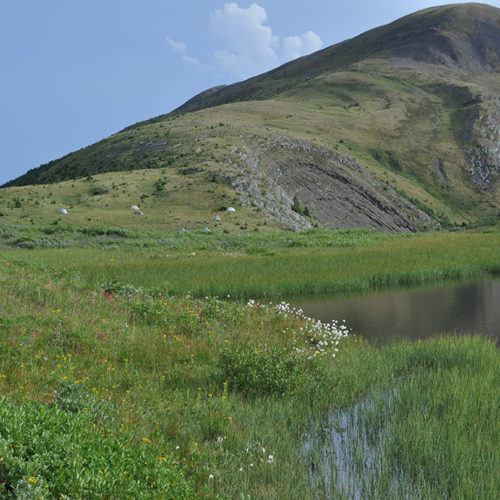
This year’s fieldwork was our 17th in the alpine of the northern B.C. We made collections from six mountains. The area is so vast and remote and access is difficult, thus few if any biological inventories have been undertaken in many large areas. Many peaks and lakes have no names; in fact there are no names on entire mountain massifs. I feel like we are to some degree just ‘scratching the surface’ of what is out there.
We again worked together with the insect and spider experts at the museum. And we followed our typical approach of setting up camp for 2-3 days and collecting specimens of every species we encounter, being intentional to reach as many different habitats as possible.

Typical day of hiking (dotted line) and collecting, striving to reach as many habitats as possible. Upper part of figure documents elevation changes during the day. Three of the four plants in this illustration were encountered only once, highlighting the importance of having several botanists in the field and covering as much ground as possible.
At one mountain, Mt. Whitford, we were joined by two staff and a contract photographer of the Yellowstone to Yukon Conservation Initiative https://y2y.net/about-us and their guest freelance journalist who produces pieces for both CBC and NPR. At a second mountain, south of Tumbler Ridge, we were joined by two staff members of the Tumbler Ridge Geopark, http://tumblerridgegeopark.ca/. What is a Geopark? According to their website “A UNESCO Global Geopark is an area recognized as having internationally significant geological heritage.” These groups are all interested in knowing as much as possible about the biota of these areas and we will share everything we learn with them.
As we have in the past, we contacted the local indigenous groups and informed them of our work and will provide them species lists when the identifications are complete.
We are often asked if we notice any of the effects of climate change during our fieldwork. Treeline is controlled by temperature, not elevation and is highest at the equator – where temperatures are warmer at higher elevations – and becomes lower and lower further north and south. One likely consequence of a warming planet is that forests will advance into the alpine, reducing the available habitat for tundra plants that generally require open, i.e. non-shaded habitats.

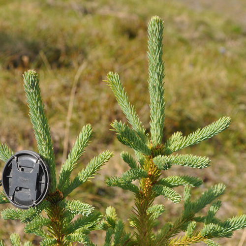
Young trees in alpine meadows at 1750 m north of Laurier Pass, Graham-Laurier Provincial Park. Note the dark skies of a storm about to dump
For a number of years I’ve noticed small trees in the alpine and of course wonder if their appearance is related to climate change as a consequence of global warming. I’ve also noticed the absence of dead trees. The absence of dead trees may mean that tree populations in the alpine are relatively young, compared to lower elevation forests where trees have been growing and dying for thousands of years.
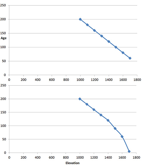
Two hypothetical graphs of tree age versus elevation curves. The upper one portrays trees that become gradually younger with elevation gain, much as one might expect if treeline was moving higher gradually. The hypothetical curve on the lower graph describes a more abrupt change, i.e. what one might expect if tree line had been stable for a relatively long period of time, slowly moving to higher elevations, then suddenly and relatively recently, young trees became established higher than before.
But a further question is this: have the young trees in the alpine arrived relatively suddenly and recently because of recent rapid increase in global temperatures, or are they gradually moving upwards due to a long term warming trend that has been taking place ever since the end of the Pleistocene, ca. 13,000 years ago? Dating trees by their growth rings could provide the answer by measuring the ages of trees along an elevation gradient from well below tree-line into the alpine. I suspect this kind of research is underway.
Every year we seem to encounter botanical surprises, either range extensions or species that we haven’t seen before. I like these kinds of discoveries because distribution patterns tell us something about the history of the landscape and when those distribution patterns are found to be different from what was previously known, the background story might change.
One notable collection this year was Dodecatheon frigidum (northern shootingstar) that we collected in northern Graham Laurier Provincial Park, about 200 km south of where it has been collected previously near the Alaska Highway. We’ve visited 8 mountains in the intervening area and have not encountered this species. What does this occurrence mean? Have we merely overlooked it in other areas or is it in fact not present for this 200 km distance?
Another interesting find was Claytonia lanceolata (western spring beauty) which I saw in the alpine for the first time. Previously I had encountered it at lower elevations in Botanie Valley north of Lytton. Indigenous people in the southern interior of BC eat the tubers either fresh or cooked. Perhaps indigenous people in the Tumbler Ridge area also eat the tubers. I haven’t had a chance to ask local people or to investigate the literature.
When is a holotype not a type specimen?
When it was never published in the first place.
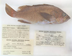
The Royal BC Museum fish collection contains a specimen which had been locked securely in one of our type cabinets since the 1980s. It was designated as the holotype for a new species – Sebastes tsuyukii – there was even a manuscript noted on the specimen label (Westreim and Seeb 1989). It sounded legit – and no one checked until recently.
Jody Riley – my ever diligent volunteer – flagged this record when she was re-organising the fish collection. She checked what is in our old paper catalog, checked the electronic database, then looked to see if the actual specimen exists. When Jody hit Sebastes tsuyukii, and found no record of the species online, yet here in her hands was the jar with a big yellow tape label saying Holotype for Sebastes tsuyukii, she knew something was fishy.
Did the manuscript stall during composition, submission, or revision? Who knows.
In the end, we can take this large jar out of the cabinet designated for type specimens, Sebastes tsuyukii now is a nomen nudum (a naked name), and I can delete the species from the taxonomy in our museum database. Some database problems are easy to solve.
But this reminds me to get my fingers in gear and type the type descriptions for species I have yet to publish.
Impact of Facility Renewal Deferment on Risk to Royal British Columbia Museum, Canada, Collections post
Abstract:
The Royal British Columbia Museum (RBCM), Canada, houses a collection of almost 7 million artifacts, archival records, and natural history specimens. Three comprehensive collection risk assessments over the past decade have resulted in improvements to the physical environments of the collections as well as new policies and procedures to reduce risk. However, there remain ongoing risks that can only be mitigated through major facility renewal. The last collection risk assessment, completed in 2016, was revisited to review the data and build a defensible case for funding to replace the RBCM’s on-site collection storage facilities. Changes to overall collections risk is a complex function of collection development and use trends, evolving risk factors both internal and external to the museum, a growing understanding of the relationship between risks and preservation, in addition to reduction due to risk mitigation projects and building systems aging and wearing out. A defensible method for illustrating the facilities-related risks over time involves estimating the expected loss of individual collection items or loss in value of a group of items that may occur if a major facility upgrade or redevelopment is not realized in the near future. Risk assessment data for representative collection units were reviewed to differentiate risk due to permanent facility characteristics versus more active controls, operations budget controlled risk versus capital budget controlled risk, and collection management-controlled risk versus facility management-controlled risk. This enabled the risk model to isolate risks that could only be mitigated through major facility upgrades. Change in collection value was expressed as Object Equivalents Lost (OEL) and its compliment Object Equivalents Remaining (OER). Projections into the future indicating the effect of varying facility renewal dates could then be clearly shown. Losses, when presented as numbers of items expected to be lost from the collection, become emotionally salient to persons in senior management and governance roles.
Yesterday I posted a video from my time up in the mountains in the Tumbler Ridge Global Geopark. Today I give you a video, near that same spot, but from our new Ricoh Theta V 360 camera. Amidst all the botanizing and mushroom-hunting, I was also testing out this new tool for our online learning programs.
If you’ve never watched a 360 video before, use the circular symbol in the top left corner by using your mouse or finger (depending on the device you’re using). If you’ve got Google Cardboard or other VR goggles you can watch the video through that for an enhanced experience. Look up at the sky, look at the ground or at me swiping at bugs and using the camera controls through the app on my phone (not very exciting). Watch for my wave near the end!
Mountain Stream post
My attempt to video a sublime mountain stream without a tripod and while fending off bugs, near Bone Mountain, south of Tumbler Ridge, BC. July 24, 2018
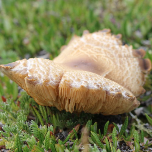
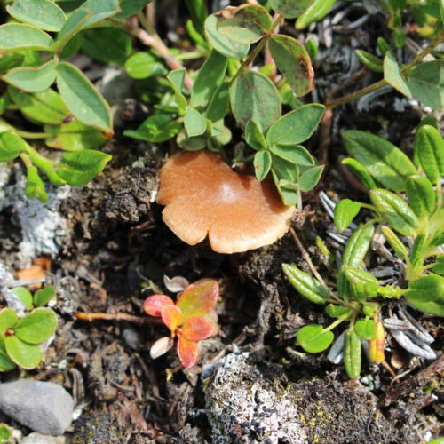
I did not know mushrooms grew at such high elevations, but they do! While up there wandering around at about 6000 feet one of my tasks was to look for mushrooms. Mushrooms in the alpine have not been studied much at all in BC, but mycologist, Dr. Shannon Berch, Research Soil Scientist at the BC Ministry of Environment is on it. For every mushroom I found and photographed, Dr. Ken Marr took a sample, and bottled it to be sent to Dr. Berch for study.
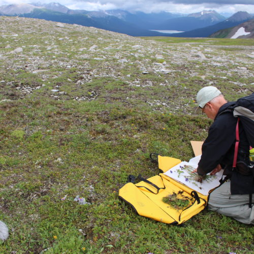
When I’ve been in the alpine in the past, it’s mostly been on long day hikes, where I had to get up and down a mountain during daylight hours. This does not leave much time or energy for wandering around alpine meadows. But on this trip, that is all we did. We walked and walked, looking for plants for the collection. It was easy to lose sight of the others, so I had to keep reminding myself to not wander too far. Thick fogs can come in quickly in the mountains and create a difficult and dangerous situation and although we’d seen no signs of bears, we were also in Grizzly territory.
It was so beautiful up there I just wanted to keep going. Over every rise there was a new vista. There was birdsong, and far in the distance, running water coming from a stream or a waterfall, (I could not tell which but I had to get closer). That’s when (unbidden I swear) dialogue from The Sound of Music, (the part where Maria is being reprimanded by the Mother Superior for being late) came into my head. Clearly, I heard Maria exclaiming how she could never be lost up there, that these were her mountains and besides the birds were singing and the brooks were babbling and she felt like she was being called higher and higher up into the mountains. That was me that day. At one with Maria.
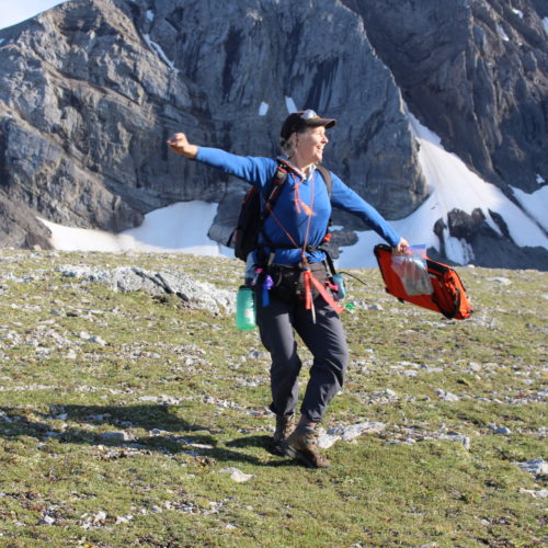
I mentioned my mental imagery to nearby Royal BC Museum botanists Heidi Guest. Heidi in the mountains with (I kid you not) braids in her hair. Being a good sport, Heidi, spontaneously swung her plant collecting gear around her not unlike Maria while singing I have Confidence. I’m telling you it was a moment.
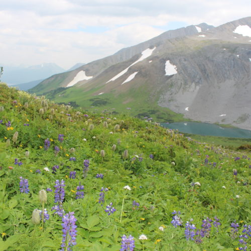
What I was surrounded by up above the treeline:
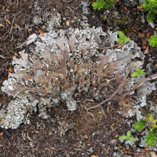
What I spent most of my time looking at:


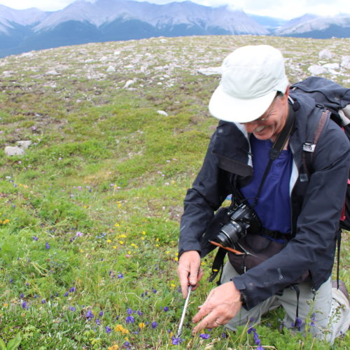
Dr. Ken Marr is Curator of Botany at the Royal BC Museum. I ambled with Ken (botanists amble) last month while he was out collecting plants in the mountains south of Tumbler Ridge.
Mountain Excursion – Post #2
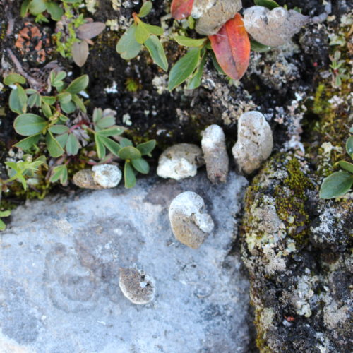
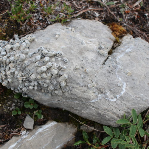
Okay, I don’t even know what to tell you about these photos. I only know that there are fossils in every one of them. There are fossils everywhere in the geopark. They were incredibly distracting! I was to be taking 360 video, botanizing and mushroom hunting (more on that in a future post), but kept happening upon these rocky wonders and wanted to just sit down in front of them to look. So I snapped pictures when I could.
Also, we had no paleontologists with us or identification guides. Have a look at the pictures and wonder with me, or if you are in the know, please comment!
Mountain Excursion image
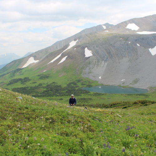
Last wee k I went where few British Columbians go: the high alpine in our spectacular Northern Rockies. When at the last minute one of the Royal BC Museum scientists could not make the trip, I had the good fortune to take her place in the helicopter and spend two days in the field with a small team of museum researchers. My purpose was to bring back photographs and videos for our online learning programs, (especially with our new 360 camera) and to use my naturalist skills to help the botanists collect plants.
On July 23rd, the helicopter dropped us off about 40 kilometres south of Tumbler Ridge in the Global GeoPark. It was glorious. I took so many photographs I’ve decided to blast you with a series of short photo-posts over the month of August! (It’s like being stuck at a friend’s home movie night, except this is optional and hopefully you won’t feel stuck, but awed by BC’s beautiful and biodiverse northern alpine).
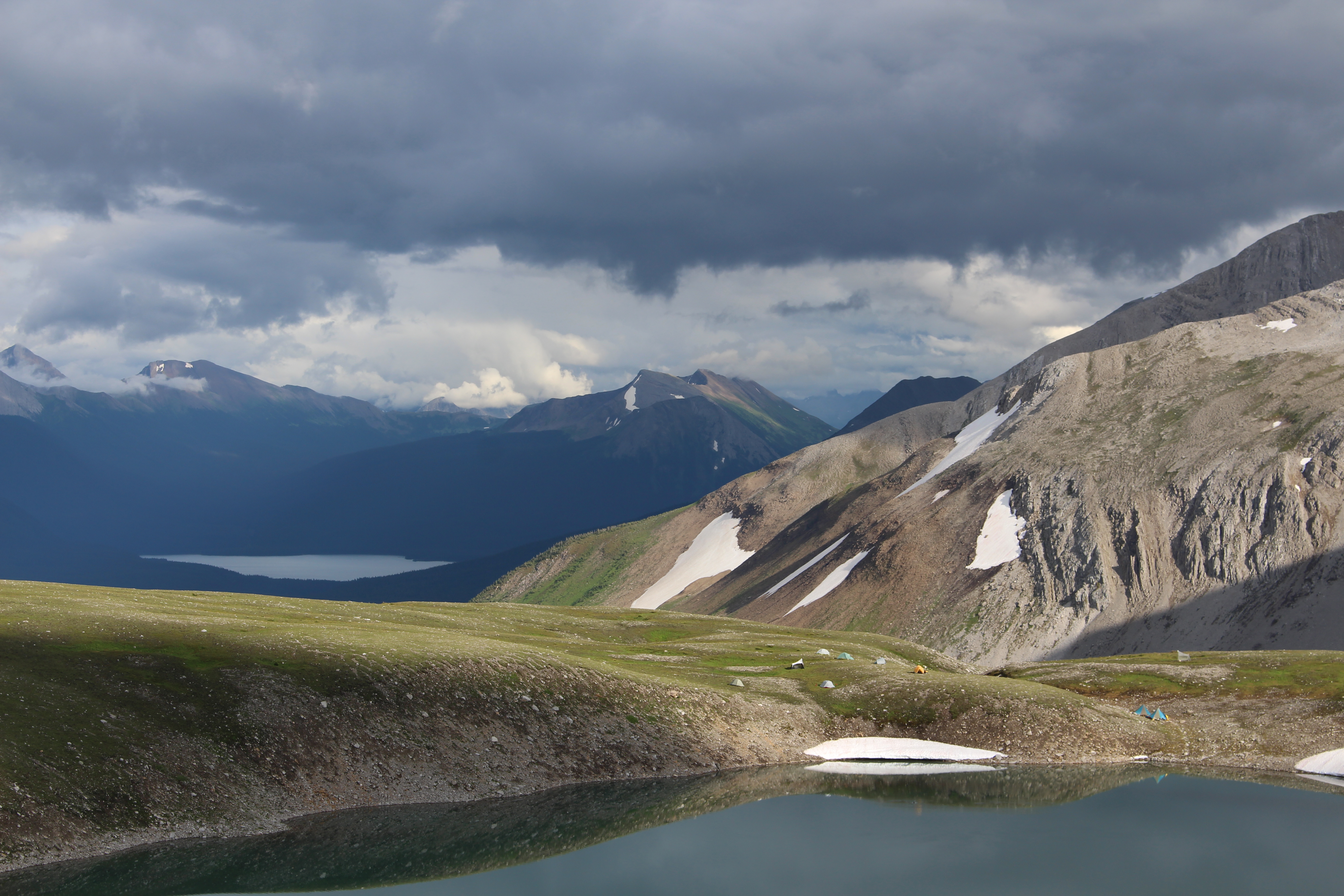
Royal BC Museum field camp tents near an alpine lake.

Alpine flowers including anenomes gone to seed or ‘hippies on a stick’ as they are affectionately and aptly known.
Orca Abscessed post
Nitinat (T12A) was a well known Orca along the BC coast. Born in 1982, he was a fixture along the BC coast and an active participant in the 2002 attack on a Minke Whale in Ganges Harbour, Saltspring Island. This animal – with its characteristically wavy dorsal was found dead off Cape Beale near Bamfield, September 15th, 2016. Funds weren’t available to prepare the entire skeleton, so I had to settle for the skull and jaws.
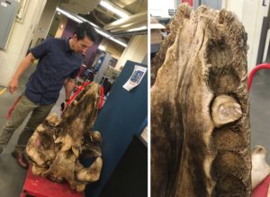
As you can imagine, the head of an orca would pop the frame of any domestic chest freezer, and it blocked the aisle of the walk-in freezer at the Pacific Biological Station in Nanaimo. It was also no small feat to fork-lift the head into the museum’s van, and then get it back out of the van and wheel it to the museum’s walk-in freezer. It also was a surreal experience driving around with an orca head in the truck. The head is heavy – and slippery – and difficult to tie down – so I drove smoothly to avoid having the head roll around behind me. Imagine explaining to an insurance company how an orca head caused you to lose control of your vehicle?
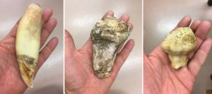
Nitinat’s head was prepared by Mike DeRoos and Michi Main – their internationally acclaimed business, Cetacea, focuses on cleaning and articulating whale skeletons. While preparing this skull for burial, they noticed that Nitinat had broken teeth. Given that I broke a molar on a frozen Reese’s Piece in a Dairy Queen Blizzard, I could imagine how Biggs Orcas could break a tooth when biting down on a sea lion or elephant seal. Large pinnipeds have dense bones.
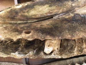
Once the skull was cleaned, Mike and Michi found that not only were teeth broken, there also is a nickle-sized hole in the palate and many teeth were abscessed. The hole in the palate is particularly interesting. It has smooth sides and so certainly had healed before Nitinat’s death. Was it a puncture and the source of the infection that caused the distortion of the teeth? Or was it a channel for the abscess to weep into Nitinat’s mouth (not a pleasant thought regardless).
Normal teeth (left) have a long root and recurved crown, with natural wear for their ecotype – but the abscessed teeth were stunning with their broken crown and expanded root. They almost remind me of some squash varieties that are available.
One of the teeth is so swollen that it couldn’t be removed from its distorted socket.
Red lines beside the skull indicate expanded tooth sockets – perhaps age and infection combined to create this effect. The sockets for the abscessed teeth were eroded and far larger than normal sockets (in this non-mammalogist’s opinion). Erik Lambertson made a great scale bar.
Nitinat’s teeth are enough to make anyone who has had a toothache cringe, and a dentist’s eyes pop with fascination. I am just waiting for the day someone requests to see Nitinat as the focus of a pathology research paper. For now, he is a permanent addition to the Royal BC Museum collection and will soon get his official catalog number.
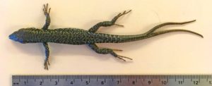
I don’t know if the title of this article is an accurate way to say fork-tailed lizard in German, but the Gabelschwanz-Teufel – the P-38 Lightning (the fork-tailed devil) could take a lot of punishment and still get home at the end of a sortie. A fork-tailed lizard has a parallel story – it has taken a beating and survived.
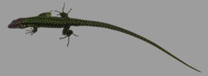
It is common to find lizards with regenerated tails or tails that are recently dropped – with their tell-tail stump. Sometimes the tip is lost, others about 90% of the tail is lost. The regrown tail segment is never as nice as the original and has different scale patterns and colouration.
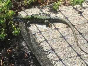
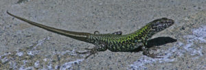
This male Wall Lizard photographed by Deb Thiessen, lost its tail near the base and the regenerated tail is obvious. Its meal had a perfect tail.
I have seen fork-tailed, even trident tailed lizards in photos – I remember images like this in the books I poured over earlier in my ontogeny. Had I ever seen one in person? Not until now. During my PhD thesis work, the only fork-tails I thought about were thelodont fishes known from Early Devonian rocks of the Northwest Territories.
This July, Robert Williams, a colleague from University of Leeds in England was here working on Wall Lizards. He was trying to determine if our native Northern Alligator Lizards react in any way to the scent of the European Wall Lizard.
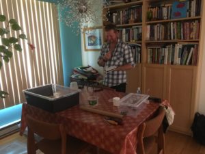
Live animals are not allowed at the Royal BC Museum, so Rob had to perform scent trials in my dining room. The lizards were held in containers in my kitchen – and I thank my wife for her patience.
The work helps give a frame of reference to reactions between the native Sand Lizard in the UK and introduced Wall Lizards, but you’ll have to wait to hear the results. While hunting Wall Lizards on Moss Rocks here in Victoria, Rob caught a fork-tailed specimen.
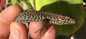
Since this was such a neat specimen I requested it be saved intact for the Royal BC Museum’s collection. Here is a photo of a fork-tailed Wall Lizard from England, but Rob had to come all the way to the Pacific coast of Canada to catch one.
Lost Soles post
In museum collections, space is critical. We can’t waste space. Every millimeter of shelving is critical. If you can arrange cabinets more efficiently, do it. Can you pack more jars in a given area? Do it. If you can make space. Do it.
I have been on a binge of deaccessioning lately. What is deaccessioning? It is the museum practice of removing accessioned/cataloged specimens from the collection. Once deaccessioned, we either send specimens to other museums where they are relevant, or give them to teaching collections or perhaps to nature centers. Only rotten specimens are destroyed. We try everything we can to re-purpose specimens before we resort to destruction.
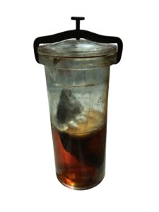
This surfperch, Embitoca lateralis, is a rare candidate for destruction. It has been deaccessioned – someone had cranked the clamp too tight years ago and the glass at the apex of lid popped. Alcohol evaporated and by the time it was noticed, it was too late. If the fish in the jar could speak, they’d say, “There’s a fungus among us.”
Deaccessioning allows me to make space in the collection for new material. Since I am trying to keep the Royal BC Museum’s vertebrate collection focused on British Columbia, the eastern North Pacific Ocean and any adjacent territory, specimens with no relevance to this region obviously have my attention. Specimens with incomplete information (or no information), also flare my obsessive nature and are on my deaccession hit list. Space is created on a jar-by-jar basis.
Putting ‘incomplete information’ in everyday terms – if we are going to meet somewhere, you generally expect some level of detail. If I say I want to meet in Tofino in June, what would you say? Imagine now that I didn’t even give you my name – but still wanted to meet in Tofino in June. I am betting you’d put on your best Monty Python-esque King Arthur and say, “You’re a Loony.” Incomplete or missing data is a real issue.
My long suffering volunteer Jody found a jar of flatfish this weekend which had never been cataloged, but was in the collection. It was only a 125 ml jar – so not a huge waste of space. On closer inspection the fishes were identified (Parophrys vetulus, English Sole), there was a location (Tofino), and a date (June 1985).
Where was I in June 1985 – oh yea – just about to graduate from grade 12. Oh the 80s – I am listening to Duran Duran while typing this – RIO – the obvious choice with its maritime theme.
Yep, that was me in 1985.
Parophrys vetulus is a common fish here in BC, so it is likely you can catch them all around Tofino in June – but it would be nice to know which beach relinquished its sole. And when did it happen? Was it at night? Was it a full moon? On the 1st of the month, or mid month? Were they in ankle-deep water or at 10 meters depth? Open beach or a tidepool? Caught by hand or with a net? Inquiring minds may want to know. And with no collector noted in the hand-written label – I can’t even badger someone by email to jog their memory or review old field notes.
These are the lost soles Jody found. Is one of them yours?
To a museum, data is everything. If you collect and preserve a specimen, record as much as you can about the event. If you are giving me your sole, then tell me its secrets.
Lacertophagy post
I have said before that European Wall Lizards (Podarcis muralis) will eat smaller conspecifics – there are a few photos online from elsewhere on Earth – but until now I didn’t have solid evidence of lacertophagy (lizard eating) here on Vancouver Island.
However, this last week, Deb Thiessen took a few videos of a Wall Lizard eating a yearling Wall Lizard on her property just north of Victoria. These are really good videos and clearly show that Wall Lizards can stuff down a huge meal.
https://www.facebook.com/deb.thiessen.9/videos/10214455524975688/
In this first video the smaller Wall Lizard is already dead, and I suspect that the larger lizard killed it. Looks like another lizard had thoughts of stealing the meal. Sure looks like breathing is an issue while stuffing down so large a meal. Snakes solve the problem of eating and breathing by pushing their trachaea (windpipe) out of the mouth so that food does not block air flow.
https://www.facebook.com/deb.thiessen.9/videos/10214455487814759/
The victor looks like a male, and in the second video you can see how quickly it disposes of the tail rather than having that part of the meal hanging out of its mouth for a few days.
Almost all of the victor’s own tail had been lost some time ago. You can always see where its original tail ended and the re-growth takes over – the new tail is never as neatly patterned.
Be glad Wall Lizards aren’t the same size as Varanus prisca, otherwise we’d be on the menu.
Science is Serious post
Or if you are an astronomer, then your science is Sirius. If you are a geologist, then your science is pretty gneiss. Don’t take science for granite.
I have been tracking Wall Lizards now for a while – and I am sure my wife will say lizard tracking has become an obsession – a serious obsession. I look at rock walls as we drive around town. I look for lizards on our weekend hikes. I watch for lacertids when I walk our daughter too and from school. Science is serious.
I have been watching the range expansion of two nicely segregated populations of lizards in Victoria – one population is about 0.63 km SSW from our house west of Hillside Mall, and the other is about 0.24 km north of us near Doncaster School – not that I have measured.
Each year I walk the perimeter of these populations to get an idea how fast lizards disperse in urban environments – again – this is serious science. Stop laughing. I can hear you laughing. Rolling your eyes does not help.
Wall Lizards seem to spread 40 to 100 meters – and it is the young ones that do the dispersing. Why? They race off to new habitat to avoid the cannibalistic tendencies of their parents. Parents with a 40 year old trekkie in the basement may want to consider this option as an incentive to get kids to move out.
Young lizards head for the relative safety of boring lawns – garden areas with lots of structure are occupied by hungry adults. Homeowners sometimes claim their lawn is crawling with young lizards in August – when all the summer’s eggs have hatched. In contrast, adults are relatively sedentary – once they find good sunny, rocky (complex) territory, they tend to move very little from year to year.
Now imagine my surprise when I walked up my driveway last night (May 23rd, 2018) and heard the characteristic rustling sound of a lizard in our food forest (yes, the lawn is gone and we have a food forest – the entire front garden is devoted to plants we can eat, and plants that attract bees to pollinate the plants with edible bits – but I digress). The lizard I found is at least 0.24 km from the nearest known population of lizards in my neighbourhood, and is an adult – with a perfect tail too – must have lived a charmed life free of bird and domestic cat attacks. Did this adult go walkabout? I doubt it.
The new colonist in the food forest at UF1510 (yes, as sci-fi nuts we gave our place a code name Urban Farm1510)…
Furthermore, the lizards nearest to my house are not brightly coloured – in fact they are kind of drab as far as Wall Lizards go. But our new lizard is gorgeous – more like ones from Triangle Mountain or farther north on the Saanich Peninsula.
This male is from Durrance Road – far more colourful than the ones near Doncaster School or Hillside Mall.
Is this a case of seriously good science prank? Was this a drive-by lizarding? Did a neighbour just buy some new garden supplies and a stow-away lizard emerged to find utopia in our food forest? I may never know.
My daughter has named the lizard Zoom. I guess he is there to stay.
Here’s a link to a new paper by: Luke R Halpin, Jeffrey A Seminoff, and myself.
Source: Northwestern Naturalist, 99(1):73-75.
Published By: Society for Northwestern Vertebrate Biology
This new paper provides the first photographs of a Loggerhead Sea Turtle (Caretta caretta) from west of Vancouver Island. The species has been spotted in the region before and as far north as Alaska, but until now, there were no photographs or specimens as solid evidence.
While the photos in this paper are black and white – the original photographs by Luke Halpin are color and van be viewed upon request. PDFs also are available – just send me an email.
British Columbia is now within the range of 4 species of marine turtle. This Loggerhead survived into February of 2015 because of the unusually warm water in the eastern North Pacific Ocean (the Warm Water Blob), whereas Green Sea Turtles (Chelonia mydas) and Olive Ridley Sea Turtles (Lepidochelys olivacea) wash up dead (or near dead) in early winter. Unfortunately, the fate of the Loggerhead from 2015 is unknown.
Nanaimo Invasion post
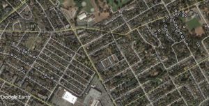
Years ago after coming off parental leave, I found a series of photographs of Wall Lizards and a Google Earth image of a road intersection marked to show locations for a lizard colony. Quick search in Google Earth showed that this colony was in Nanaimo. I fired off a fast blog article to generate interest and get people looking for Wall Lizards.
It worked. Reports came in.
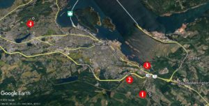
Jump forward a few years and now that street (Flagstone – site 1) is crawling with lizards according to eyewitnesses. But we now also have another site (2) along the Nanaimo Parkway near Douglas Avenue and Tenth Street. Oh wait, there’s also a third site (3) in the Chase River Estuary Park, and as of this weekend, there’s another (4) – way north of the rest along Arrowsmith Road. The report of the lizards in the Arrowsmith Road area was accompanied by video – there was no doubt as to the identification of those lizards – and that was a big jump from previous known occurrences.
Two other records – one along Enfer Road near Quennell Lake, and along Leask Road south of Nanaimo have yet to be verified with specimens, photographs or video.
There you go Nanaimo, the invasion has picked up pace. Keep your eyes peeled for lizards with a green tint to their scales, minute scales on their back, and generally more delicate proportions than the native Alligator Lizard.
Look at this post to help identify any lizards in your neighborhood.
If you find suspected Wall Lizards – email me at: ghanke@royalbcmuseum.bc.ca
If you find a lizard that is not a Western Skink, Northern Alligator Lizard, or European Wall Lizard – I definitely want to know about it.
Please record the date and street address (or prominent landmark) to pin down exactly where the lizard was seen. A photo would be really helpful to confirm the lizard’s identification. Happy hunting.
Non-indigenous invertebrate species in the marine fouling communities of British Columbia, Canada download
Heidi N. Gartner, Cathryn Clarke Murray, Melissa A. Frey, Jocelyn C. Nelson, Kristen J. Larson, Gregory M. Ruiz and Thomas W. Therriault
Abstract
Marine fouling communities on artificial structures are invasion hotspots for non-indigenous species (NIS). Yet, little is known about NIS infouling communities of British Columbia (BC), Canada. To determine NIS identity and richness in BC fouling communities, we deployed settlement plates at 108 sites along the coast of BC between 2006 and 2012. Of the 295 invertebrate taxa identified to species, 20 were NIS while an additional 14 were cryptogenic, including several global invaders. This study documents the range expansion of tunicates Botrylloides violaceus Oka, 1927 and Botryllus schlosseri (Pallas, 1766), including the first known records on Haida Gwaii. NIS were detected within each of the six distinct geographic regions with the southern, more populated regions of BC (Straits of Georgia and Juan De Fuca) having the highest NIS richness and frequency of occurrence compared to the less populated northern regions. This study provides a contemporary baseline of invertebrate NIS identity and richness in fouling communities that will allow comparisons through time and a means to focus research and prioritize management efforts.
Key words: non-native species, introduced species, invasion, Northeast Pacific, West Coast, North America, biofouling
The Special Issue of Aquatic Invasions on “Transoceanic Dispersal of Marine Life from Japan to North America and the Hawaiian Islands as a Result of the Japanese Earthquake and Tsunami of 2011” has been published as Volume 13, Issue 1, pages 1-186 (totalling more than 220 pages with supplementary files).
The Special Issue includes the 14 papers (all Open Access) by 39 researchers, including Dr. Henry Choong, Curator, Invertebrate Zoology.
Funding support was provided by the Ministry of the Environment (MOE) of the Government of Japan, through the North Pacific Marine Science Organization (PICES), which made this Special Issue possible.
The Introduction to the Special Issue provides vignette summaries of examples of notable Japanese Tsunami Marine Debris objects, and also details contributions to the knowledge of Japanese and North Pacific marine biota as a result of JTMD research. These contributions include new species, new species records for Japan, and a rediscovered species (last documented in 1929). A final summary table in the Introduction provides examples of molecular genetic contributions to our understanding of JTMD biodiversity.
The JTMD project, which commenced in 2012, and which is now entering its 6th year of research, as we continue to monitor for the potential arrival of living species, 7 years after the tragic disaster of March 11, 2011.
Calder, D.R., Choong, H.H.C., Carlton, J.T., Chapman, J.W., Miller, J.A., and Geller, J. 2014.
Abstract
Fourteen species of hydroids, including two anthoathecates and 12 leptothecates, are reported from the west coast of North America on debris from the tsunami that struck Japan on 11 March 2011. Six species were found on a dock that stranded at Agate Beach, Newport, Oregon, five from a boat at Gleneden Beach, Oregon, four from a dock in Olympic National Park, Washington, and two from a boat in Grays Harbor, Washington. Obelia griffini Calkins, 1899, the most frequently encountered species, was collected on three of the four derelict substrates. Eight of the species are known to be amphi-Pacific in distribution. Of the rest, at least five (S tylactaria s p . ; Eutima japonica Uchida, 1925; Orthopyxis platycarpa Bale, 1914; Sertularella sp.; Plumularia sp.) are not previously known from the west coast of North America. Hydroids of E. japonica occurred as commensals in the mantle cavity of the mussel Mytilus galloprovincialis Lamarck, 1819. Obelia griffini, O. gracilis Calkins, 1899 (not its secondary homonym Laomedea gracilis Dana, 1846) and O. surcularis Calkins, 1899 are taken to be conspecific. Of the three simultaneous synonyms, precedence is assigned to the name O. griffini under the Principle of the First Reviser in zoological nomenclature. The species is sometimes regarded as identical with O. dichotoma (Linnaeus, 1758).
Henry H. C. Choong* and Dale R. Calder
Invertebrate Zoology Section, Department of Natural History, Royal Ontario Museum,100 Queen’s Park, Toronto, Ontario, Canada, M5S 2C6
*Corresponding author
Abstract
The leptothecate hydroid Sertularella mutsuensis Stechow, 1931 is reported on debris from the 2011 Japanese tsunami that came ashore on 5 June 2012 at Agate Beach north of Newport, Oregon. Its discovery on a barnacle (Semibalanus cariosus) from a derelict floating dock originating at Misawa, Honshu, confirms the capability of successful transoceanic dispersal for this species. We compare our specimens to Stechow’s syntype material of S. mutsuensis in collections at the Zoologische Staatssammlung München, and designate a lectotype and paralectotype of the species.
Key words: Leptothecata; hydroid; lectotype; transoceanic dispersal; anthropogenic debris; Oregon coast
The Power of 1 post
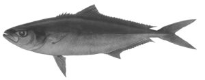
It is always satisfying to update taxonomy in the museum’s database or find and correct mistakes. This week I spent some time sorting out details on Royal BC Museum specimens of California Yellowtail (Seriola dorsalis) and Great Amberjack (Seriola lalandi). Turns out that since these fishes were collected, Seriola dorsalis has been sunk, and all our fishes are Seriola lalandi (as noted by Gillespie 1993). This carangid fish is known to move into our waters in warmer years.
While reviewing what we knew about the first BC specimen (979-11312) it became obvious that the Royal BC Museum’s database was missing some information for that fish. Fortunately, this information was easily updated – the original report was published in the Royal BC Museum’s extinct periodical Syesis (see Nagtegaal and Farlinger 1980).
Drawing of Seriola dorsalis – oops lalandi (979-11312) by K. Uldall-Ekman.
In fixing that record, I noticed that some online sources had given incorrect coordinates for this fish. Contrast the capture location of 54°35’N, 131°00’W in Caamaño Passage as reported by Nagtegaal and Farlinger (1980), with online sources which state the fish was caught at 54°35’N, 31°00’W. That missing 1 in the reported longitude determines which ocean is linked this fish.
The takeaway message? Always check the original paper rather than relying on internet sources. Precise data is everything – and in the words of a well known scoundrel: “Without precise calculations we could fly right through a star, or bounce too close to a supernova and that’d end your trip real quick, wouldn’t it.” Or in this case, you’d be landing southwest of Iceland to look for Great Amberjack.
References:
Gillespie, G.F. 1993. An Updated List of the Fishes of British Columbia, and Those of Interest in Adjacent Waters, with Numeric Code Designation.Canadian Technical Report of Fisheries and Aquatic Sciences 1918. 116 p.
Nagtegaal, D.A. and S.P. Farlinger. 1981. First record of two fishes, Seriola dorsalis and Medialuna californiensis, from waters off British Columbia. Syesis 13:206 –207.
I’ve received a steady series of emails this year detailing European Wall Lizard locations here on Vancouver Island, and it’s now April and wall lizards certainly are active. However, an email arrived April 11th which gave me a WTH (What The Herp) moment. The email contained a beautifully focused photo of a new turtle for BC. Then it occurred to me that I’d lost count of how many turtle species have been dumped here – unwanted pets that outlived the interest of their owners.
I really like when people send me photos of things they think are unusual – and this week’s email was no exception. We know that Red-eared Sliders (Trachemys scripta elegans), Yellowbelly Sliders (Trachemys scripta2), and a Map Turtle (Graptemys sp.) have been dumped in Goodacre Lake, and Red-eared Sliders into Fountain Pond, but this new turtle photographed by Deb Thiessen (see below) certainly was not just an odd coloured slider, nor was it another map turtle. As an aside, I haven’t had a chance to catch the Map Turtle in Beacon Hill Park to get a good look at it, but I have seen it at a distance, and ID’ed it based on photos from Darren Copley and James Miskelly. It looks like a False Map Turtle (Graptemys pseudogeographica). I think that’ll be a summer goal, to get good photos of that turtle to be sure which species it represents.
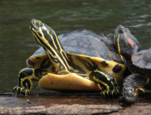
A Peninsula Cooter (Pseudemys peninsularis) from Fountain Lake, Beacon Hill Park, Victoria, BC. Photograph by Deb Thiessen, retired CRD Parks naturalist.
As you can see from Deb Thiessen’s photograph, this new turtle has a large shell for the size of the head, and the stripes on the neck are crisp, and bold yellow offset by black. The bold markings to me suggested Peninsula Cooter (Pseudemys peninsularis). The short claws on its forelimb indicate it is female. Males would have claws double the length of those in the photo. This animal is way outside its normal range – Peninsula Cooters are from Florida.
This animal brings our list of pet turtles to 10 species abandoned in BC ponds and lakes – that we know of. Here is the list I have of turtles that have been found in BC – way out of their native range – and (shockingly) it parallels species available in the pet trade here in BC.
Trachemys scripta (Pond Slider – both T. s. elegans and T. s. scripta)
Pseudemys peninsularis (Peninsula Cooter)
Pseudemys concinna (River Cooter)
Chrysemys picta marginata (Midland Painted Turtle, possibly also Southern Painted Turtles, C. p. dorsalis)
Graptemys pseudogeographica (False Map Turtle)
Emys orbicularis (European Pond Terrapin – always did like the word Terrapin – a bit of nostalgia from my British roots)
Chinemys reevsi (Reeve’s Turtle)
Malaclemys terrapin (Diamondback Terrapin)
Apalone spinifera (Spiny Softshell Turtle)
Chelydra serpentina (Common Snapping Turtle)
Fortunately most turtles are dumped one at a time and do not reproduce. Sadly though, I can’t say the same for the Red-eared Sliders – they now can reproduce successfully here in British Columbia (I have two pets from the first successful clutch found on the south coast of BC, ca. January 11, 2015). Red-eared Sliders now are common in artificial and natural ponds and in lakes here in southwestern British Columbia – and until recently, we were sure that each adult represented an abandoned pet (or maybe the occasional escapee). Now males are finding females. Females are finding decent nesting locations. And eggs are surviving to hatch.
Knowing that sliders can breed here, I stopped to check whether sliders and cooters can hybridize, and it has been suggested to be possible – but no solid proof. And since it is better to be safe than sorry… Does anyone know how to neuter a Cooter?
This time of year, my garden is one big mudslide. Sunny days with a blue horizon are not that common here on Vancouver Island in winter – but when they occur, we certainly enjoy them. So do our slim little European Wall Lizards.
This January and February I collected lizards which were active when the air temperatures were between 5° to 7°C. As a survivor of the Canadian prairies, collecting lizards in winter seems about as strange as an empty room in a museum collection.
I found lizards along Derby Road in my neighborhood, on Moss Rocks, at Gardenworks Nursery in the Blenkinsop Valley – winter lizard activity is nothing new here on Vancouver Island.
Lizards were found in south-facing locations with full sun exposure and when caught, were very warm to the touch. It is obvious that they are effective solar collectors and can elevate their body temperatures well above that of the chilly air – even when it is a bit windy. It is not uncommon to see lizards only exposing their head for a while, then the rest of the body. Perhaps this is a low-risk way to warm blood via blood vessels in the throat before they venture out and deal with intruding conspecifics. I haven’t seen any wall lizards feeding in winter – but that doesn’t mean they don’t. I’ll have to examine museum specimens to see what’s in the stomachs of winter-caught lizards.
An adult European Wall Lizard caught on Derby Road in Victoria, February 26th, 2018.
As of this February, the Royal BC Museum collection has 30 lots of European Wall Lizard specimens representing surface activity for each month of the year. Some people collect trading cards to get a complete set, I collect lizards to get one per month. Wall Lizards are active in winter as far north as Denman Island, and given that range, probably could extend further north of Campbell River in areas with a warm microclimate.
The collection of lizards for each season put a song from 1971 into my head – so I reworded the chorus a bit…
Winter, spring, summer or fall,
All they have to do is crawl,
And I’ll be there, yes I will,
Their spread has to end.
Tristan A. McKnight & Robert A. Cannings
Abstract: Stackelberginia cerberus sp. nov. (Diptera: Asilidae) is described from the Amargosa desert (USA: Nevada) and compared to related taxa. This is the first record of the genus in the Western Hemisphere; other species live in the deserts of central Asia. Stackelberginia Lehr is proposed as the sister taxon to Lasiopogon Loew in the subfamily Stichopogoninae based on morphological characters and a Bayesian species tree estimated from one mitochondrial (COI) and three nuclear protein-coding loci (AATS, PEPCK, wingless). Stackelberginia has the medially divided epandrium and rotated hypopygium of Lasiopogon, but the facial gibbosity is flat, macrosetae of thorax, head, and legs are unusually long, and phenology peaks in late autumn.
Key words: Stichopogoninae, robber fly, assassin fly, species tree, molecular, Palearctic
Joel. F. Gibson
Abstract: The thick-headed flies (Diptera: Conopidae) are rarely observed parasitoids. Confirmed hosts include many species of bees and wasps. Often collected from flowers, conopids may serve as either pollinators or pollinator predators. The last detailed checklist of the Conopidae of British Columbia was published in 1959. An updated checklist for British Columbia, the Yukon, and Alaska is presented based on over 1,000 specimens and specimen records. Geographical distribution, using an ecoprovince approach, is documented for each of 26 species in the region. Host, plant association, and hilltopping behavioural records based on past literature and new observations are also included. An identification key to all species recorded is included.
Key words: parasitoid, biogeography, plant associations, host associations, Nearctic
Colin J. Curry, Joel F. Gibson, Shadi Shokralla, Mehrdad Hajibabaei, and Donald J. Baird
Abstract: We reviewed the availability of cytochrome c oxidase subunit I (COI) sequences for 2534 North American freshwater invertebrate genera in public databases (GenBank and Barcode of Life Data Systems) and assessed representation of genera commonly encountered in the Canadian Aquatic Biomonitoring Network (CABIN) database. COI sequence records were available for 61.2% of North American genera and 72.4% of Insecta genera in public databases. Mollusca (73.9%) and Nematoda (15.4%) were the best and worst represented groups, respectively. In CABIN, 85.4% of genera had COI sequence records, and 95.2% of genera occurring in >1% of samples were represented. Genera absent from CABIN tended to be uncommon or members of groups not routinely used for biomonitoring purposes. On average, 94.1% of genera in well-identified samples had associated sequence data. To leverage the full potential of genomics approaches, we must expand DNA-barcode reference libraries for poorly described components of freshwater food webs. Some genera appear to be well represented (e.g., Eukiefferiella), but deposited sequences represent few sampling localities or few species and lead to underestimation of sequence diversity at the genus level and reduced confidence in identifications. Public COI libraries are sufficiently populated to permit routine application of genomics tools in biomonitoring, and ongoing quality assurance/quality control should include re-evaluation as new COI reference sequences are added or taxonomic hierarchies change. Next, we must understand whether and how established biomonitoring approaches can capitalize on high-throughput sequencing tools. Biomonitoring approaches that use genomics data to facilitate structural and functional assessments are fertile ground for future investigation and will benefit from continued improvement of publicly available sequence libraries.
Key words: COI, invertebrates, biomonitoring, high-throughput sequencing, DNA metabarcoding, identification,
genus, Biomonitoring 2.0
Robert A. Cannings & Russell V. Pym
Archilestes californicus McLachlan (California Spreadwing) is a large damselfly native to western North America, ranging from Washington and Idaho south to New Mexico, Arizona and California and, in Mexico, to Sonora and Baja California Sur (Paulson 2011; Westfall and May 2006). This note records the species for the first time in Canada—from three sites in the southern Okanagan Valley, British Columbia (BC; Figure 1).
Russell Pym saw several males and females at a small, shallow, artificial pond at the end of an artificial stream near the entrance to the Liquidity Winery at 4720 Allendale Road, Okanagan Falls, BC (49.32553°N, 119.54993°W). He observed them from 13:00 to 14:00 PDT on 26 September 2016; one male was photographed (Figure 2). From 16:30 to 17:00 PDT the same day, he recorded a female in knee-high grass, three to four metres from the shore of a dugout pond across the road from Walnut Beach Resort, 4200 Lakeshore Drive, Osoyoos, BC (49.01825°N, 119.43580°W). Cattail (Typha latifolia) and willows (Salix spp.) lined the pond margins.
Introduction
I would like you to consider for a moment a poem.
One of the losses in the story of Canadian literature was the murder, at the hands of her husband, of the brilliant, Vancouver-born poet Pat Lowther. She herself is a loss—and I will take up the issue of cultural loss in a moment. But she also has a sharp eye for describing loss: for describing the long movement of history and what may so easily, if we are not careful to preserve it, disappear.
In her “Elegy for the South Valley”, Pat Lowther writes that in Canada “we have no centuries / here a few generations / do for antiquity.”
In the poem—as the rains “keep on and on” and the South Valley silts up—we see
the dam that served
a mine that serviced empire
crumbling slowly deep
deep in the bush
for its time
for this country
it’s a pyramid
it’s Tenochtitlan going back
to the bush and the rain.[1]
This is, I think, quite astonishing, for here is the recognition that the culture that surrounds us, however plain, however modest, however workmanlike, is a monument. A concrete dam in British Columbia is an Egyptian pyramid. It is the capital of Aztec Mexico. And like them, though in only “a few generations”, it too can disappear into the wilderness.
[1] Pat Lowther, “Elegy for the South Valley” in Time Capsule: New and Selected Poems (Victoria, BC: Polestar Book Publishers, 1996), pp.205–7.
The remains of an ancient village, in the form of a shell midden, are located around the intersection of Store and Chatham Street off Victoria’s upper harbour. The site, listed as DcRu-116, was on a rocky bluff on the east side of the Harbour between the Johnson Street and Point Ellis (Bay Street) Bridges. This specific location on a rocky bluff with a good view up the Harbour would suggest the site was chosen for defensive purposes.

Figure 1. Capital Iron building on the right foreground, 2017.
Archaeological Excavations

Figure 2. 1976 excavation of pit 2 looking N.W. The author Grant Keddie taking measurements with Jim Pike of the Archaeology Branch. Tom Bown excavating. John McMurdo of the Archaeology Branch standing. Don Abbott Photograph. 1976.

Figure 3. Excavation pits looking north. Ray Kenny and Bob Powell in unit 1. Jackie Cornford above second pit, with Grant Keddie, Jim Pike and Tom Bown excavating with trowels. Don Abbott Photograph. 1976.
In 1976, buried shell midden was discovered during the removal of massive amounts of overburden for building a new facility next to the Capital Iron building at 1900 Store Street. On an emergency basis, volunteers from the (then) Provincial Museum and the Archaeology Branch spent the weekend of April 10-11 recovering information from this site. After removing over a meter and a half of disturbed overburden we encountered partially intact and then intact cultural material. We excavated to the base of the midden, which extended to a depth of 110cm, before we encounter non-cultural material below. Two excavation Units were each approximately 2 meters square and measured from the N.E. corner of the main building adjacent to the pits. Pit 1 was located North 8m – 9.8m and East 18m – 20m from the main datum. Pit 2 was located North 10.2m – 12m and East 18m – 20m. A 40cm bulk was left between the excavation pits (See figures 2-4).
The midden extended north from the Capital Iron building for 24 meters, but was visible under Store Street for 40 m north of the main building. The upper levels of the excavation units were disturbed with a mixture of non-indigenous artifacts and older shell midden – especially in the first two levels. Excavation started in level one at 10-20cm. This level contained mixed historic materials – coal, glass, slag, window and bottle glass (one square green whiskey bottle with applied top), round headed copper nails, five square-headed cut iron nails and round thick headed nails and spikes. Level 2, at 20-30cm, contained smaller amounts of square nails, bottle glass and ceramics from the late 19th century. Level 3 at 30-40cm contained only one iron spike, a few square headed nails and portions of a few dark glass pantile based bottles.
What was noticeable in level 5 (50-60cm) in Unit 1 and level 6 (60-70cm) in unit 2 was the large quantities of herring bones and scales. An occasional piece of burnt wood and a few square headed nails protruded into portions of level 5, but levels below to the base of the cultural deposits (80cm in Unit 2 and 120cm in Unit 1) were in tack. The predominant mollusks observed were native oyster with much smaller amounts of native little neck, butter, cockle and horse clams as well as bay mussel, whelks and barnacles.

Figure 4. Looking east at two excavation units with cut soil profile below. Capital Iron building in background. Art Charlton, from the Archaeology Branch standing. Don Abbott Photograph. 1976.

Figure 5. DcRu-116 location seen from the water. The Capital Iron Building is on the far left. Hope Point is on the Victoria West side on the far right.
A water source was available for people living at this site from a creek that ran down the Haultain valley into Rock Bay to the North (see figure 6 & 7). This can be seen in a portion of Joseph Pemberton’s 1852 detailed map of the west side of Victoria Harbour (figure 6). Many historic activities have altered the landscape in this area (see Appendix I).

Figure 6. Site DcRu-116 seen on an 1852 map. Johnson Street Ravine on the right.

Figure 7. Portion of 1863, map showing the relationship of site DcRu-116 to the upper harbour, Rock Bay and the south end of Selkirk Waters.
Dating the Site
The charcoal sample I extracted from the lower intact deposits of this site was radio-carbon dated to an uncorrected date of 1690-+70 (Beta 59892). The Calendric Age is calBP: 1608+or-82. 68% range calBP: 1526-1690. Calendric Age cal:342+/-82. This would place the bottom deposits of the site in the calendar date range of around 260 to 424 A.D.
There are few sites in the Victoria region that have dates in this time range. This period is missing in the large DcRu-12 shell midden on the Songhees Reserve in Esquimalt Harbor. There is, however, a partial overlap of the date range from the bottom of DcRu-116 with the bottom of the shell midden, DcRt-9, in Cadboro Bay which has a time range of 138 to 388 A.D. (Keddie- RIDDL571). There is also a partial overlap with the bottom of the main shell midden deposits at the large defensive site on Ash Point in Pedder Bay with a bottom range of 373-581 A.D.
Because of disturbed upper deposits I could not determine if this site was occupied in late pre-contact times. The small map, drawn by John Woolsey in 1859, (See Keddie page 46) shows houses as being “Songhees”. These could be construed as being in the area of shell midden, DcRu116, but the Woolsey map is not detailed enough to place the houses at this location with any certainty. There is no recorded tradition of a village at this location.
DcRu-116 artifacts.
There are 133 artifacts from this site. This assemblage includes artifacts recovered from an emergency excavation undertaken on the weekend of April 10 and 11th 1976, by staff from the Royal B.C. Museum and the Archaeology Branch. Nine of the artifacts were from disturbed surface midden deposits at the site and 30 artifacts were found in a large amount of shell midden mixed with other materials from this site that was dumped on April 9th at a location off Kimta Road in Victoria West. Tom Bown and I visited the latter location on a number of occasions to recover artifacts in the washed out material. I examined the excavation level bags, with their recorded site provenience, in November of 1992 and identified artifacts #59-132.
There were two excavation units established with a 40cm wide bulk in between. Unit 1 or Pit 1 was located at North 8m-9.8m, East 18m-20m. Unit 2 or Pit 2 was located at North 10.2m-12m, East 18m-20m. Both were dug down to the bottom of the cultural material. The main datum and unit or sub-datums were the same at this site. The main datum was a point on the then existing building wall, with the two excavation units marked out in meters north from the wall. I intentionally made the main datum to be level with the N.W. corner of each excavation unit in order to make the depth of each of the units easily comparable.
Artifact Descriptions
The artifacts are described here under classes and sub-classes that reflect different kinds of human behavior. The class Wealth, Status, Ceremonial is represented by only one artifact here. The class Subsistence is related to the procurement and processing of food. Tool Making refers to fabrication equipment that includes implements primarily used in the alteration or assembling of raw materials for use in the various stages of manufacture of other implements or equipment, and the waste material from these activities. This latter class includes the majority of the artifacts from this site.
Class: Wealth, Status, Ceremonial

Figure 8.DcRu-116:67. Ground deer phalange artifact.
DcRu-116:67. Shaped, deer phalange. Use unknown. This is a one-of-a-kind bone object. A deer phalange is heavily ground and tappers to the distal end. The proximal end of the bone is ground flat and the bone hollowed out. The open distal end is 0.5cm in diameter and ground around the edges. There is an intentionally made 0.3cm hole 0.5cm from the proximal base that has fractured into a larger hole. This could be part of some larger composite artifact or possibly a whistle if used with a reed. The fact that it is hollowed out would suggest that it was not intended to be used as a pendant, in which case it would likely have a notch around or a hole through the thin end. Provenience: N10-12 E18-20. DBD 40-50cm.
DcRu-116:36. Dog canine tooth. This is not an artifact, as initially recorded. The nob-like structure on the proximal end is a natural root feature. Kimta Road midden. 4.2×1.1×0.7cm.
Class: Subsistence Artifacts

Figure 9. Projectile Points. Upper left to right: DcRu-116:40; 21; 52. Lower 58;1;44.
Sub-Class: Subsistence. Hunting General.
DcRu-116:44. Projectile Point. Arrow Point. Mottled chert. Corner indented notches. Provenience: Kimta Road dumped midden.(4.6)x2.1×0.6cm.
DcRu-116:52. Triangular biface. Point for arrow or small harpoon. Basalt. Small straight sided point with incurvate base and basal thinning. Provenience: Disturbed surface at Capital Iron. 2.90×1.96×0.49cm.
DcRu-116:58. Projectile point. Point for a spear or harpoon. Basalt. Wide corner indented notches. Tip of tapering base broken off. Provenience: Kimta Road midden. 2.7×3.4×0.7cm. .
DcRu-116:40. Biface. Point for arrow or small harpoon. Basalt. Strait base and slightly excurvate sides. Provenience: Kimta Road midden. 4.35×2.5×0.7cm.
DcRu-116:21. Unfinished biface. This is a basalt biface that appears to have been broken and discarded in the process of manufacture. Minimal bifacial flaking occurs on two sides. Straight sides. Provenience: N10.2-12/E18-20 (NE Quadrant) DBU 60-70cm. (3.1)x2.85×0.5cm.
DcRu-116:1. Projectile Point. Spear or small harpoon point. Basalt. Corner indented notches. Tip of tapering base broken off. Provenience: N10.2-12/E18.11m. DBD 19cm. (4.4)x3.45×0.8cm.
Sub-Class: Subsistence. Hunting. Sea Mammals. Ground slate Points.

Figure 10. Portions of Ground Slate Points. DcRu-116:6;29;14.
DcRu-116:6. Ground slate Point. Distal portion missing and small part of proximal end. Beveled edges. N11.65 E19.3m DBU 46cm.
DcRu-116:29. Ground Slate Point. Flat proximal end. Portion of distal end missing. Beveled edges. Kimta Road Midden. (7.95)x2.3×0.5cm.
DcRu-116:14. Ground Slate Point section. A longitudinal flat piece from the side of a slate point of a much larger size.
A portion of the original ground edge is on one side. The original worked surface has 11 short cut marks and 4 ground short groves on its surface. Most of these are connected to the edge, but five short grooves are further in from the edge. N11.60 E19.92m DBD 60cm.
Sub-class: Subsistence. Fishing Equipment.

Figure 11. Fishing related artifacts. DcRu-116:8;15;7;37;18.
DcRu-116:56. Ground slate fish knife portion. No bevelled edges but the thin and very fine surface is most like finished fish slicing knifes. Disturbed surface. (5.18)x(4.75)x0.29.

Figure 12. Portion of fish cutting knife.
DcRu-116:57. Bone shank for composite trolling hook. Three small tying notched on proximal end. Groove on one side for tying bone hook on distal end. Kimta Road midden. 6.25×0.55×0.39cm.
DcRu-116:18. (DcRu-116:19 is now part of this). Bone point. Small piece of proximal tip missing. N8.86 E19.6m. In ash lens. DBU 55cm. #19 portion found in screen and recorded at 60cm DBD.
DcRu-116:37. Pointed bone object. Most likely a fish hook barb. This is the broken end of a deer ulna bone tool that has been re-worked. Fractured on proximal end. Kimta Road midden. (6.4)x0.7×0.3cm.
DcRu-116:7. Fragment of ground pointed bone artifact. Most likely a portion of a fish hook barb. N9.0 E19.90m Level III. (3.4)x1.1×0.4cm.
DcRu-116:8. Fragment of ground pointed bone. Most likely a portion of a fish hook barb. N8.0-9.8 E18-20m. DBD 40cm.
DcRu-116:15. Fragment of ground pointed bone artifact. Most likely a portion of a fish hook barb. N9.48 E19.84m DBU 51cm. (2.7)x.0.8×0.7cm.’
Class: Tool Making
Sub-class: Fabrication Tools. Adze Blades
DcRu-116:13. Adze blade. Tapered cutting edge mostly on one side. Nephrite. N8.82 E 20.31 DBD 50cm. 6.5×4.85×1.1cm.
DcRu-116:17. Adze blade. Portions of ends missing. Chlorite-like material. N8-9.8 E 18-20m. S.E. quadrant. DBD 51cm. (7.25)x4.1×1.15cm.
DcRu-116:28. Adze blade fragment. Chlorite-like material. N10-12 E 18.21m. (4.7)x(2.25)x(1.3)cm.
DcRu-116:12. Adze blade fragment. Chlorite-like material. Disturbed surface at Capital Iron. (4.4(x(1.6)x(0.8)cm.

Figure 13. Adze Blade and blade portions. DcRu-116:12; 28;17;13.
Sub-class: Fabrication Tools. Bone & Antler tools.
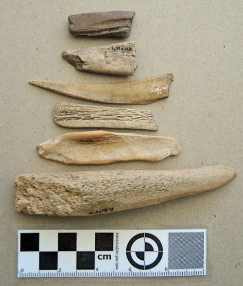
Figure 14. Bone and Antler tools. DcRu-116:101;9;35;51;26;10
DcRu-116:10. Antler tool. An antler wedge that has been sectioned and re-worked into a tapering point on the distal end. Could be used as a finer wedge or a fibre fabricating tool. Disturbed surface at Capital Iron. 12.1×2.3×1.7cm.
DcRu-116:26. Possible worked bone object. Mammal leg bone splinter. Water worn. May have extra use wear on one end. N 9.74 E18.33m DBD 84cm. 7.9×1.85×0.4cm.
DcRu-116:51. Spatula-like bone tool fragment. Use unknown. Heavily ground mammal rib with one end nearly complete, but split longitudinally along one side. Likely the proximal end of the unknown object. Kimta Road midden. (4.37)x(1.35)x(0.27)cm.
DcRu-116:35. Distal end of deer Ulna tool. Ground to pointed rounded tip. Kimta Road midden. (8.0)x1.4×0.3cm.
DcRu-116:9. Mid-section of the distal end of a deer ulna tool. N8.32 E20.35. DBD 40cm. (4.1)x1.9×0.7cm.
DcRu-116:101. Broken portion of a ground bone tool that has been graved to remove a section for other uses. N8-18m E18-20. DBD 0.50-0.60m. 3.8×1.5x.07cm.
Sub-class: Fabrication Tools. Abrading stones.
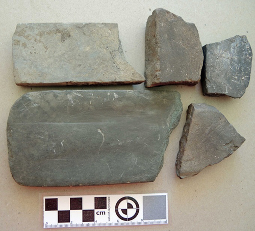
Figure 15. Abrading stones. DcRu-116:24;27;133;3;22.

Figure 16. Ground stone beach cobble. DcRu-116:25.
DcRu-116:39. Large abrading stone. Provenience: Kimta road dumped material. 19.3×16.0x4.6cm
DcRu-116:3. Abrading stone. Shale-like material. Portion of one end missing. Rectangular. Ground on both surfaces and sides, but very fine surface on one side with two shallow grooved areas. N8.408.55 E18.0-18.12. DBD 16cm. (14.3)x7.6×1.35cm.
DcRu-116:24. Abrading stone. Sandstone. Portion of one end missing. In tan-brown ash. Rectangular. Ground smooth on both flat surfaces and sides. N9.65 E19.48. DBD 77cm. (10.7)x5.1×1.4cm.
DcRu-116:27. Abrading stone fragment. Sandstone. Ground on both surfaces. N10-12 E19.15. DBD 80cm. (6.35)x(4.65)x2.7cm.
DcRu-116:22. Abrading stone fragment. Sandstone. Ground on both surfaces. N11.64 E19.55. DBD 64cm. (6.2)x(5.5)x1.5cm.
DcRu-116:133. Shaped abrader fragment. Ground on both surfaces and side. Kimta Road dumped material. (5.2)x(4.3)x1.6)cm.
DcRu-116:25. Ground portion of beach pebble. This was originally a naturally flattened and round edged cobble that was fractured into a few pieces. It may have been a larger complete ground cobble artifact that was broken. However, wear patterns extend over the two fractured edges showing that the stone was used after the original stone was fractured into portions. There is heavy grinding, mostly on one larger surface, of the portion of the original cobble that remains. The long side and to a lesser extent, the shorter end have been ground. There are numerous very fine scratches in all directions on the two smoothed and polished surfaces of this cobble. Its function is unknown, but it could be a rubbing stone for rubbing substances into and compressing wood, such as various practices in treating canoes. Provenience: N9.08 E.18.40. DBD79cm. (6.8)x(4.6)x(2.3).
Sub-class: Fabrication Tools. Hammerstone.
DcRu-116:23. Hammer stone. Elongate coarse sandstone cobble, pecking on one end. Provenience: N8-9.0 E18-20m. DBD 65-70cm. In ash, crushed shell and dark brown soil. 9.4×5.1×3.8cm.

Figure 17. DcRu-116:23. Sandstone Hammer.
Sub-class: Fabrication Tools. Worked stone flakes.
DcRu-116:20. Retouched stone Flake. One long side and the distal end of this flake are intentionally retouched to create a special use edge. This could have been used for shaving hard wood. N9-9.8 E19-20. DBD 60-68cm. 3.8×2.15×0.65cm.
DcRu-116:16. Use retouched flake. Fine grained grey chert. Tiny flaking on two edges suggest this may have been used as a scrapping tool. Given that it was found on the surface the damage on the fine edges could be a result of recent crushing. Provenience: Surface at the Capital Iron site. 3.9×2.8×1.15cm.
DcRu-116:41. Use retouched flake. A few areas of tiny flaking suggest this fine dacite flake may have been used as a scrapping tool. Provenience: Kimta Road midden.4.2×3.4×1.1cm.
DcRu-116:5. Flake with bifacial flaking on one side. Basalt. This is likely a flake fractured off a larger piece in an attempt to make a projectile point. N10.23 E19.20. DBD 38cm. 3.5×2.5×1.1cm.

Figure 18. Worked Stone flakes. DcRu-116:20;41;16;5
TEST
Sub-class: Debitage. Antler.
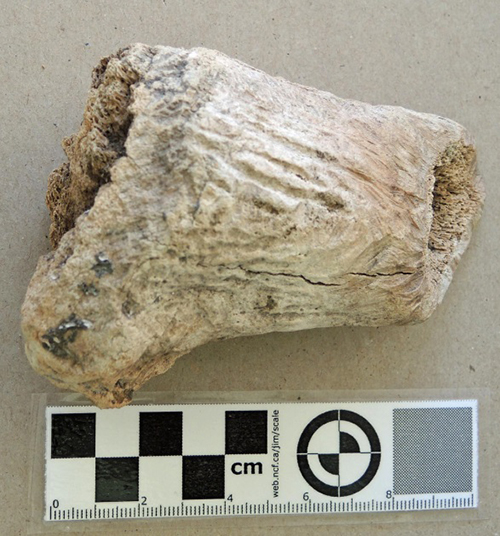
Figure 19. Worked elk antler debitage. DcRu-116:32.
DcRu-116:32. Antler. The base portion of an elk antler that has been chopped off and subsequently chewed by rodents. Disturbed surface deposits at Capital Iron. 10.4×7.7×4.1cm.
Sub-class: Debitage. Flaked Stone.
In urban areas, fine grained rocks crushed by machinery can be found scattered about, especially when used on pathways and fill around houses and in cement structures. It is not uncommon in this environment to find what falsely appear to be ancient flakes or cores discarded in tool manufacture. Since many of the items described here are from disturbed deposits – that is midden mixed with other material of unknown origin – we need to be cautious that some may be of more recent non-First Nations activity. Many of the flakes do have an old surface patina demonstrating that they are ancient. I have included two that I have determined are of a recent nature – numbers 11 and 30. Artifact no. 11 was found in the 0-30cm level of unit 2 – indicating some historic disturbance in this upper level.
From my own experience of collecting and flaking many thousands of stones from many sources in the greater Victoria Region, I am able to observe there are what I would call field cobbles and beach cobbles. Where the original outside cortex of the flaked basalt is present, field cobbles have a duller and mottled heavy patina on the outer surface as opposed to beach or stream cobbles which have smoothed surfaces and less evident outside patina. DcRu-16:49 and DcRu-116:46 are examples of the latter types. X-ray analysis is needed to see if these types have any compositional differences. One item, DcRu-116:128, is not flaked, but is a fire-exploded cubicle piece of fine basalt or dacite that may have been intentionally heat treated and intended as a core of raw material.
DcRu-116:46. Basalt Core segment. Original cortex on two sides. Field basalt based on surface texture. Kimta road dumped midden. 5.66×4.40×3.6cm.

Figure 20. Two types of surface texture. Mottled surface of field cobble (DcRu-116:46) on left and smoother surface beach cobble (DcRu-116:49.

Figure 21. Flakes with original cortex surface. DcRu-116:54:47:45:43:50:55.
DcRu-116:49. Basalt Flake with cortex on one side. Beach cobble based on surface texture. Kimta road dumped midden. 7.6×3.8×1.9cm.
DcRu-116:54. Flake with original cortical surface on one edge. Kimta Road midden. 3.4×2.7×1.3.
DcRu-116:45. This is a section of a cobble that has been formed by bi-polar percussion – that is, smashing one end of the cobble while the other end rests on a stone anvil. It is a very hard chert-like material. Kimta Road midden.
DcRu-116:47. Flake with most of the original cortical surface on one side. 5.16×3.36×1.35cm. Kimta Road midden.
DcRu-116:43. Large flake of basalt. Some original cortical surface. 7.4×4.1×1.1cm. 6.11×4.00×1.61. Kimta Road midden.
DcRu-116:50. Core segment with remnants of the original cortical surface remaining on one end. Provenience: Kimta Road midden.
DcRu-116:55. Large flake of basalt. Some original cortical surface remaining on one end and in small amounts of two thin edges. 4.6×4.1×1.8. Kimta Road midden.
DcRu-116:2. Basalt core segment. N 8.52m E18.19m. Upper level. 4.85×4.0x1.5cm.
DcRu-116:42. Basalt flake. Some recent edge crushing. 3.9cmx2.8cmx0.5cm.
DcRu-116:48. Basalt flake. Some recent edge crushing.
DcRu-116:53. Basalt flake. Some recent edge crushing.
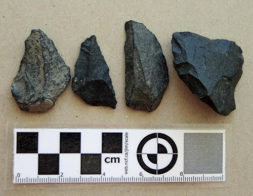
Figure 22. Stone detritus from Tool making. DcRu-116:42;48;53;2
DcRu-116:4. Small percussion flake that likely came off a core with the removal of larger flakes. Although it has a similar size as some micro-blades, it is not a pressure flaked micro-blade. Surface at Capital Iron site. 1.25×0.8×0.25cm.
List of Debitage within the DcRu-116:59-133 range.
In 1992, I extracted the following artifacts from the 1976 excavation level bags that were labelled as to provenience in the excavation units. Exceptions are numbers 129-132 from the Kimta Road midden that were originally lumped together as #49.
Measurements are not given, as anyone undertaking lithic analysis would want to measure the artifacts in a prescribed way and develop more specific descriptions of flake morphology. The majority of these are basalt, andesite and other volcanic rocks.
DcRu-116:64-65(Pit 1,Level 1, 10-20cm); DcRu-116:60(Pit 1, Lev. 3, 30-40cm); DcRu-116:66-67 (Pit 1, Lev. 4, 40-50cm); DcRu-116:101-107 (Pit 1, Lev. 5, 50-60cm); DcRu-116:59&76-88 (Pit 1, Lev. 6, 60-70cm); DcRu-116:121-127 (Pit 1, Lev. 7, 70-80cm); DcRu-116:117-120 (Pit 1, Lev. 8, 80-90cm); DcRu-116:89-90 (Pit 1, Lev. 10, 100-110cm). DcRu-116:100&128 (Pit 2, Lev. 2, 20-30cm); DcRu-116:61-63 (Pit 2, Lev. 3, 30-40cm); DcRu-116:68-75&133 (Pit 2, Lev. 4, 40-50cm); DcRu-116:91-99 (Pit 2, Lev. 6, 60-70cm); DcRu-116:108-116 (Pit 2, Lev. 7, 70-80cm).

Figure 27. Basalt core or raw material. DcRu-116:38.
DcRu-116:38. Basalt core or raw material. Large five sided core of coarse grained basalt. Flakes are fractured from two faces resulting from single impact point on the corner of one side. This could be a raw material sample that was tested by removing a flake or a piece of unworked raw material brought to the site in ancient times and subsequently struck once by modern machinery while being dug up. Kimta road dumped midden. 9.3×9.2×6.8cm.
Modern stone artifacts
Two stone artifacts are of a recent nature. DcRu-116:11 is a section of a quartzite cobble that has been formed by heavy bi-polar percussion. It was found in a disturbed level with historic materials. Modern commercial cement is still adhering to the rock. This appears to be a mechanically crushed rock that was inside a cement structure. N10-12 E18-20.DBD 0-30cm. 5.9×4.5×1.8cm. DcRu-116:30 is a small spall off of a large cobble that was removed with enormous force. Although spall tool artifacts are occasionally found in ancient sites, this one exhibits a large secondary outside spall and a crushed point of impact which is typical of recent machine crushed rock.

Figure 28. DcRu-116:11 & 30. Modern machine crushed pebbles.
Provenience: Kimta Road midden. 5.6×4.75×1.5cm.
Private Collection Artifact
In March of 1991, I observed shell midden at the west end of the parking lot located at the S.W. corner of Store and Chatham Streets. It had been exposed by large truck ruts. I observed a nephrite adze blade found by a private citizen at this location. The 9.5cm long adze blade had a cutting edge that was beveled mostly on one side with a slight bevel on the other. It measured 6cm across the cutting end and 3.4cm across the poll end. It was thickest, 1.4cm, near the cutting end and 1.2cm thick at the poll end.
Observations of DcRu-116 in 2014.
Midden deposits were found underneath a small building on Store Street when it was being torn down in 2014. This location was to the north of the 1976 excavation area. On November 20, 2014 I visited the site to examine and photograph the exposed shell midden. The upper portions of the midden were disturbed by historic non-First Nations activity, but the southern lower portions were intact.
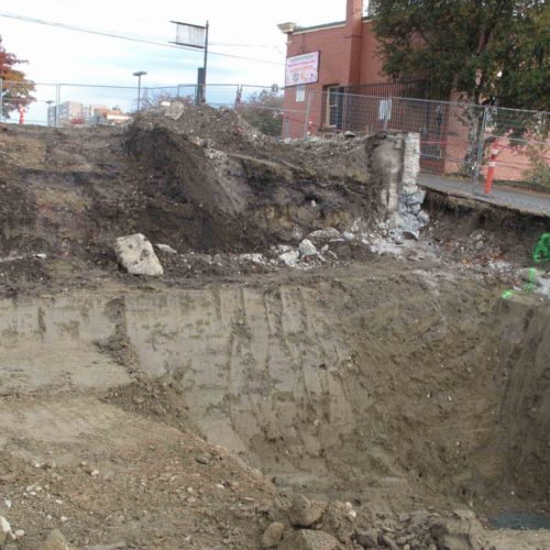
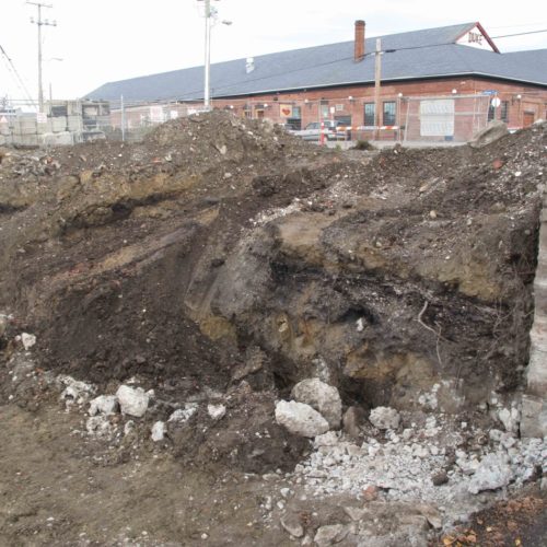
Midden Content Observations
Figure 32, shows a close-up of the shell midden which is composed mostly of native oyster shell. In a close examination of the exposed midden, I observed many small weathered beach pebbles (1-3cm) mixed in with the shell fish remains. There are no local inner harbour beaches that could be the source of these small pebbles. They are similar to the small pebbles that one often observes entangled in the roots of the Bull kelp (Nereocystis luetkeana), that has been pulled up either by storms or by people. I would suggest that these pebbles came to this site when First Nations brought large canoe loads of kelp that they processed on the site for making a variety of items. The long stalks of Bull kelp were dried and cured, and spliced or plaited together to make ropes, nets, and fishing, harpoon and anchor lines. Kelp bulbs were also used for liquid storage and for steam bending wooden fish hooks.
In 2014, Stantec undertook archaeological work on the site under alteration Permit 2014-0300. This work resulted in the removal of the last of the shell midden from the west side of Store Street.
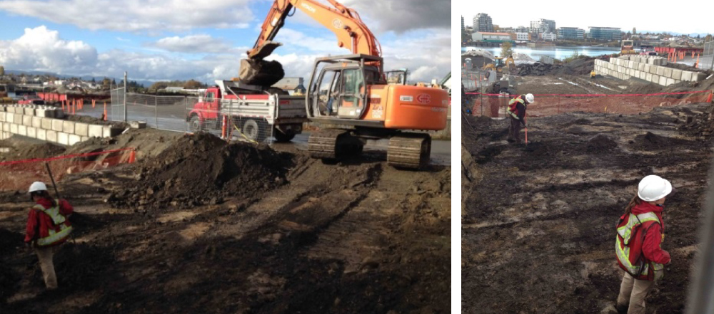
Figure 33. Stantec monitoring removal of Midden. Tom Bown photograph October 31, 2014.

Figure 34. Site location after archaeological monitoring and removal of cultural material. Grant Keddie photograph December 3, 2014.
Summary
The Capital Iron site, DcRu-116, is one of only three pre-contact archaeological sites in Victoria’s Inner Harbour. The other two are located on rocky bluff peninsulas at Raymur Point and Lime Point across from each other near the entrance to the inner harbour. The Lime Point site dating between 600 and 1200 years old is a known defensive site – having once had a trench embankment dug around the back end of the peninsula. The Capital Iron site was first occupied earlier around 260A.D. to 424 A.D. It is likely that the location of the Capital Iron site was chosen for both economic reasons and its defensive features – being high above the beach with a good view of the harbour. Modern development has now destroyed all of the Lime Point site and most of the Raymur Point site.
DcRu-116 has been heavily impacted by historic activities. The recovery of information has been piecemeal but has begun to build a story of the human activities that occurred here in the past. The recovery of more information from any intact midden will help to build a more complete picture.
Future archaeological work at DcRu-116.
The shell midden is now mostly or all gone from the west side of Store Street on the property around the Capital Iron Buildings. The low areas near the water are landfill on a previous embayment that will not contain any intact midden.
Portions of site DcRu-116 are known to exist under Store Street east of the Capital Iron buildings and extending, at least, onto the parking lot at the S.E. corner of Chatham and Store Streets. If some of this midden is still in-tact, it will be important to recover an adequate faunal sample that was not recovered in the 1976 excavations due to the rushed emergency nature of that project and also to get more radio carbon dates to provide a better time frame as to when the site was occupied. This site has the potential to be a valuable source of information on the history of Lekwungen peoples and their use of Victoria Harbour.
Appendix 1
Historic Disturbance of the Archaeological Site Location
Lot 114 adjacent to the south of the excavation area was owned by a J. Crow in 1861 (Victoria Archive tax assessment records). Extensive activities, modifying the landscape began in this area with the building of the two story stone warehouse of Dickson and Campbell & Co. on lot 114, with a wharf and other buildings adjacent (they later bought lot 113). The three foot thick walls were “built of granite, blasted from the adjoining primeval rock” (Colonist October 31, 1862 & September 8, 1863).
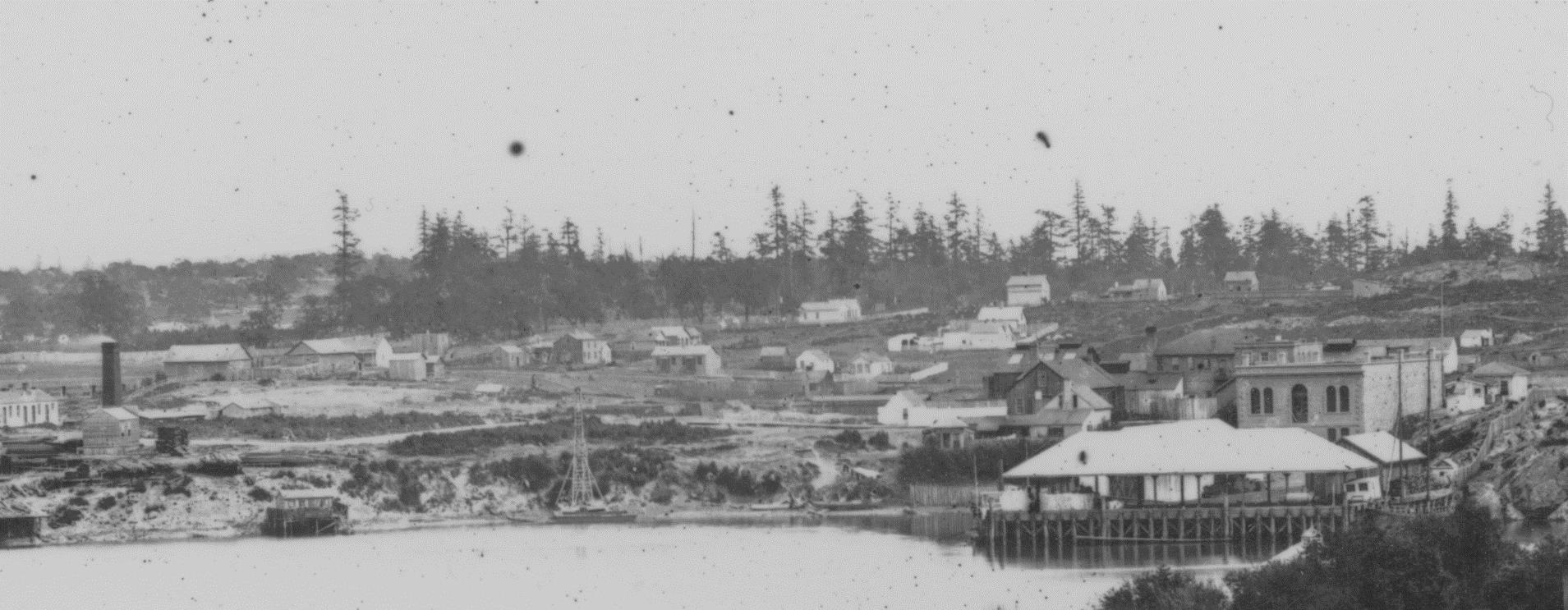
Figure 35. The Dickson and Campbell & Co building (later the Capital Iron building) on the far right in 1863.
In 1885, the location had become the Mount Royal Milling and Manufacturing Co. on lot 113 (two floors added) and Joseph D. Pemberton’s Royal Milling and Manufacturing Co. on lot 114. These properties later became part of the Capital Iron and Metal Company property at 1900 Store Street (an earlier address was 1832 Store Street).
It is likely that some intact midden still exists beneath Store Street and extending onto the properties east of Store Street on both sides of Chatham Street. Less disturbance of the landscape has occurred in the past on the south side of Chatham. I observed shell midden at this parking lot location in the 1970s when some shallow bulldozing activity was undertaken. A private citizen found a stone nephrite adze blade for a work working tool in exposed shell midden at this location.
On the north side of Chatham Street extensive disturbance occurred beginning in 1862, with development of the Albion Iron Works facilities. This included Foundry buildings, machine shops and a sequence of other buildings (see 1885 Fire Map for later changes).

Figure 36. 1885 Fire Map.
After the Iron works closed the railway was extended into this area (see 1957 Fire Map). Large amounts of land fill were dumped in the area, especially toward Government Street where bottle diggers, during the 1960’s and early 1970s, uncovered large amounts of refuge that came from the Brewery site on the other side of Government Street.

Figure 37. 1957 Fire Map.
You and Yew post
Plants make molecules that chemists could never imagine. Chemical poisons that deter herbivores are advantageous for organisms that can’t move. For humans, depending on the dosage, these molecules can be either poisonous or medicinal. The small shrub circled here is Pacific Yew. In 1962 it was discovered that its tissues, especially the bark, contain ‘taxol’ effective in treating cancer. It took many kg of bark (in 1993 34,000 kg were harvested in BC) for a single dose – and killing the tree. Now the drug is synthesized in a lab using precursors from the needles. The seed is surrounded by red, fleshy tissue called an ‘aril’, sometimes incorrectly called a ‘berry’.

The small shrub circled here is Pacific Yew.
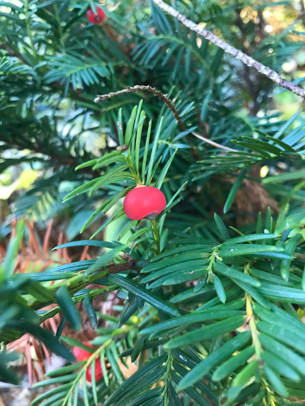
The seed is surrounded by red, fleshy tissue called an ‘aril’, sometimes incorrectly called a ‘berry’.
Swordfishes in BC post
In an earlier post I mentioned that Luke Halpin was out surveying marine mammals and birds from the deck of the CCGS John P. Tully, and spotted something totally different west of Brooks Peninsula. The fish was estimated at 3.5-4 meters in length, and was cruising against the current just below the surface.
But until the paper announcing his find was accepted by a scientific journal, I didn’t want to spill the beans and say what he had found. His research paper (Halpin et al. 2018) will be published in the spring issue of the Northwestern Naturalist.
Photo by Luke Halpin, September 5th, 2017
This picture says it all – there is no debating what this fish is – only one species that fits the bill. Swordfish are known north to the southern Kuril Islands in the western Pacific, but Luke’s find is the northern-most record for the species in the eastern Pacific and is conclusive evidence of this species right along our coast.
A Google Earth image showing where the Swordfishes from 2017 and 1983 were found relative to Vancouver Island.
A previous record from 1983 (see Sloan 1984, and Peden and Jamieson 1988) was from just inside of our exclusive economic zone (EEZ) and barely qualified as a BC fish. The 1983 specimen was caught as by-catch at 47°36’N, 131°03’W, during an experimental fishery survey by the M/V Tomi Maru. The rostrum and tail were preserved in the Royal BC Museum’s fish collection (RBCM 983-1730-001). I am guessing the edible bits in between were cut into steaks, and ended up on someone’s dinner table. At least Luke’s Swordfish was left alone and for all we know, is happily cruising south to slightly warmer water.
References:
Halpin, L.R., M. Galbraith, and K.H. Morgan. 2018. The First Swordfish (Xiphias gladius) Recorded in Coastal British Columbia. Northwestern Naturalist, 99(1): XX-XX. (pages not set)
Peden, A.E., and G.S. Jamieson. 1988. New distributional records of marine fishes off Washington, British Columbia and Alaska. Canadian Field-Naturalist, 102(3), 491-494.
Sloan, N.A. 1984. Canadian-Japanese Experiental Fishery for Oceanic Squid off British Columbia, Summer 1983. Canadian Industry Report of Fisheries and Aquatic Sciences No. 152: pp. 42.
We Three Kings post
Keep your eyes peeled for deep-sea fishes while strolling along our shores. In the last month, three King-of-the-Salmon (Trachipterus altivelis) have washed up in the Salish Sea. Two were found in September (21st and 26th) in the Oak Bay area, Victoria. One of these was still swimming when found. A third was found October 3rd in Hood Canal, in Puget Sound. The first Oak Bay specimen will be preserved for the Shaw Centre for the Salish Sea in Sidney, the second was not recovered, and the third will be preserved in the Burke Museum’s collection. The Royal BC museum has 18 Trachipterus specimens, with several of these from the Salish Sea area.
The King-of-the-Salmon from Hood Channel, photographed by Randi Jones.
Is this species new to the region? No. The species ranges from Alaska to Chile, and knowledge of this species pre-dates European arrival on this coast. Is this trio of King-of-the-Salmon a case of post-spawn mortality? A sign of change in our oceans? We don’t know. Actually, when you look at the diversity of marine fishes off our coast, there is a lot of basic biology that we don’t know. We also get Longnose Lancetfishes (Alepisaurus ferox) washing up from time to time, although it has been a few years since I have heard report of a Lancetfish in the Victoria region.
King-of-the-Salmon swim by passing a sine wave down their dorsal fin – they can get a fair bit of speed just by doing that. They can also reverse using the same fin flutter. They slowly turn by putting a curve in the body. However, in the first few seconds of the linked video you can see that they also swim in a more typical fishy way (using eel-like body oscillation) when they need a burst of speed or a really quick turn. If you’d like to see this form of locomotion in person – you can see it in a pet shop. Knife fishes use the same basic locomotion method – except they use their anal fin rather than the dorsal.
Close up of the head of the King-of-the-Salmon showing the premaxillary (red) and maxillary (green) bones extended, photographed by Randi Jones.
Note also in the video that the fish has a very short face compared to the Hood Channel specimen photographed onshore. As with many fishes, the jaws of the King-of-the-Salmon are protrusible – the premaxillary and maxillary bones swing out to create a tube – the gill chamber dilates, and water rushes into the mouth along with the prey. The same sort of suction pump mechanism is used by a wide variety of fishes – from tiny seahorses to giant groupers. Once the prey item is inside the fish’s mouth, the mouth closes, water is released through the gills and the prey is swallowed. The entire sequence is lightning fast – even in pipefishes and seahorses – blink and you miss it. In some fishes, the process is even audible – you can hear a snapping sound when seahorses slurp up crustaceans (and fishes). You can’t hear the same snapping sound when larger fishes engulf their prey, but it is no less dramatic an effect.
In 2014, a Louvar and a Finescale Triggerfish were found in BC – a double-header of interesting southern fishes in our waters. But wait… it looks like 2017 is also a double-header for cool coastal fish.
This summer of 2017 (and in 2016), Basking Sharks were sighted here in BC. I think every Basking Shark is newsworthy given that they were nearly eliminated here in an ill-conceived plot to protect BC fisheries (see Wallace and Gisborne 2006 for that sad story). This year’s Basking Sharks were found in Caamano Sound in July, and near the Delwood Seamounts in August. Was it one roving shark? Or two? Are there others?
This September however, Luke Halpin was out surveying marine birds from the deck of the CCGS John P. Tully, and spotted something totally different west of Brooks Peninsula. The fish is estimated at 3.5-4 meters in length, and was cruising against the current just below the surface.
We are really fortunate that it was sunny and seas were so calm – because his picture leaves no doubt as to the fish’s identification. The best part about the story is that the fish is still out there. Don’t get me wrong, I’d have loved to have the fish as a specimen for the museum’s collection – but then again, it would require a custom vat – three to four meter fishes don’t fit in jars.
This species is known north to the southern Kuril Islands in the western Pacific, but Luke’s find is the northern-most record for the species in the eastern Pacific and is conclusive evidence of this species as a new addition to our coastal fish fauna. Which species did he find? You’ll have to wait until he publishes his observations in a scientific research paper. Consider this a trailer – a teaser – there’s a big fish out there – it is cool… and I am jealous. I would love to see this fish alive.
100 Meter Dash post
The Doncaster population of the European Wall Lizard probably is 6 years old based on conversations I have had with home owners. In the Google Earth image – the white dots are known locations – the green dots are new locations for 2017.
How do I know these are new? Homeowners specifically said they had no lizards in 2016 – but they certainly do now. That’s the power of local knowledge and citizen science. The green dots along Oak Crest Drive were newly reported in the spring of 2017, with at least three adult lizards now known on the property. The two green dots along Cedar Avenue to the northeast are based on sightings of at least three young lizards – probably lizards that hatched this year and got well-clear of their parent’s territory. Cannibalism is a good emigration motivation.
Based on where lizards were known in 2016, these 2017 records represent range extensions from 20 to 100 meters. Compared to their body size, that’s pretty decent dispersal given that adult lizards only grow to 21 cm (those fortunate enough to have a perfect tail), and in many cases, the dispersing lizards are young-of-the-year at 8 or so centimeters in total length.
If younglings continue to bolt at this rate and make a bee-line south, I will have lizards in my garden in 2 years. More realistically, it will be another 3 years before we see them along our raised beds or in our greenhouse – not that I’m counting.
We now have 21 orca specimens at the Royal BC Museum—the latest to arrive was T-171, a 6.07 meter female Biggs Orca which was found near Prince Rupert, October 19th, 2013. She had pinniped skulls, vibrissae (whiskers) and partially digested bones in her gut but was emaciated. Why was she emaciated?
During the necropsy, researchers discovered that T-171 had mid-cervical to lumbar vertebrae with severe overgrowth of the neural arches and lateral processes (noted as spondylosis in the necropsy) – the overgrowth looks roughly like popcorn or cauliflower – and had the effect of interlocking some vertebrae. This likely explains her emaciated state. Was she able to hunt? Was she supported by her relatives?
The skull of T-171 (ventral (palatal) view [left], right side [center], and dorsal view [right]) awaiting its catalog number and final place in the Royal BC Museum collection.
Comparison of T-171’s vertebra (left) with overgrowth of bone vs. the normal vertebra of another Biggs Orca (12844) (right). The two vertebrae are not from the exact same position along the spine, but the difference between the two is still shocking.
Many of T-171’s vertebral centra are eroded and porous – not like those of a healthy animal (12844).
The overgrowth of the neural arches pinched the spinal chord of T-171; compare to a neural arch of 12844 (right). The vertebral malformation must have limited this animal’s mobility. It is hard not to anthropomorphize and imagine the discomfort due to this deformation.
T-171 originally was prepared for exhibit at the Royal Ontario Museum, but they wanted a clean articulated skeleton for exhibit. In contrast, we were interested in T-171 because of its skeletal malformation. To make a short story long, we came to an agreement with the ROM to transfer T-171 to the Royal BC Museum, and since, the ROM has acquired L95 (Nigel), a 20 year old southern resident who was found near Esperanza Inlet, March 30th, 2016.
Which Orca is next? In most cases we have no clue – it is not like we hunt orca just to add them to the collection. And we don’t usually have a production line of specimens in preparation. New specimens are acquired when a body washes up, and we make a snap-decision to cover the cost of specimen recovery and preparation. However, September 15, 2016, T-12A (Nitinat) was found off Cape Beale and towed to Banfield. I was contacted September 16th to see if the Royal BC Museum was interested (obviously that was a YES), and now his massive skull is being prepared. Once degreased, Nitinat’s skull will be added to the Royal BC Museum collection – sometime in 2018 – and made available for scientific research.
As a kid I collected many things – from reptiles and amphibians to model airplanes to Star Wars cards – and now look where I am. I dress in black and white as a Stormtrooper with the 501st legion and collect black and white delphinids – Killer Whales – for the Royal BC Museum. Life sure takes you to unexpected destinations.
In the 1970s, I was aware of an old lantern slide in the Royal BC Museum ethnology collection that I later identified as a Songhees First Nation. I based my information on the original field portrait catalogue of Paul Kane – created when he was at Fort Victoria in 1847 (Harper 1971:315-317). I did not know at the time the original sketch was missing, and this seemed to be the only image of it.
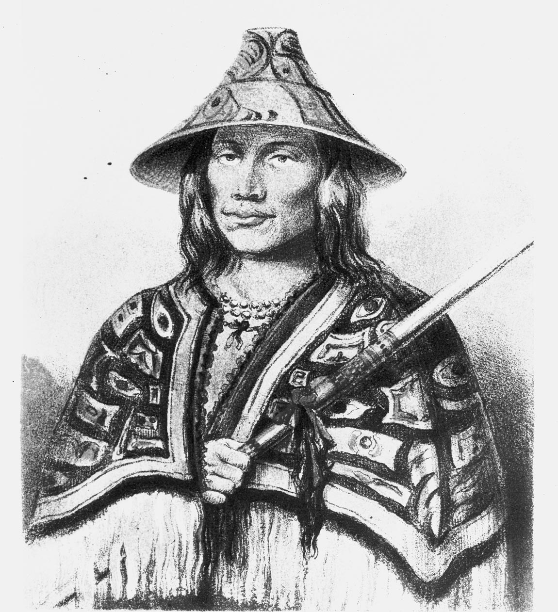
Figure 1. Photograph of a missing sketch by Paul Kane, 1906. Charles Newcombe. PN17161.
Figure 1, is No. 46 in Paul Kane’s portrait log: “Ska-tel-san – a Samas Tillicum with a (grass) hat that is much worn here south of de Fuca”, and in his Exhibition of 1848 he is listed as: “124 Sca-tel-son – a Songhes Indian, Vancouver’s Island” (Harper 1971:316 & 319).
A painting in the Royal Ontario Museum (ROM912.1.870) was made from this original sketch. Harper was led into miss-labelling the latter as “A Babine chief” (1971:265). There was a mix-up of information during exhibits of Kane’s work, where various writings and collection lists, rather than his original accurate field logs, were used as source information. Incorrect identifications in publications of Kane’s friend Daniel Wilson also contributed to the confusion in names.
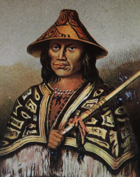
Figure 2. Lithograph of painting of Sir Daniel Wilson, Published in 1862.
Lister in his Paul Kane/the Artist/: Wilderness to Studio (fig.58; 2010:301) and again in his editing of Wonderings of an Artist Among the Indians of North America (Plate 60; 2017: 242-243) labels this later painting (ROM912.1.87) as “A Babbine Chief. Tsimshian. Skeena River region, northwest British Columbia.” He records that the description is based on “A list of Pictures sent to Mr. G.W. Allan, March 6, 1856”. Harper’s speculation on this painting in his Catalogue Raisonne IV-587, is correct: “This canvas is probably based on an unlocated sketch. When lithographed for the frontispiece in the Wilson book, Prehistoric Man, the title was changed to “Chimseyan Chief” (Harper 1971:308).
Figure 2, shows a lithograph of a painting by historian and artist Sir Daniel Wilson copied from the missing Paul Kane original. This did appear in volume I of Wilson’s 1862 publication.
In the third edition (1876) of Volume 1, of Wilson’s Prehistoric Man, this person is noted as “Kaskatachyuh, a Chimpseyan” Chief”, where it is noted that Wilson drew it “from sketches by Paul Kane”. Wilson, in discussions about what are obviously Haida argillite pipes, refers to them as those of the “Babeen Indians”, and mentions, mistakenly (in the second part), that they are: “from a drawing made by Mr. Kane, during his residence among the Babeen Indians” (Wilson 1857:42). Paul Kane never went to the northern coast of British Columbia, and First Nation visitors from that region did not come to the Victoria area until after Paul Kane’s visit. A few First Nations from the central and northern coast of British Columbia did work at the Hudson’s Bay posts, but there is no indication that these were the source of Kane’s sketches.
In the mid-19th century, accurate writing about the First Nations of British Columbia was lacking. Kane’s historian friend, Daniel Wilson, kept current with the ethnographic literature of the times, such as the writings of geographer and ethnologist Henry Schoolcraft, but often lumped unrelated groups together or got their geographic locations wrong. Wilson was likely a strong influence on the use of First Nation names in the Paul Kane writings and exhibits.
This Songhees person in Wilson’s (1862, Vol. 1) frontispiece, is also the same person, but from the original Kane sketch in reverse image in my book (Keddie 2003:3). I have since realized that lantern slide RBCM PNH104 was mistakenly photographed in reverse. I have identified the person as Sketlesun, a Songhees from the old Cadboro Bay village. He is the 6th person on the Che-ko-nein treaty list of 1850. Because Sketlesun is wearing a Chilkat blanket and northern style hat, this image has been mistakenly labelled as a “Tsimshian chief” (Keddie, 2003:30). This style of Chilkat blanket was a valuable and high status trade item in the mid-19th century. Kane had purchased his own Chilkat blankets (see Lister 2010), but used designs from at least two different ones in his portraits.
In 1906, Charles Newcombe took, at least twelve, photographs of Kane paintings. In regard to three of these (not figure 1) that he published, he notes they are: “reproduced by kind permission of E.B. Osler, Esq, M.P., of Toronto, who owns the originals” (Newcombe, 1909:53). He also acquired copies of paintings that were used in Daniel Wilson’s, two volumes – Prehistoric Man: Researches into the Origin of Civilisation in the Old and the New World (Wilson 1862). Wilson made copies of several of Kane’s sketches for use in these and other publications.
I have now found the original negative from which Newcombe’s lantern slide was made (RBCM PN17161). Newcombe seemed to accept the naming of this image as Tsimshian because of the cape – not having access to Kane’s field catalogues at this time. It is clear that the photograph taken by Newcombe of Kane’s No. 46 portrait is a photograph of what Harper referred to as Kane’s “unlocated sketch”. I do not know where the original is, but this photograph might lead to its re-discovery.
Edmund Osler had much of his collection on loan to the University of Toronto from 1904, until it became part of the Royal Ontario Museum collection in 1912 (Harper 1971:35). We know that in 1906 Charles Newcombe was in Montreal visiting “Dr. Lowe” to see his collection on June 2, and the next day visited the Red Path Museum. On June 10, he was in New York and around that time visited the Field Museum of Chicago. Somewhere after Newcombe took photographs of the collection(s), the sketch of the Songhees man named Sketlesun, referred to in Kane’s portrait log, disappeared or lies unidentified in some collection.
References
Harper, Russell J. 1971. Paul Kane’s Frontier. Including Wanderings of an Artist among the Indians of North America by Paul Kane. Edited with a Biographical Introduction and a Catalogue Raisonne by J. Russel Harper. The Amon Carter Museum, Fort Worth, and the National Gallery of Canada, Ottawa, University of Toronto Press, Toronto.
Keddie, Grant. 2003. Songhees Pictorial. A History of the Songhees People as seen by Outsiders, 1790-1912. Royal B.C. Museum, Victoria.
Lister, Kenneth R. 2016. (Editor) Wonderings of an Artist Among the Indians of North America by Paul Kane. Royal Ontario Museum.
Lister, Kenneth R. 2010. Paul Kane/the Artist/: Wilderness to Studio. Royal Ontario Museum Press, Toronto.
Newcombe, Charles. 1909. Guide to Anthropological Collection in the Provincial Museum, King’s Printer, Victoria, B.C.
Wilson, Daniel. 1857. Pipes and Tobacco: An Ethnographic Sketch. Lovell and Gibson, Toronto.
Wilson, Daniel. 1862. Prehistoric Man: Researches into the Origin of Civilisation in the Old and the New World, McMillan, Cambridge.
There is an ancient archaeological shell midden – the refuse from what was once, at least, a seasonal camp on Raymur Point at the intersection of St. Laurence Street and Kingston Avenue. Raymur Point is a raised bedrock peninsula on the south side of Victoria’s inner harbour located to the west of Laurel Point and at the east end of Fisherman’s Wharf. The site was not occupied by First Nations in historic times and appears to have had a limited occupation in the distant past.

Figure 1. Western portion of Victoria’s Inner Harbour in 1878. Shoal Point in the foreground is the start of the inner harbour. Raymur Point can be seen as a small peninsula with a house on it at the centre of the right side of this lithograph. Close up of Bird’s Eye View of Victoria, 1878. RBCM PDP-02625 .
The midden location, known as Archaeological site DcRu-33, includes the extreme northern extension of the point and the shoreline along the wider section of the point extending along the west shore to the area around lots 1291 and 1292 on the west side of St. Lawrence Street.
The site is now mostly destroyed by the building and clearance of the large Texaco Oil storage tanks that were here until the 1980s (see figure 10), and the more recent building of apartment units. Midden may still be intact on some parts of the adjoining lots 1291 and 1292. The latter locations were not included in the last Archaeological work undertaken on the site in 1998 (Hewer 1998).
The original configuration of the peninsula can be seen in Figure 2. The large home just to the right of the centre of this photograph is still on lot 1291 near the corner of St. Lawrence and Kingston Street’s.

Figure 2. Raymur Point in the late 1890s. Richard Maynard Photograph. BCA A-3457.
An 1890s, close up of the northern tip of the Point can be seen in Figure 3. This shows the area of the (then) probably undisturbed midden. The midden eroding over the bank can be seen in Figure 4. I took photographs in March 1990, during the digging out of the foundations left over from the removed of oil tanks.

Figure 3. North end of Raymur Point at centre. The house on the right is located beyond the next small bay and not on Raymur Point. Close-up of RBCM F-9653.

Figure 4. Midden eroding out of a crevice.
The house on lot 1291 can be seen in figure 5. This photograph shows the west side of the site where only disturbed midden and extensive rock fill existed in the foreground in 1990. Figure 6, shows the north end of the site where midden can be seen slumping down the bank into a tiny embayment in the bed rock. It is below this area where I collected some of the artifacts.

Figure 5. The west side of the site in 1990, showing disturbed shell midden. Grant Keddie photograph.
The east side of the site is seen in Figure 7. This area was previously destroyed and now being dug up again. The northern tip of Raymur Point is on the other side of the bulldozer in the photo. The now destroyed Lime Bay First Nations defensive site, DcRu-123, can be seen across the harbour in the form of the knoll just to the right of the backhoe.
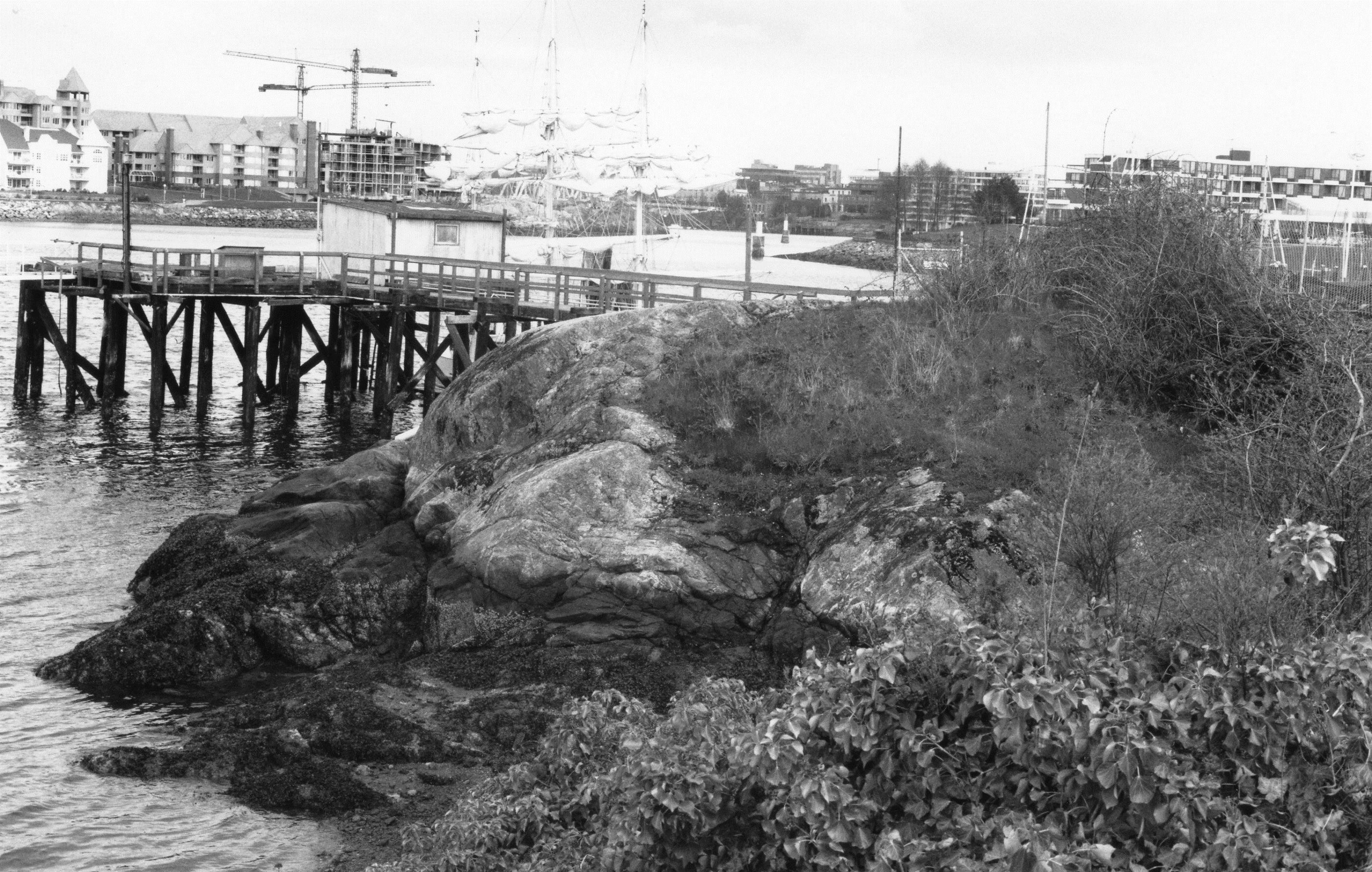
Figure 6. The north end of Raymur Point in 1990, before the condominium development. Midden can be seen eroding down the face of the bedrock. Grant Keddie photograph.

Figure 7. Looking North on East side of Raymur Point.

Figure 8. Looking east at the black midden on the outside of the cement wall.
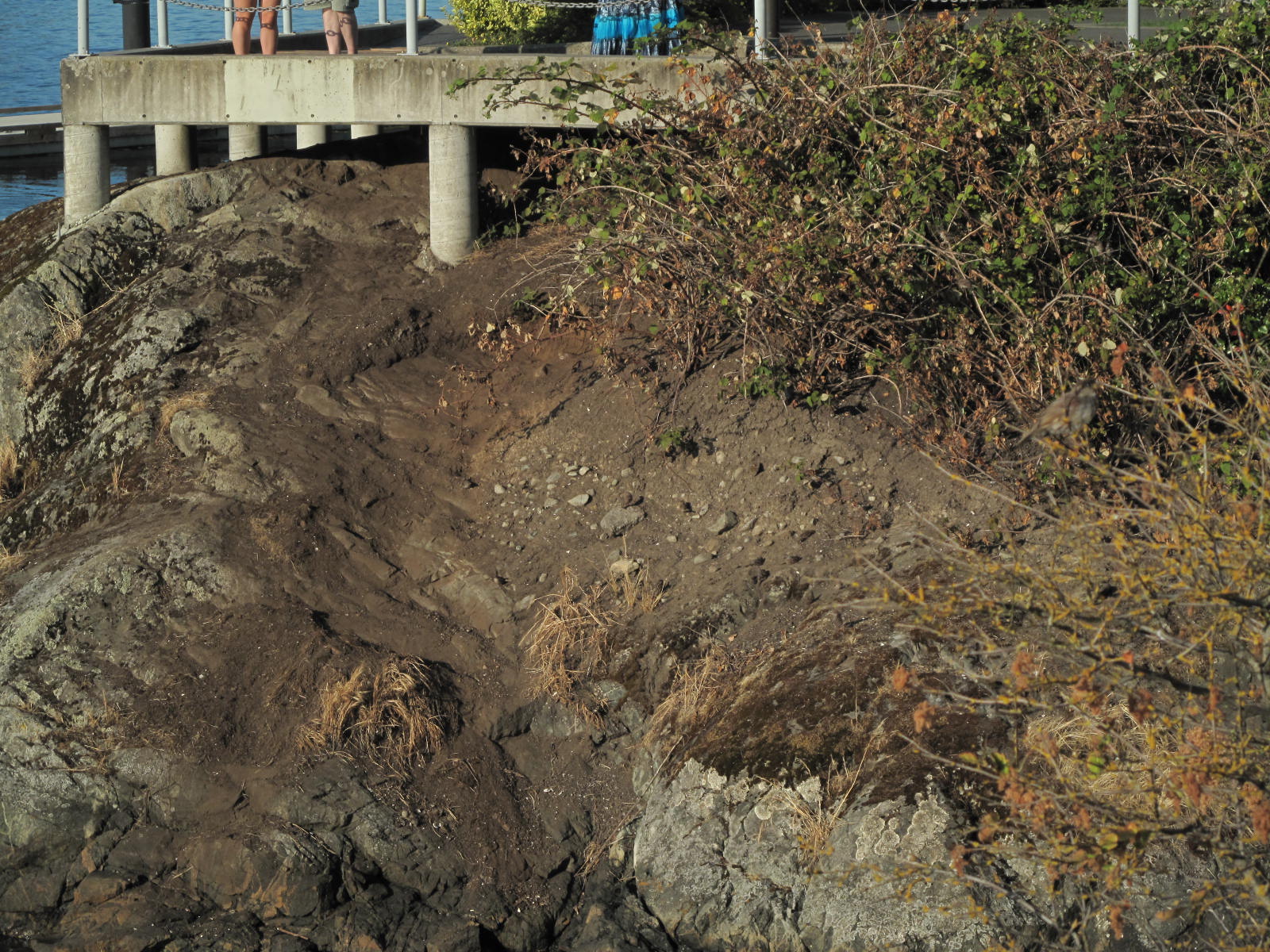
Figure 9. The same bedrock area seen in Figure 6, after 25 years of erosion. Grant Keddie photograph, 2015.
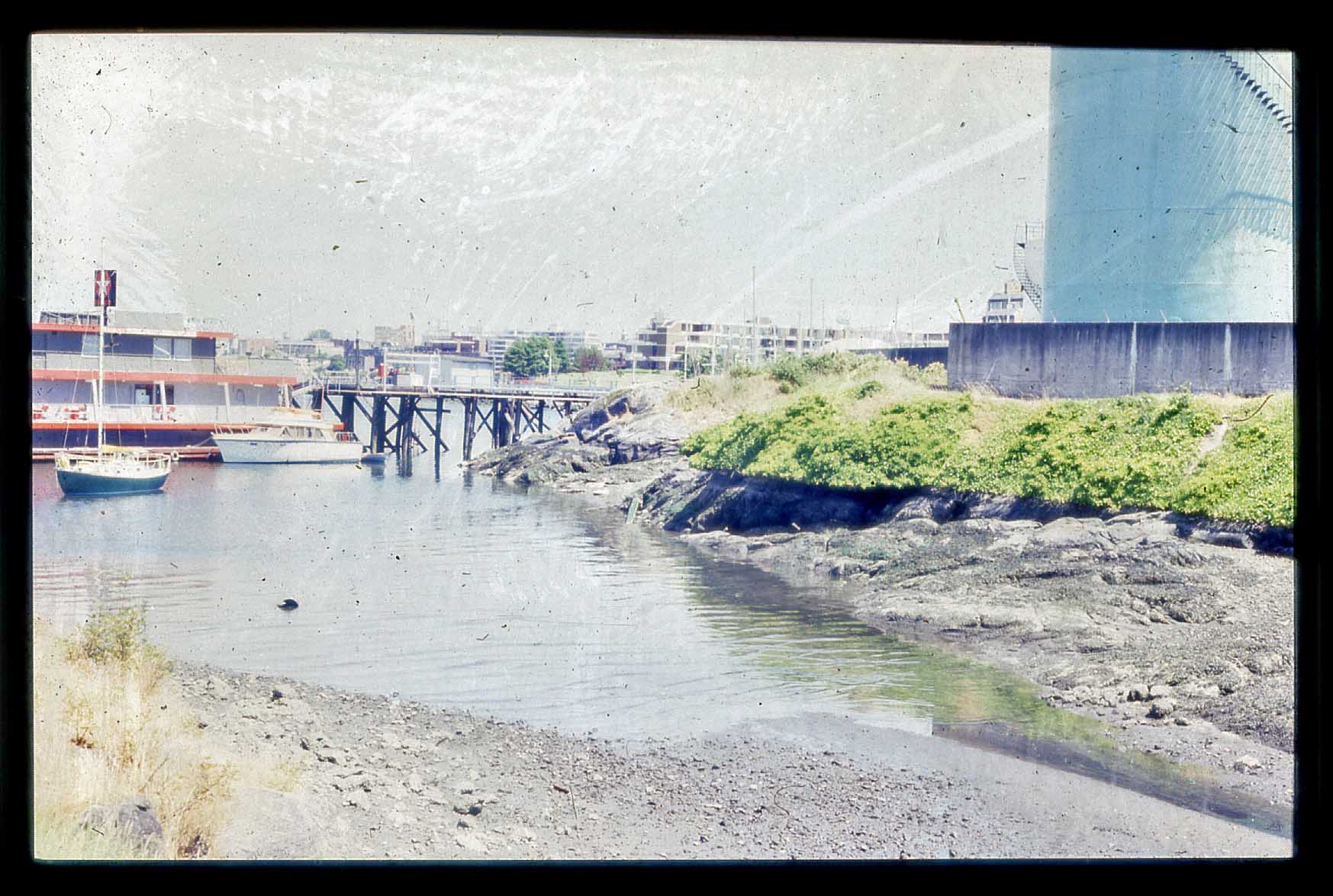
Figure 10. Raymur Point covered with oil storage tanks. Keddie photograph 1986.
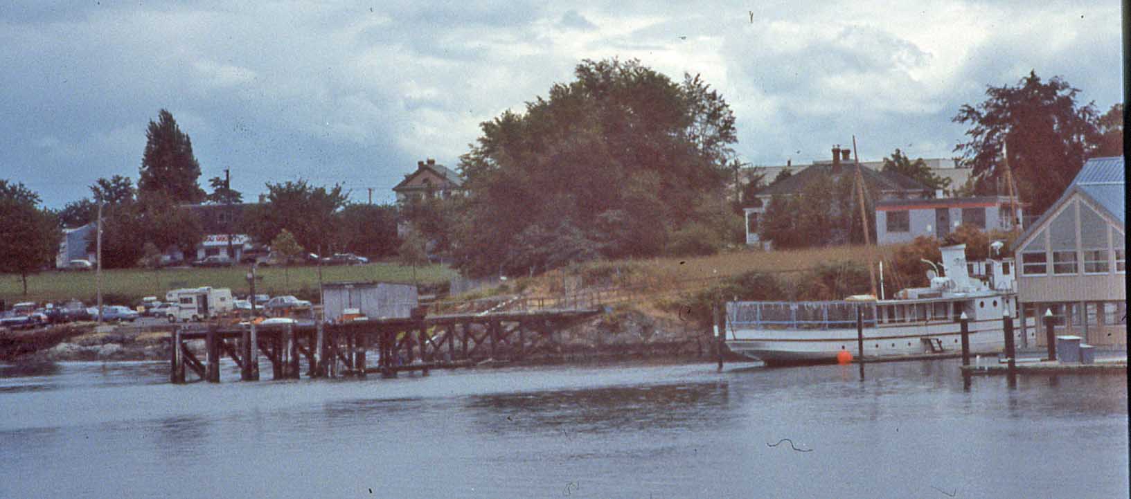
Figure 11. Raymur Point on right with dock on north end. Keddie photograph July 29, 1993.

Figure 12. Raymur Point as it looked on March 29, 2012. Looking east from the Fisherman’s Wharf Area.
The Midden Contents
On May 8, 1986, I observed that the shell midden was composed of mostly native little neck and butter clams, and some cockle clams and barnacles. This is not the unusual kind of mollusks found in other ancient sites in Victoria’s inner harbour and those further up the Gorge Waterway. The latter contain mostly native oyster shells.
The site contained many fire-altered rocks, scattered throughout the midden. These were traditionally used for steaming or boiling food. Most artifacts found in the site were stone waste materials, such as cores and flakes, resulting from the making of stone tools. These, the other limited artifact contents of the site, and the shallowness of the cultural deposits indicate that the location was occupied for a limited time, at least on a seasonal basis, around 2000 years ago.
A single human burial was recovered from the site in 1956, when constructing a cement wall. These remains were subsequently re-buried in the cemetery on the Songhees reserve. I located and talked to the bulldozer operator who worked on the site in 1956. He told me that the burial was in a flexed or fetal position. He observed that most of the midden was concentrated toward the east of Raymurs Point, where midden can still be seen eroding down the bank today.
On May 7, 1991, I examined the excavation trench for a waterline installation around the north side of the centre line on Kingston and St. Lawrence. There was no midden under St. Lawrence Street in front of 1293, 1292 and 1291 lots or under the Kingston Street and St. Lawrence intersection.
The Artifacts
Artifacts were sporadically collected from the surface of this site from 1956 until 1998, when the first formal site evaluation was undertaken that involved the excavation of test pits. Museum employee Micheal Kew recovered bone artifacts DcRu-33:1-2 in 1956. #1 is a portion of a ground bone that is broken at both ends. It was likely a fish hook barb; #2 is a mid-section of a deer femur with ends that were sectioned through but have extensively weathered, making it difficult to see if it might have been cut with an iron hacksaw. Butcher shops in 19th century Victoria often sold deer and elk meat. The way this bone is cut is similar to others found in historic garbage dumps, and not like those found in ancient aboriginal sites (Figure 12).
Don Abbott and John Sendey of the (then) Provincial Museum, surface collected artifacts DcRu-33:3-17. These included #3, a sawn section of a deer femur bone; #4 is a unique side indented projectile point, likely for use as a point on a spear as it is too large for an arrow point. It is a flaked basalt point that is heavily ground on both sides from the notched area near the bottom to near the top or distal end (Figure 11). #5 is a fragment of a burnt sandstone abrader; #6 is a naturally fractured basalt cobble, but is of stone tool making quality and may have been brought to the site location; #7 is a small section of a mammal bone with grinding of one edge.
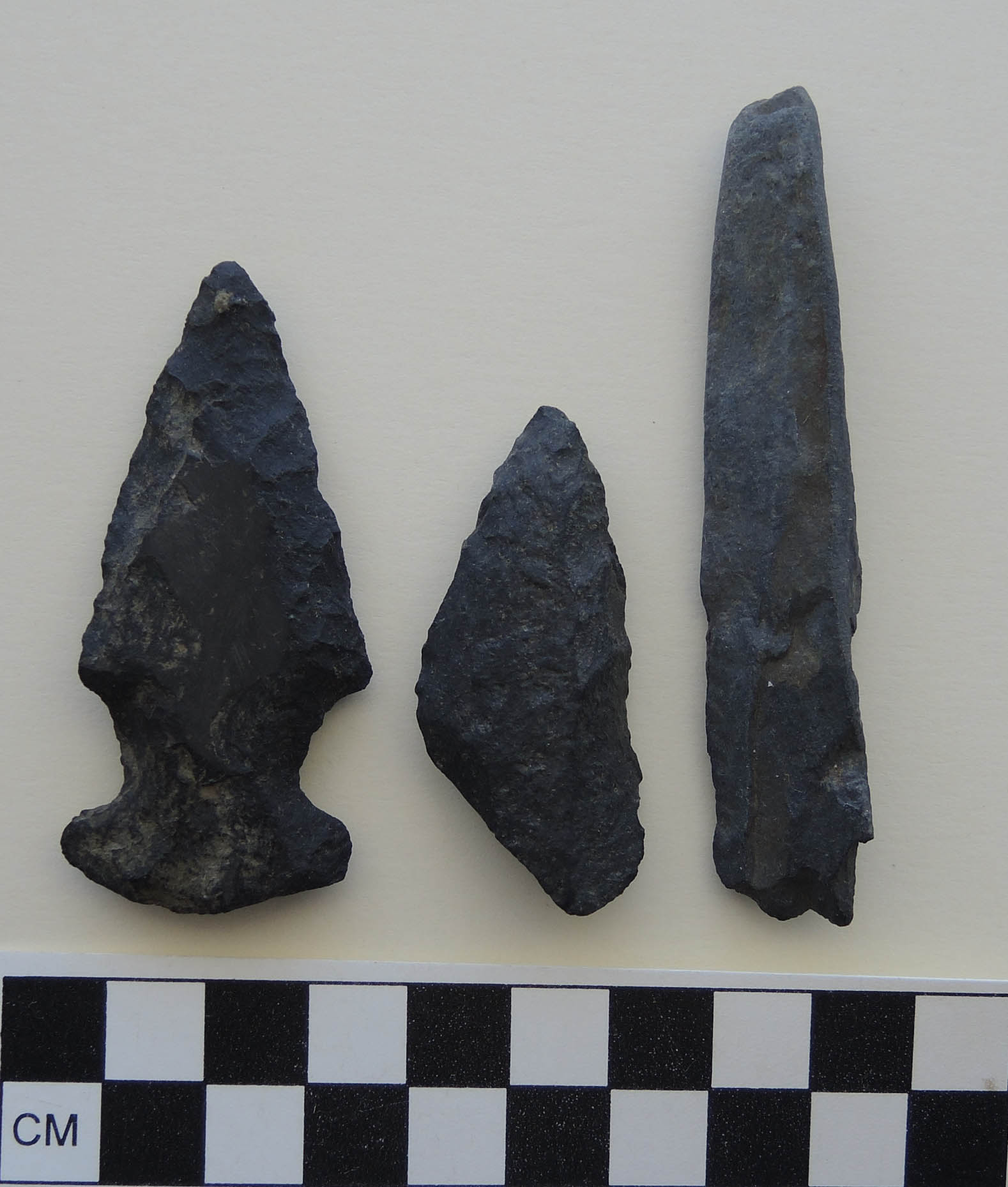
Figure 11. Projectile points. Left to right. DcRu-33:4. Corner indented point. Possibly for small spear. DcRu-33:21. Unfinished projectile point that was broken during manufacture. DcRu-33: Small portion of what was once a large hexagonal slate spear point.
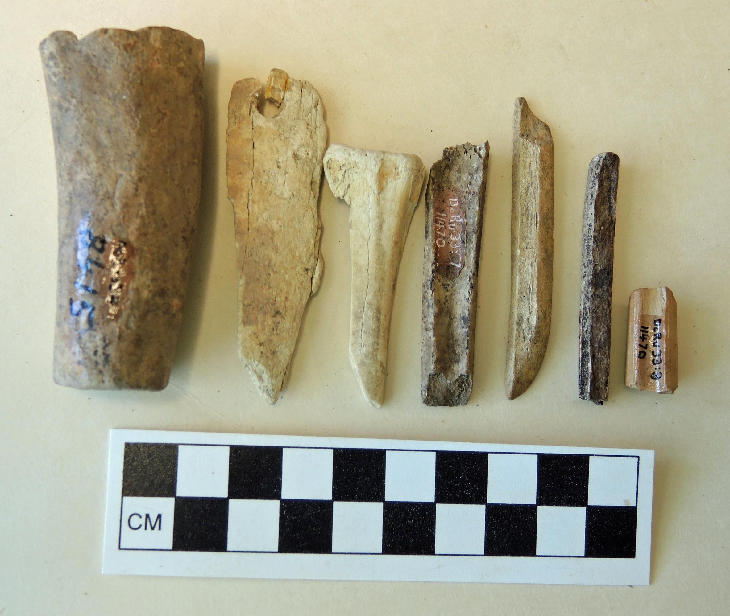
Figure 12. DcRu-33:3. Sawn and ground section of mammal bone. DcRu-33:20. Fragment of ground bone tool with drilled hole. DcRu-33:19. A non-artifact. Unworked deer cannon bone.DcRu-33:7. Section of a mammal bone with grinding of one edge. DcRu-33:9. Portion of a split deer cannon bone, ground on one end. DcRu-33:1. Portion of a bone fish hook barb.
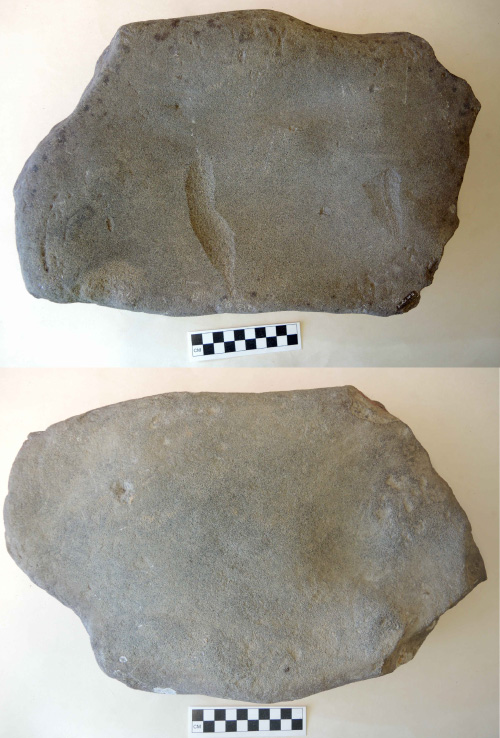
Figure 13. DcRu-33:16. Two sides of a large block sandstone abrader.
#8 and #18 are very small siltstone beads. These types of beads are only found in sites pre-dating 1800 years in this area; #9 is a portion of a split cannon or lower leg bone of a deer which is ground on one end; #10 is a broken portion of what was once a large thick hexagonal slate point. This type of point, like the stone beads, is not found in sites dating in the last 1700 years in this area; #11 is an extremely fine flat bar shaped abrading stone ground on both surfaces; #12 is a thicker rectangular sandstone abrader ground on two sides.
#13 and #17 are large fractured beach cobbles from the disturbed surface of the midden. It is possible that they are both rocks smashed by heavy machinery working at the site during the time that the large Texico oil tanks were installed on the property. This is a common pattern I have observed in urban areas around construction sites. The edge damage does not suggest that they were used as cobble choppers and the flake patterns are inconsistent with intentional human flaking patterns for this type of raw material. The type of stone is not the same as that found in the flakes at the site, which suggests they are not cores from which intentional flakes were removed (Figure 16).
#14 is a stone flake with the original cortex on one side; #15 is the mid-section of a very fine abrader with similar dimensions to # 11; # 16 is a very large block sandstone abrader that has been heavily abraded on both sides. This is an artifact that may have been used to grind items such as shell, slate or wood. Barnacle attachments indicate it was found on the beach (Figure 13);

Figure 14. Bottom row L. to R.: DcRu-33:12. Rectangular sandstone abrader. DcRu-33:5. Triangular portion of a course grained abrading stone. DcRu-33:11. Smooth, shaped slate abrader. Top: DcRu-33:15. Fragment of shaped sandstone abrader. DcRu-33:14. Stone flake.
On December 4, 1986, I found artifact #s 19 to 21 in disturbed midden on the surface at the north end of the site. #19 is an unworked deer cannon bone; #20 is a fragment of a mammal bone tool. It is a broken flat piece of bone with a bi-conically drilled hole near its intact end. This is possibly a netting needle fragment; #21 is a portion of a bifacial tool that was started, but broken during manufacture and not finished.
On May 8, 1986, I found 103 stone flakes eroding out of the midden and fallen on the beach at the edge at the north end of the site. #22 includes a group of 35 stone flakes with no original outer cortex – indicating they are secondary flakes struck after the outer cortex of the original stone was removed; # 23 includes 68 stone flakes with remnants of the original outer cortex of the rock. Another eight flakes I collected from disturbed surface midden on February 15, 1991, included 6 with portions of the cortex and two without. This assemblage indicates a practice that likely involved collecting local cobbles and flaking them in the process of tool making on the site.
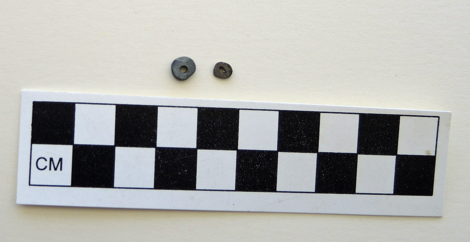
Figure 15. Small flat siltstone beads. DcRu-33:8(6mm diameter). DcRu-33:18 (5mm diameter).
I. R. Wilson Consultants Ltd., working under permit in 1998, recovered 23 stone flakes in excavation test pits and in disturbed midden areas. #24a included 8 stone flakes and #24b to # 38, another 25 stone flakes.
None of the flakes from this site show any signs of intentional secondary flaking or unintentional use wear. Some slight breakage on a few very thin edges is not a produce of tool use but of tool manufacture.

Figure 16. DcRu-33:17 and DcRu-33:13, are large fractured stone cobbles. DcRu-33:6. A naturally fractured basalt cobble.
Figure 17. Top: DcRu-33:23. 68 stone flakes with portion of the original outer cortex of a stone cobble. Bottom: DcRu-33:22. 35 secondary flakes.

Figure 18. Left: DcRu-33:24b-38. Stone flakes collected by I.R. Wilson excavations in 1998. Right: DcRu-24a. 8 stone flakes collected by author in 1991.
References:
Hewer, Tony. 1998. Archaeological Inventory and Site Evaluation 129 Kingston Street, DcRu-33, Victoria British Columbia. Heritage Conservation Act Permit 1998-050.I.R. Wilson Consultants Ltd. Prepared by Tony Hewer.
Terry Fox and Family post
Right now at the Royal BC Museum, Family: Bonds and Belonging is running concurrently with Terry Fox: Running to the Heart of Canada. The two exhibitions stand side by side. This is personally fitting to me because I have long associated my grandfather with Terry Fox, and there is a photograph of me with my grandfather in the Family: Bonds and Belonging exhibition.
Here’s how I have linked them in my mind: Terry Fox started his run on April 12, 1980 in Newfoundland. One year before on April 12, 1979, ‘Gramps’, a Newfoundlander, died of cancer. So when Terry dipped his leg in the Atlantic off the east coast of Newfoundland, it seemed extra meaningful to my adolescent mind.
Terry’s story unfolded when I was an impressionable teenager and like millions of Canadians at the time, I was riveted by his story. Plus, he was from Port Coquitlam, just across the Fraser River from where I lived in Langley. We were practically neighbours. Like most of BC’s Lower Mainland, we felt like Terry was ours.
I remember imagining what it would be like if Terry made it over the mountains and down into the Fraser Valley. But as we all know, that day didn’t happen. In BC, we never saw the van up close. But now we can.
If you remember Terry Fox, like I do, it’s compelling and moving to peer inside the van that is parked just inside the Royal BC Museum lobby. It’s not so hard to imagine him there: A sweaty, young athlete with an astounding will.

Terry Fox van in the Royal BC Museum lobby.
When I watched Terry’s van being pushed into the Royal BC Museum before the exhibit opened, even though I knew it had been rebuilt and fixed up and a punk band lived in it for years, it still felt real. It still felt like a return. A homecoming. It felt important.
Like a lot of Canadians, I remember the terrible day that Terry’s run ended. I remember watching his heartbroken mom and dad at his side on TV as he was loaded into an airplane to fly home. I remember well the day Terry died. And after all these years, I can still not get over that he ran a marathon a day, for months, on one leg.
There’s nothing like an indisputable hero in your midst to make you feel inadequate. That sounds cynical. I’m not trying to be cynical. I think Douglas Coupland said something like ‘It’s impossible to be cynical about Terry Fox’. I think this is true. Terry’s accomplishments are so exemplary, so astonishing, so inspiring, that I am humbled by what he accomplished and what he has done since he died. I don’t feel less around his legacy, I feel in awe, inspired, hopeful.
Where I feel inadequate is in my everyday habits at the Royal BC Museum while the Terry Fox exhibit is here. There’s nothing like our every day routines to put us on autopilot. Every morning since the exhibit opened in April, I’ve walked past Terry Fox’s van on the way to my desk. Terry Fox’s van. At first I couldn’t look at the van without a lump in my throat, and now I often rush past it like it’s nothing.
Which it’s not.
Terry’s incredible story lives with all of us who remember him and it is here now at my museum in his van, in his running shoes, in the thousands of letters children wrote to him and it lives in that jug of Atlantic Ocean he scooped up that first morning in April 1980. The jug of water right now sitting not far from a photograph of me with my Newfoundlander grandfather. The Atlantic Ocean on exhibit and in my veins. Terry Fox and Gramps, their proximity here on the Pacific coast, making this big country feel small and close.

The jug of Atlantic Ocean water from the first day of Terry Fox’s Marathon of Hope in the Terry Fox: Running to the Heart of Canada exhibition.
At museums we often talk about objects telling stories. For me this summer, the objects in these exhibitions tell me to slow down and remember that there is sacred in the every day. Until the Fox exhibition closes in October, I’ll try not to rush past the van on the way to my desk.
A little while back I was musing over a spot on my Wall Lizard map that shows a large expanse east of Highway 17 between Cordova Bay Road to Mt Newton Cross Road that appears to be Wall-Lizard-free turf. Wall Lizards are crawling everywhere just the other side of the highway on Tanner Ridge. Either no one has reported lizards from this area – and it seems unlikely given how many reports I receive each year, or lizards have not been able to cross HWY 17.
Cedar Hill Road in the Southeast Cedar Hill area also seems to be a decent barrier even though it is not a particularly busy road. Lizards have been in that area for about 6 years(as of 2016) and have crossed Derby Road without a problem – but not Cedar Hill Road. Cedar Hill may be just busy enough to limit the survival of adventurous lizards.
It seems interesting that a lizard as fast as the Wall Lizard could not cross – but then again – why would they? Young ones disperse to avoid cannibalism, but perhaps the noise, vibration and sight of passing vehicles is enough to dissuade all but the most suicidal of lizards.
I recently tripped across an article detailing road crossing behaviour in snakes (Andrews and Gibbons 2005). In their study, smaller snakes seemed to avoid crossing roads, whereas larger snakes have no problem with the concept. I wonder if the same is true for Wall Lizards? Interestingly, all snake species they studied crossed perpendicular to the road’s length – an adaptive behaviour minimizing distance and time on the tarmac. Some species froze in place when a car passed – that is maladaptive – and significantly increased an animal’s exposure to vulcanized rubber.
I have not seen Wall Lizards crossing a street – but would be interesting to see if they too cross perpendicular to the curb, and whether they blast across or dart and pause – unintentionally increasing their risk of catastrophic z-axis reduction.
Andrews, K.M., and Gibbons, J.W. 2005. How to Highways Influence Snake Movement? Behavioural Responses to Roads and Vehicles. Copeia 2005(4): 772-782.
Another lizard arrived in BC last week. We can add Brown Anole (Anolis sagrei) to our list of accidental imports – but this certainly is not the first one to have arrived by accident in BC. Many lizards travel the globe as stow-aways. This one travelled here in its egg along with a Snake Plant (also known as the Mother-in-Law’s Tongue). Sansevieria are popular houseplants – Snake Plants are easy to keep and look neat. My wife bought one for our living room – no lizards in our plant though.
Where was the plant from? Who knows. This plant could have come from anywhere. Brown Anole’s have invaded Florida, and southern parts of Georgia, Louisiana, Mississippi, and Alabama. They also have invaded Hawai’i, southern Texas and southern California along with their relative the Green Anole (Anolis carolinensis). The Green Anole is native to the south-eastern United States, and in their native range, Green Anoles may be forced out of their usual habitat by their exotic relatives. Brown Anoles are native to Cuba and the Bahamas.
Even if it got loose, this anole would not survive our winter. It was no real threat to our environment or fauna, but does show that the transport of exotic species is ridiculously easy – an egg in the soil in a plant pot. This time we are fortunate. Only one egg was present. Anoles are light-weight arboreal lizards which lay one egg at a time, and they are not parthenogenetic. Anole eggs develop in alternate ovaries at about a two week interval – if I remember correctly. This ensures the female lizard is not excessively encumbered, and for us it meant that only one egg likely was present in the pot (or any other pot at the home hardware store).
Brown Anole eggs are a bit bigger than a Tic-Tac candy, so no wonder they are overlooked – they also are buried a centimeter or so in the soil – so they’d be out of sight. As long as the soil was not disturbed, was warm and moist – but not too wet, and the egg was not rolled, the developing embryo would survive transport.
I wonder where this lizard’s brothers and sisters ended up? They could be anywhere. Since the lizard travelled here in an egg, I vote we name it Mork. Na-Nu Na-Nu.
Just tripped across this fish while sorting out odd records in the RBCM fish database.
999-00114-001 – unidentified fish – Family Triglidae (Searobins, Gurnards)
Well, it turns out to be Prionotus stephanophrys – a Lumptail Searobin – and a new family, genus and species for BC. Three other triglid species (two of them are Prionotus species) are known to stray into Atlantic Canada.
This one was caught in 1998 on La Perouse Bank, it was added to the RBCM collection in 1999, and sat there ever since. No one had taken a second look at this specimen – until today. It was completely new to our system and as such, I had to add the genus and species to our database’s taxonomic tree.
Until now, its northern record was off the mouth of the Columbia River – this new(ly rediscovered) record extends this family north about 260 km in the eastern North Pacific Ocean.
The lower three pectoral rays of this fish are almost like fingers – it probably walks along the bottom like other triglids – the walking mechanism makes me think of face-hugger Alien larvae.
I took these photos of Royal BC Museum lizard specimens with my iPhone 4 through the eyepiece of the old dissecting microscope in my lab. Then sent the photos via two emails to office thanks to WiFi – and to think – this is the “low-tech” way of doing things these days. Low-tech – sending files through the air from a hand held device… I have to laugh how technology has changed since I was a kid with my first pet lizards. The nerd in me can’t help but hear James Earl Jones’ voice – “Several transmissions were beamed to your inbox. I want to know what happened to the scans they sent you.”
In earlier blogs I have mentioned scale differences between BC lizards – so I thought I may as well take close-up shots to clearly show the differences. Under a dissecting microscope (diss-secting, not die-secting), you can easily see the shape of the bead-like back scales of the European Wall Lizard (Podarcis muralis). It’s like a microscopic cobblestone pavement. Each scale is about the diameter of a standard sewing pin.
European Wall Lizard (2112)
The larger back scales of the Northern Alligator Lizard (Elgaria coerulescens) are painfully obvious, and each scale has its own raised keel. The keel gives each scale an angular appearance.
Northern Alligator Lizard (1358)
The Pygmy Short-horned lizard (Phrynosoma douglasii) has a really complex squamation with tiny granular scales interspersed between clusters of larger keeled scales. The larger scales are raised into spires above the general scale-scape (the lizard equivalent of landscape).
Pygmy Short-horned Lizard (323)
Western Skinks (Plestiodon skiltonianus) by contrast are painfully even and smooth – yawn. It’s a good thing they have speed-stripes and a bright blue tail to make them stand out in a crowd.
Western Skink (1964)
Western Fence Lizards (Sceloporus occidentalis) have scales each with a trailing spine – characteristic of all Sceloporus species. Some, like the Crevice Spiny Lizard in the United States have really robust spines on their scales, others like the Sagebrush Lizard have tiny spines. Cordylids in Africa take spiny scales to a whole new level.
Western Fence Lizard (705)
Sorry, I forgot a scale bar in the photos, but the images were fairly close to the same magnification.
CETA 1972 style post
While working with archival documents it is always of interest to look at the other side of the page.
In today’s example, A person needed to publish several legal notices in the local paper.
Luckily, the entire newspaper page was submitted.
The following article appeared on the back of the page (The Province [Vancouver], Friday, 10 November, 1972.)

It describes how Pacific Western Airlines was able to ship live beef to Europe, because its cargo plane could return with a cargo of grapes which were now available throughout BC and Alberta.
The article also explains how the plane was cleaned, presumably before the grapes were loaded on to the plane.
The Wikipedia page for PWA mentions the following:
Boeing 707 equipment was added to the fleet in 1967… The addition of a cargo model Boeing 707 meant that livestock and perishables could now be carried all over the world, and the name Pacific Western became synonymous with “World Air Cargo”. The company aircraft visited more than 90 countries during this period of time.
Pacific Western operated a worldwide Boeing 707 cargo and passenger charter program until the last aircraft was sold in 1979.
This is in the era where container shipping was beginning its world wide adoption.
Air cargo was expanding during this time as well, when “Boeing launched the four engine 747, the first wide-body aircraft” in 1968.
As the newspaper report explains, transportation of people and goods only makes sense if the airplane is loaded to maximum capacity at all times.
This was the thinking behind the Triangular trading system of the 19th century.
Moving people extended this thinking to modern day hub airports such as Toronto Pearson, London Heathrow and Dubai UAE.
Even today with airplanes that can travel half way around the world, the take off and landing locations are the national hub airports.
Air cargo has undergone the same thinking.
In the 1972 news report, it only made sense to Pacific Western Airlines to undertake this one-off trip once the entire route was fully booked.
The article goes on to describe how the airline was looking for other opportunities. They recognized the potential, but the tipping point (the development of an airport hub for cargo) had not yet arrived.
To see what kind of completion PWA would face today simply go to an airplane tracking app and filter for FedEx planes, or track the Memphis airport.
UPS has a similar hub in Louisville. Here is an example of one airplane in the UPS fleet that revisits the hub city regularly. This particular plane left Louisville on 28 May 2017 and travelled around the world via Honolulu, Hong Kong, Dubai, Cologne, and Philadelphia, before returning to Louisville three days later.
When you read this article, there will probably be more recent examples of round the world trips or forays to Asia or Europe before returning to it’s home base.
The article does not quote anyone from the BC Livestock Export Association, however Europe is again front of mind for the Cattlemen’s Association.
Mr. W. Allan Eadie produce manager for Woodward’s, and PWA cargo specialist Ken Bjorge would be impressed!
As Mister Eadie says in the report, he hoped that this operation would expand because of “this cattle thing.”
He and Mister Bjorge may have failed to realize that the problem was not to solve the “cattle thing.” They needed to solve the “hub thing.”
On a side note, The Imax movie “Living in the Age of Airplanes” has an excellent section on the transportation of flowers that is well worth the price of admission.
PWA purchased CP Air to form Canadian Airlines International in 1987.
Canadian Airlines has the distinction of being the first airline in the world to have a website on the Internet (http://www.cdnair.ca/).
It merged with Air Canada in 2001.
Geraldine A. Allen1 & Laurie J. McCormick1 & Johanna R. Jantzen1 & Kendrick L. Marr 2 & Becky N. Brown3
Abstract: Phragmites australis (common reed) is a widespread perennial grass of wetland habitats, with cryptic native and introduced subspecies in North America. We determined the relative abundance of the subspecies and the distributions of plastid DNA haplotypes throughout British Columbia, Canada, at the northwestern distribution limit of common reed in North America. Of 203 specimens assigned to subspecies using molecular markers, we identified only 9 plants as the introduced ssp. australis; all remaining samples were the native ssp. americanus. The two subspecies co-occurred at only one locality. We identified four native haplotypes (one widespread in British Columbia and three others more localized) and two introduced haplotypes. Using plants of known haplotype, we assessed the utility of different morphological traits and trait combinations for distinguishing native and introduced subspecies in this geographic region. No single morphological trait was diagnostic, but principal components analysis and identification indices based on combinations of traits consistently separated the native and introduced subspecies in our sample. Two- or three-trait combinations of ligule length, lemma length and stem anthocyanic coloration gave the best separation. These indices could reduce the need for confirmation of the introduced subspecies using molecular tools, facilitating efforts to monitor and control this invasive plant.
You’d think that sharks and rays would be pretty well known along our coast. Did you know that two Hammerhead Sharks have been found off Vancouver Island? Even a Tiger Shark has strayed north to Alaska. Did it swim along the BC coast, or did it take a more direct route from Hawai’i? We’ll never know. However, in 2016 a new shark was added to our fish fauna – the Pacific Angel Shark (Squatina californica) – based on a clear photograph by Mark Cantwell and his detailed description of the dive location.
We have known since 1931 that Angel Sharks ranged north to Seattle, and there is a single record from Alaska. The specimen label for this 35 cm Alaskan female had been lost (Evermann and Goldsborough 1907) and we cannot pin down its collection location with certainty. Until now, we had no Angel Shark records for British Columbia – but it was only a matter of time.
On the 30th of April, 2016, a single adult Angel Shark was sighted by a diver off Clover Point right here in Victoria. The shark’s gender cannot be determined from the photograph since claspers, if present, are not visible. The Angel Shark was found in about 12 meters of water, about 30 meters off the point. The diver estimated the shark’s length at about 1.1 to 1.2 meters in length. The specimen was not collected, but it would have made a fantastic museum specimen.
King and Surry (2016) published the discovery of this shark in BC in a recent issue of the Canadian Field-Naturalist. While this now is not breaking news – in fact it is a year late – people may still want the primary reference to our latest elasmobranch.
PDFs are available here [as a new paper, King and Surry (2016) is available by subscription to The Canadian Field-Naturalist or by contacting the primary author]:
Belted Kingfishers (Megaceryle alcyon) usually take fishes – why else would they be called kingfishers. They sometimes take crustaceans and frogs, and I’d be shocked if they turn their beaks up at big juicy insects. However, mammal predation is quite a dietary shift. Apparently no one explained the meaning of “fisher” to a kingfisher in the southwestern Yukon.
This female obviously read its species description. Looks like she caught a young goldfish. (From: https://en.wikipedia.org/wiki/Belted_kingfisher#/media/File:Belted_Kingfisher_with_prey.jpg)
A paper came out in a recent issue of the Canadian Field-Naturalist (see Jung 2016) detailing the capture of a Western Water Shrew (Sorex navigator) by a Belted Kingfisher. That would make a decent meal and a real energetic boost for the Kingfisher. Jung (2016) mentioned that Belted Kingfishers have been known to take Eastern Water Shrews (Sorex albibarbis), and he (Jung 2013) also reported on a kingfisher trying to subdue a Spotted Bat (Euderma maculatum).
From: https://upload.wikimedia.org/wikipedia/commons/8/8f/Belted_Kingfisher.jpg
Imagine if kingfishers changed tactics to regularly prey on other small animals? Their ecology could converge on that of butcher birds (shrikes). What’s next? Lizards and snakes?(Yes, shrikes impale their prey on thorns (or barbed wire) to age a bit).
Sure glad kingfishers aren’t the size of a Banshee or Leonopteryx from Avatar, or we’d all be at risk when swimming.
Keep your eyes on the sky. And as for that specific Water Shrew, all you can say is: “Hair today, gone tomorrow.”
PDFs are available here:
Was this an odd title? Actually I think the song went,
“On top of spaghetti… all covered with cheese,
I lost my poor meat ball… When somebody sneezed.
It rolled off the table… and onto the floor.
And then my poor meat ball… rolled out of the door.
Wow that was a dredged from deep cephalic crevices…
Anyway, I got a tip from Purnima Govindarajulu, my herpetological counterpart in the Ministry of Environment that she’d seen a European Wall Lizard on Mount Tolmie here in southern Saanich. Given how fast and far Wall Lizards are spreading, it was only a matter of time before they colonized this rock. This pocket of lizards will form another expanding sub-population – pretty-much midway between the single lizard I saw at the University of Victoria and the lizards near Doncaster School.
This morning (April 27th) was nice and sunny, and I hiked up to the summit after dropping my daughter at daycare. What did I find first? A Northern Alligator Lizard. That made me very happy – I don’t see those everyday and this lizard was more than patient with the iphone-wielding twit who wanted its picture.
Then less than 2 meters away were the Wall Lizards – five of them. A meter or so along the road, another Wall Lizard. Up along the southeast corner of the reservoir – another large male Wall Lizard.
Yep, looks like they have found a solid toe-hold in this region. Cedar Hill X Road may make a decent barrier to northward dispersal (not that Wall Lizards aren’t north of there anyway) – but they will easily spread southeast and southwest into gardens adjacent to the park. Note the small scales and green colour on this Wall Lizard’s back, compared with the larger coppery scales on the Alligator Lizard (above).
Keep your eyes on rock gardens, rock walls, woody debris, and any bedrock with decent cracks for shelter. The photo below shows just how slender the Wall Lizards are – this one with an intact tail is the largest lizard I have caught to date (21.2 cm total length). After checking the RBCM’s herps database, I see that the only months where I haven’t caught Wall Lizards are January and February – too bad that this spring was consistently cold and wet. I have missed my chance to get a full year’s worth of lizards in 2017.
Expo 86 opened its doors to the world on 02 May, 1986.
Leading up to the World Fair, several large infrastructure projects were proposed and planned for, so that they would be open and useable by the public by the time the fair opened.
These projects included
These projects were discussed on the Webster Show.
Of course politics was involved, as the mayor defended his vision of what Vancouver would look like, as it celebrated the hundredth anniversary of its founding.
Redevelopment of False Creek was a major issue – BC Architect Arthur Erickson and the director of planning for BC Place, David Padmore discuss the Expo 86 site plans.
Here is the interview of a member of the BC Place planning committee.
Sky train was a region wide issue.
This episode shows the proposed route of the LRT as Steve Wyatt drives the streets of Vancouver, trying to get as close to the proposed route as possible.
Bear in mind that the route used existing railway rights of way for the majority (if not all) of the line.
There are several versions of this. The final one was slowed down somewhat so you can see the surrounding city a little more easily.
For the unedited show see this Link.
Canada Place – the cruise ship terminal. Webster goes on a fly about/ walk about
BCTV was a major sponsor and broadcast daily from the Expo grounds.
Here is part of the hype, when some of the pieces get lost.
Counting Down to opening day
And after the exhibition
The auction
And distributing the wealth
Somnolent Sculpins post
Yesterday I worked with Chris O’Connor from our Learning Department – we took some children on a tidepool tour. The main point was to chat about museum collections and things we record or measure when we are out sampling. We didn’t go crazy catching fishes, only taking 3 Tidepool Sculpins (Oligocottus maculosus) in the end. But we talked about our role as museum researchers, and why we take more than 1 specimen (if possible) to get an account of variation within and between species.
You can see slight differences between these fishes – even an injury – just like the subtle, or not so subtle differences we see in each other.
The three fishes will be added to the Royal BC Museum’s ichthyology collection, but before that, they are fixed in 10% Formaldehyde. Researchers used to drop fishes directly into Formaldehyde – many fishes died horrible deaths. When I accidentally get Formaldehyde in a cut – it stings intensely – I couldn’t imagine being dunked directly into that chemical.
Today we are more humane, and give fishes an overdose of anaesthetic before immersion in Formaldehyde. They are dead before they are fixed, and are preserved with a relaxed posture. The primary anaesthetic I use is 2-Phenoxy-Ethanol, but it is hard to get without ordering from a chemical supply company, and the chemical is a suspected carcinogen. I still have about 500 ml of the stuff – so I will use up what I have. Do I really want to buy more? Maybe not.
Do we have safer options? Yes, Clove Oil is a good anaesthetic if mixed as an emulsion in a small volume of 99% Ethanol. But you have to carry a jug of 99% Ethanol everywhere you go – that may not go over well at a Police check-stop. The up-side to this chemical mix is that you smell spicy at the end of the day if you accidentally spill some on yourself.
People have tried Alka-Seltzer tablets. They fizz and release CO2, which knocks-out fishes – but the process is slow and some fishes (those like catfish that gulp air to survive in low oxygen conditions) are resistant and survive way too long in a stressful condition.
A few months ago I tried using Oragel (20% Benzocaine) on European Wall Lizards – colleagues had found it worked well on amphibians. They put Oragel along the spine of an amphibian and it soaks into the skin; I give lizards an oral dose. It renders bullfrogs and wall lizards unresponsive in 20 seconds to a minute. Oragel seems to be a convenient anaesthetic for these invasive herpetiles.
Yesterday, I told the tidepool group that we’d be performing an experiment – I tried Oragel for the first time on the 3 sculpins we caught. As I hoped – less than 20 seconds and the fishes were out cold. 2-Phenoxy-Ethanol takes about the same time on similar sized fishes.
The beauty of Oragel is that it is readily available, and if you run out, you can stop by the nearest pharmacy. It also is safe – we use it on sore teeth or gums. Perfect – it works fast on specimens and is safe for the researcher.
Perhaps someone needs to do a larger scientific study to see how effective over-the-counter Oragel is on larger fishes. Maybe this is an effective over-the-counter tool for preserving new museum specimens.
A Big Shark in BC post
A specimen with no data is not worth keeping. A specimen with vague data is not worth keeping either. The Royal BC Museum’s ichthyology collection contains a vertebral centrum with cartilaginous remnants of its respective haemal arch and neural arch from a shark that washed up November 5th, 1975 (only a few months after Jaws was released in cinemas). It was cataloged as 976-00052-001 in the fish collection (with a variant of the catalog number listed as a previous number ~ B.C.P.M. #97652). Our electronic database only had a collection date for this centrum (no location, no collector).
Flip to our original paper catalog, and we find that there is indeed a collection location: Ahousaht Village, Flores Island – but this never got translated to our electronic database. The paper catalog states that the shark washed up on a beach – but there was no latitude and longitude provided for the record beyond 49°N, 125°W. If you plot the western-most limit of 125°W, it is nowhere near Flores Island – so the location is questionable. Ahousaht Village’s nearest beach is at about 49°16’N, 126°03’W.
Worse yet, the vertebral centrum indicates that this was a big shark – we don’t have a lot of big sharks here…
Great White Shark (Carcharodon carcharias) reaches 6 meters
Pacific Sleeper Shark (Somniosus pacificus) reaches 5-6 meters
Basking Shark (Cetorhinus maximus) reaches at least 9 meters
The shark centrum in the Royal BC Museum collection is about 7.3 cm in diameter – it spans most of the palm of my hand. This must have come from a decent-sized shark. Was it a small Basking Shark? A large Great White? A large Sleeper Shark? It’s not ‘reptilian’ so we can rule out Cadborosaurus (whew). Hang on, Cadborosaurus’ so-called “type specimen” was a photograph of a digested basking shark – Hmmm…
It is a shame no one bothered to take a skin sample – the scales may have been diagnostic. What about teeth? A sample of teeth – even one tooth – would have been enough to identify this fish. Sadly though, nothing remains other than this centrum and a bit of cartilage. It was fixed in formaldehyde and stored in isopropanol – so I think we can forget sending a chunk to Guelph for DNA barcoding. DNA barcoding wasn’t a thing back in 1975, so tissue samples were not preserved for future analysis.
If no one in Ahousaht has a photo of this shark on the beach, or some teeth stashed away, all I have to say is , “Sorry Charlie, the Royal BC Museum wants specimens with good data.”
A Winter so Harsh post
This winter has been cold here in Victoria – relatively speaking. We have had lots of rain, several rounds of snow – and I even had to shovel my driveway and sidewalk. Actually I have had to shovel several times this winter. The rest of the country is not all that sympathetic to the wintery-woes of its Pacific Islanders.
One odd feature of Victoria is that Anna’s Hummingbirds are present year-round – because people feed them. Without artificial feeding stations, they likely would migrate south in autumn with the Rufus Hummingbird and return each spring. It still strikes me as strange to see a hummingbird in winter – given that I moved here from Winnipeg.
In my neighbour’s yard there is Holly bush that is a regular nesting site for our resident male Anna’s Hummingbird – the spot must be coveted because the prickly leaves are a great deterrent to would-be nest thieves.
This nest from 2005 was near the junction of Government Street and Niagra Street in James Bay – also in a Holly bush.
Our hummingbird – yes we are possessive even though we don’t feed hummingbirds in winter – is a regular visitor to our veggie garden and flowers in summer. It stayed this winter even though it was snowy and cold. Someone nearby must have a hummingbird feeder.
Not all Anna’s Hummingbirds were so lucky this year. Today I received a nest containing two feathered nestlings which were snuggled together in their soft little lichen-cup nest. This is certainly an early nesting attempt – they are known to nest from February to August, but nesting this early in the spring is a big risk.
The fate of the female is a mystery (males don’t raise their young). Did she hit a window? Run short of food and die? Did a free-range domestic cat get her? These two nestlings were in a sheltered spot alongside a house here in Victoria, but without a parent, they didn’t last long. Natural selection can be as cold as this winter.
In 2006 I spent a month at sea on the CCGS W.E. Ricker, collecting hundreds of deep sea fishes during a Tanner Crab Survey. Most fishes were identified the traditional way using anatomical features, but we didn’t have an extensive library on board, so many ‘field’ identifications were wrong. Such is life on the high seas when you are rushed to process samples.
Several snailfishes and of course the poorly known Flabby Whalefishes were only identified to genus. One snailfish with its distinctive pelvic girdle resembling a pair of bat’s wings – was simply labeled as “Batwing.” It was a few years later while sorting out some of the samples, that I tripped across a paper by David Stein (1978) describing our “Batwing” species in detail – Osteodiscus cascadiae. Keep in mind that the last comprehensive book on BC fishes – Pacific Fishes of Canada – was published in 1973… I was 6 years old. Pacific Fishes of Canada needs an update – it is woefully out of date.
This week I have been cataloging the last of the fishes caught on the 2006 Tanner Crab Survey – Screech – I know what you are thinking. A decade has passed since these fishes were caught. I am not a slacker – well, some would argue that – but there are many reasons why I am only now sorting and cataloging the last of the Tanner Crab specimens. Forgive me if progress is slow.
Many of the specimens we collected in 2006 had a small plug of tissue removed for DNA Barcoding. Three specimens (DNA barcode field tags from left to right, G5036, INV792, and 0738-Bo2), from Queen Charlotte Sound and west of the northern end of Vancouver Island were identified as Careproctus canus. If this is correct, they are the first for British Columbia.
The same can be said for specimens (barcode field tags from left to right, R5826 and G5026), both from Queen Charlotte Sound which were identified as Careproctus attenuatus. If correct, they are the first of their kind for BC, and both species C. canus and C. attenuatus, are way-south of their known ranges in the Aleutian Islands. We also caught one other snailfish identified as Paraliparis melanorhabdus (15943) – if correct it is the first specimen for the RBCM, but not the first for BC.
When I got down to the last few unidentified fishes to catalog in the RBCM database, I found that they had tags from the DNA Barcoding project. Obviously I looked up the molecular identification, but I have to wonder whether a genetic sequence was used to identify these new snailfishes, or whether the DNA barcoding team used our field identifications. We certainly do not carry an exhaustive library at sea, and we do our best to identify fishes with what we have at our finger-tips while the decks are heaving and rolling. Since I don’t trust my own eye regarding snailfishes – these noteworthy records need to be verified – and I think I’ll send them to a snailfish expert that I know just south of the border.
However, two specimens of Gyrinomimus (lovingly known as Flabby Whalefish) were identified as G. grahami (barcode tags, left to right INV0718 and R5828), and both were from west of the northern end of Vancouver Island. They don’t look much better in person. We left these specimens identified to genus because we had no literature for Flabby Whalefishes on board. As a result, I know the species-level identification did not come from me – and had to be based on molecular information. YAY, Gyrinomimus grahami (15942, 15935) is new to BC.
These interesting records alone justify the time taken to collect and send DNA samples to Guelph for the barcoding project. I may not be a gene-jockey, but if the identifications of these fishes are correct, we will rack up another three new species for BC, boost our knowledge of biodiversity, finally have two of our whalefish specimens o-fish-ally identified. Now to compare the newly identified whalefish specimens to the other 10 jar-loads of specimens to see if we have one or more species in our collection.
Thanks all you DNA barcoders – particularly Dirk Steinke who was out with us in 2006 – couldn’t have done this without you.
Abstract
In Canada, there are no native catfish west of the continental divide and until recently, the list of extant exotic catfishes in British Columbia only included introduced Black Bullhead (Ameiurus melas) and Brown Bullhead (Ameiurus nebulosus). We report that a single Yellow Bullhead (Ameiurus natalis) was collected from Silvermere Lake in the Lower Fraser River drainage. This represents the first record of the Yellow Bullhead in western Canada, and its introduction likely was accidental with a shipment of Largemouth Bass (Micropterus salmoides) rather than dispersal from Washington. Warm, eutrophic, weedy habitat in the Fraser Delta provides ample habitat for Yellow Bullheads and other exotic fishes. A Blue-eyed Panaque (Panaque suttonorum), a loricariid catfish found in 1995 in Shawnigan Lake, Vancouver Island, probably represents a single, illegally released aquarium fish, as does a large Silver Pacu (Piaractus cf. P. brachypomus), which was found in Green Lake on Vancouver Island in 2004.
ABSTRACT
Polymerolepis whitei Karatajūtė-Talimaa, 1968 was described based on isolated polyodontode scales recovered from the Ukraine, and originally was thought to be heterostracan (Agnatha). Additional scales with neck canals were described years later, and as a result, P. whitei was reclassified as a bradyodont holocephalan because it had scales similar to those of Listracanthus Newberry & Worthen, 1870. Until now, no articulated body fossils were known, and so the classification of this taxon has remained uncertain and based only on the original author’s opinion. New specimens of P. whitei from the Mackenzie Mountains, Northwest Territories, Canada, show articulated scale patches from the head, with the best specimen showing part of an anal fin, caudal peduncle, and caudal fin. This new material confirms that the original account of scale variation was accurate, but also that P. whitei possesses an anal fin spine, a feature that, until recently, was thought to be a synapomorphy of acanthodian fishes among Palaeozoic fishes. Several primitive chondrichthyans (Obtusacanthus Hanke & Wilson, 2004; Lupopsyroides Hanke & Wilson, 2004; Kathemacanthus Gagnier & Wilson, 1996; Seretolepis Karatajūtė-Talimaa, 1968; Doliodus Traquair, 1893; Antarctilamna Young, 1982, and also problematic taxa such as Gyracanthides Woodward, 1902, and now Polymerolepis Karatajūtė-Talimaa, 1968), are known from articulated remains and show a fin-spine complement like that of acanthodian fishes. They also have placoid scales or polyodontode scales that grew by areal rather than superpositional accretion. These taxa blur the distinction that exists in historic literature between acanthodians and early chondrichthyans.
ABSTRACT
New anatomical details are described for the acanthodian Lupopsyrus pygmaeus Bernacsek & Dineley, 1977, based on newly prepared, nearly complete body fossils from the MOTH locality, Northwest Territories, Canada. New interpretations of previously known structures are provided, while the head, tail, and sensory lines of L. pygmaeus are described for the first time. The pectoral girdle of L. pygmaeus shows no evidence of pinnal and lorical plates as mentioned in the original species description. Instead, the dermal elements of the pectoral region appear to comprise a single pair of prepectoral spines which rest on transversely oriented procoracoids, and large, shallowly inserted, ornamented pectoral fin spines which contact both the procoracoids and scapulocoracoids. The scales of L. pygmaeus lack growth zones and mineralized basal tissue, and superficially resemble scales of thelodonts or monodontode placoid scales of early chondrichthyans, and not the typical scales of acanthodians. However, L. pygmaeus possesses perichondrally-ossified pork-chop shaped scapulocoracoids, a series of hyoidean gill plates, and scale growth that originates near the caudal peduncle; these features suggest a relationship to acanthodians. Prior to this study, both authors conducted separate cladistic analyses which resulted in differing tree positions for L. pygmaeus and its relationships within the Acanthodii. However, both analyses did agree that there is no evidence allying L. pygmaeus to the traditional “climatiid” acanthodians contrary to previous historical classifications.
Abstract
Mid- to Late Palaeozoic sharks and holocephalans display a wide range of armour, with bodies that range from sleek, pelagic forms to slow-swimming, chimaeroids or ray-like bottom dwellers. Despite this Late Palaeozoic diversity, there still is an expectation that early chondrichthyans will be anatomically like later species. Recent discoveries from eastern Canada (Doliodus problematicus), and several heavily spined fishes from the MOTH locality in the Northwest Territories, including Kathemacanthus and Seretolepis, described here, challenge this expectation. These fishes show scale and endoskeletal features thought to be characteristic of chondrichthyans, yet they have paired fin spines, anal fin spines, and in some cases rows of prepectoral and prepelvic spines as would be expected from primitive acanthodians. Kathemacanthus and Seretolepis do not fit neatly within the cur- rent taxonomy, demonstrating that previous distinctions between acanthodians and chondrichthyans, including scale-based criteria, fail to account for the diversity being discovered in the fossil record.
Abstract:
Two new acanthodian taxa are described. The ischnacanthid Xylacanthus kenstewarti is based on large, dentigerous jaws, and Granulacanthus joenelsoni is based on isolated spines. The isolated remains of these species are similar in that they both possess pustulose denticles or tubercles, either on the mesial ridge (X. kenstewarti) or on the fin spines (G. joenelsoni). Jaws of X. kenstewarti are similar in size to those of Xylacanthusminutus, Ischnacanthus kingi, and I. wickhami and smaller than those of X. grandis. The jaws of X. kenstewarti are most similar to those of X. minutus, but are distinguished from this and other ischnacanthid species by a tapering patch of pustulose denticles that is widest midway along the jaw, mesial denticles that are simple blisterlike structures, the monocuspid, striated primary teeth that are subcircular in cross section, and a posterodorsal process that is enlarged. The spines of G. joenelsoni have distinctive tubercular ornamentation. Tubercles, or nodular ornaments on fin spines, are characteristic of primitive acanthodians, but the slender shape of the spines, the low number of spine ribs, and the fine striations posterior to the main ribs of each spine suggest that G. joenelsoni is a relatively advanced acanthodian. Xylacanthus kenstewarti and G. joenelsoni are from the Silurian (Wenlock or Ludlow) of the southern Mackenzie Mountains. Xylacanthus kenstewarti represents the earliest representative of the genus, the earliest unequivocal remains of a gnathostome from the Mackenzie Mountains, and extends the known geographical range of the genus from the Mackenzie Mountains east to Spitsbergen.
Abstract
An acanthodian, Tetanopsyrus lindoei gen. et sp. nov., is described. All specimens are from Lochkovian of northwestern Canada. The body is covered with unornamented, flat scales, with two finely noded dorsal spines, finely noded anal, pelvic and pectoral spines, a high scapulocoracoid, and toothless jawbones with large, flat, crushing surfaces. Tetanopsyrus lacks pectoral dermal plates and intermediate pre-pelvic fin spines. Tetanopsyrus is classified in the new family Tetanopsyridae, and possible relationships of the family to diplacanthids are discussed.
Abstract
Specimens of two new fish species were collected from the Lower Devonian ichthyofauna of the Mackenzie Mountains, Northwest Territories, Canada. These two species are interesting in that they have monodontode scales, lack teeth, and have an unossified axial, visceral, and appendicular endoskeleton. These characteristics have been suggested to be primitive for jawed fishes. However, the new taxa have combinations of median and paired fin spines which are similar to those of acanthodian fishes. The new taxa show no obvious characteristics to suggest relationship to any particular group of acanthodians, and for the moment, we will not try to determine their relationships, but to use them as outgroups in an analyses of relationships within the class Acanthodii. Our cladistic analysis results suggest that climatiiform fishes are basal relative to acanthodiform and ischnacanthiform taxa. However, in contrast to previously published analyses, the order Climatiiformes appears paraphyletic relative to the other two acanthodian orders. Lupopsyrus pygmaeus is placed as the basal-most acanthodian species, Brochoadmones milesi, Euthacanthus macnicoli, and diplacanthids are relatively derived “climatiiform” fishes, and the heavily armored condition in Climatius reticulatus and Brachyacanthus scutiger appears as a uniquely derived state and not primitive for all acanthodians. In addition, Cassidiceps vermiculatus and Paucicanthus vanelsti seem to be related to acanthodiform fishes based on fin spine structures. Cassidiceps vermiculatus originally was placed with climatiiform fishes in the original description. Given our character coding, we identified several primitive characteristics which were retained in relatively derived acanthodian taxa.
Abstract
A mesacanthid acanthodian, Promesacanthus eppleri n. gen., n. sp., is described based on specimens collected from the Lower Devonian (Lochkovian) Manon-the-Hill locality of the Mackenzie Mountains, Northwest Territories, Canada. The head and body resemble that of other mesacanthids, but unlike all other acanthodiforms, this new taxon has a small prepectoral spine anterior to the pectoral fin spine. This new mesacanthid also possesses ornamented, blade-like hyoidean gill covers, enlarged lobate head scales, fin spines with ribs and fine striations, a scapulocoracoid with a triangular coracoid portion and a dorsal blade which is elliptical in cross section, procoracoids that articulate with a rounded fossa on the anteromedial face of the scapulocoracoids, and jaws which articulate at a simple, single joint. Mesacanthids are thought to be basal among acanthodiforms and are grouped based on a phenetic argument and their shared retention of features which likely are primitive for acanthodiforms (most notably, enlarged head scales, blade-like hyoidean gill covers, and a single pair of prepelvic spines). Based on overall similarity, P. eppleri n. gen., n. sp. appears most similar to Mesacanthus mitchelli, but the relationships of P. eppleri n. gen., n. sp. within the Mesacanthidae have yet to be determined with a cladistic analysis.
Abstract
The acanthodian Paucicanthus vanelsti gen. et sp. nov. is described from six body fossils from Lower Devonian (Lochkovian) rocks of the southern Mackenzie Mountains, Northwest Territories, Canada. This new species is unique among acanthodians in that it lacks both pectoral and pelvic fin-spines. In the absence of fin-spines, the leading edges of the pectoral and pelvic fins are reinforced by enlarged scales. The anatomy of the acanthodiform Traquairichthys pygmaeus is similar to P. vanelsti in that both lack pelvic fin-spines, although T. pygmaeus also lacks pelvic fins. Similarly, the acanthodian Yealepis douglasi lacks both paired and median fin-spines, and its anatomy resembles that of P. vanelsti based only on the loss of paired fin-spines. The lack of paired and (or) median fin-spines in these three taxa contrasts with the widely held view that acanthodian fins all were preceded by spines. The anatomy of P. vanelsti also is similar to that of the acanthodian Brochoadmones milesi in that both have a completely unossified endoskeleton, slightly elevated pectoral fins, and deep, compressed bodies. The median fin-spines of P. vanelsti have an anterior leading edge rib followed by a field of fine striations. This striated ornamentation coupled with few leading edge ribs also is seen on fin-spines of Cassidiceps vermiculatus and primitive acanthodiform acanthodians (e.g., Mesacanthus and Lodeacanthus species). I tentatively suggest that this fin-spine ornament indicates relationship between P. vanelsti, acanthodiform acanthodians, and C. vermiculatus. However, a cladistic analysis is required to test whether or not the characteristics such as fin-spine loss, unossified endoskeleton, elevated pectoral fins, deep compressed bodies, and (or) median fin-spine ornamentation are synapomorphies within the Acanthodii or evolved convergently within the class.
Abstract
New anatomical details are described for the acanthodian Brochoadmones milesi based on nearly complete body fossils from Lochkovian rocks at MOTH, Mackenzie Mountains, Northwest Territories, Canada. The body and caudal peduncle are deep, and a prominent nuchal hump is present before the dorsal fin origin. The caudal fin is correspondingly deep and ventrally, the caudal fin lies close to and is partly joined to the slender anal fin. A delicate pectoral fin trails the flattened pectoral-fin spine where previously known specimens showed only a fin spine resembling a bivalve shell. Seen for the first time in any vertebrate, each of the six pairs of prepelvic spines supports a small, scale-covered finlet. Both prepelvic spines and scalecovered finlets increase in size posteriorly. The series of paired prepelvic finlets originates ventral to the branchial chamber and anteroventral to the pectoral fin, and extends posteriorly as far as the pelvic fins. The scales of the body and fins are thin and flat, without obvious evidence of ossified basal tissue or entry point for vascular tissue. The main lateral-line canal passes dorsal to the branchial chamber and terminates at the trailing edge of the caudal fin web. Lateral-line scales are thicker than body scales and show concentric growth zones. Scales from the dorsal midline of the caudal fin are also thicker, showing few superpositional growth zones in the mesodentine of the crown together with what appears to be cellular basal tissue. The structure and position of the pectoral spine and fin, the extremely thin body scales, the slender anal fin, and the prepelvic finlets are all unique and appear to be autapomorphic features compared to those of other acanthodians. Brochoadmones milesi is derived relative to other fishes traditionally classified in the Climatiiformes. Kathemacanthus rosulentus is removed from the Brochoadmonoidei, leaving only B. milesi in a monotypic suborder.
Abstract
An undescribed genus and species of pachyosteomorph arthrodire, Squamatognathus steeprockensis gen. et sp. nov., from the Middle Devonian (Eifelian) Elm Point Formation in Manitoba is described. It was found in the LaFarge Quarry at Steep Rock, Manitoba, and is represented by the anterior portion of a large, right inferognathal with a large terminal cusp, similar to inferognathals of the family Dinichthyidae. It has unique sculpture on the lingual surface not reported from any other dinichthyid arthrodire.
Abstract
Fish remains from the Middle Devonian (Late Eifelian) were found in three limestone quarries in the Elm Point and Winnipegosis formations, near Lake Manitoba, south-central Manitoba. The arthrodire material represents a taxon previously unknown from Manitoba. Eastmanosteus lundarensis sp. nov., is described based on an articulated, nearly complete cranial roof and incomplete cranial roof, a suborbital plate and thoracic shield fragments. E. lundarensis is the oldest representative of the genus, and is the first record of the genus in Canada. E. lundarensis is most similar to the other North American and European Eastmanosteus species rather than the two Australasian Eastmanosteus species and Golshanichthys.
Abstract
Trawl samples along the British Columbia coast between 1999 and 2006 revealed many previously undetected species living in deep water. This increase in knowledge underscores the importance of survey collections for non-game fishes, which form a vital link in marine ecosystems. Although there are few records of albuliform fishes in the eastern North Pacific Ocean, Aldrovandia oleosa (Halosauridae) and Polyacanthonotus challengeri (Notacanthidae) are known from British Columbia. The notacanthid Notacanthus chemnitzii is known from off California, Oregon, and Alaska, but until now it was not confirmed from British Columbia. The ranges of these 3 albuliform fishes are updated in this paper. Until now, 7 species of true eels (Anguilliformes) were known to exist in British Columbia based on literature records and museum specimens; Nemichthys scolopaceus, Avocettina infans, Serrivomer jesperseni, Xenomystax atrarius, Thalassenchelys coheni, Venefica ocella and V. tentaculata. Two synaphobranchids, Synaphobranchus affinis and Histiobranchius bathybius, also occur in adjacent waters of Alaska, and until recently S. affinis was thought to exist in British Columbia based on a misidentified specimen. This paper provides a re-identification of the Synaphobranchus from British Columbia as the 1st record of S. brevidorsalis for the province and also adds Nemichthys larseni and Cyema atrum (Saccopharyngiformes) to the diversity of eels now known from British Columbia waters. We also provide significant range extensions for Serrivomer jesperseni, Thalassenchelys coheni, and Venefica tentaculata along the British Columbia coast.
Abstract
Cusk-eels and brotulas of British Columbia have been poorly studied, and until now, there were published records of only Spectrunculus grandis and Brosmophycis marginata from our waters. However, a single specimen of S. crassus has been identified from among the few S. grandis from British Columbia held at the Royal British Columbia Museum. Furthermore, increased sampling effort from deep-water surveys, shrimp surveys, and the commercial fishery revealed 5 additional cusk-eel species and 1 brotula offshore of British Columbia. Two specimens of Chilara taylori were collected from the southern Strait of Georgia at depths of 78 to 109 m. A single specimen of Acanthonus armatus was taken from near Triangle Island at 1778 m and is the 1st record for the eastern North Pacific Ocean. One specimen of Cherublemma emmelas was found at 1097 m in Kyuquot Canyon, west of Vancouver Island; 4 specimens of Bassozetus zenkevitchi were collected from depths of 1909 to 2125 m west of Vancouver and Graham islands; and a specimen of Cataetyx rubrirostris from 2000 m and a Porogadus promelas from 1967 m were taken in Queen Charlotte Sound, east of the Tuzo Wilson Seamounts. Because of increased sampling effort from 1999 to 2007, we now understand the number of cusk-eels and brotulas in British Columbia to be 9 species.
Abstract
Between 1999 and 2006, the Department of Fisheries and Oceans performed deep-water sampling and discovered new range records for many species of fishes. Here we report 3 species new to British Columbia: Idiacanthus antrostomus, Benthalbella linguidens and Scopelengys tristis, and update the known ranges of 7 additional species (Argyropelecus sladeni, Sternoptyx pseudobscura, Aristostomias scintillans, Opostomias mitsuii, Bathophilus flemingi, Scopelosaurus adleri, and Magnisudis atlantica) in British Columbia waters.
Abstract
Deep-sea anglerfishes were taken in trawls between 1999 and 2006. The 3 most commonly encountered species, Oneirodes thompsoni, O. bulbosus and Chaenophryne melanorhabdus, were known already from British Columbia waters, and here we report significant range extensions for these 3 species. Ceratias holboelli also had been reported from British Columbia, but until now, no specific collection localities had been published. In addition, 3 oneirodids (Oneirodes eschrichtii, O. acanthias and Chaenophryne longiceps), Melanocetus johnsonii (Melanocetidae), and Cryptopsaras couesii (Ceratiidae) are reported for the 1st time from British Columbia.
Abstract
Single specimens of Finescale Triggerfish (Balistes polylepis) and Louvar (Luvarus imperialis) were found in British Columbia’s coastal waters in 2014. Both B. polylepis and L. imperialis normally are found off southern-most California and Baja California. Although a stray B. polylepis was caught as far north as Metlakatla, Alaska, during the 1982–1983 El Niño event, and L. imperialis is known to stray north along the Washington coastline, these 2 new specimens represent 1st records for British Columbia. Both probably moved north during the warm-water anomaly that has persisted along the North American coast since 2013.
Hooker’s Onion post
Allium acuminatum
We are fortunate to have six species of attractive native flowering onions in British Columbia. Nodding onion (Allium cernuum) is widespread. But Hooker’s onion (Allium acuminatum) or taper-tip onion is uncommon BC but widespread on the continent.
Hooker’s onion of the Lily Family (Liliaceae or more recently Amaryllidaceae) grows as a bulbous perennial. The generally creamy to light brown true bulb has the shape of a slightly flattened globe. It is small, less than the size of a thumb nail on average 1.5 cm (0.6″) across. Wild, bulbs occur in clusters of about the size that would fit easily into the palm of a hand. Each bulb bears two to four channeled leaves which are predominantly grey-green with a reddish base. At first the leaves stand erect, but by the time they reach 15 cm (6″) long they reflex. By onion standards, the leaves seem nearly insignificant reaching a maximum of scarcely half a centimetre across and 30 cm (12″) long or less. Leaves usually dry out and break off by flowering time.
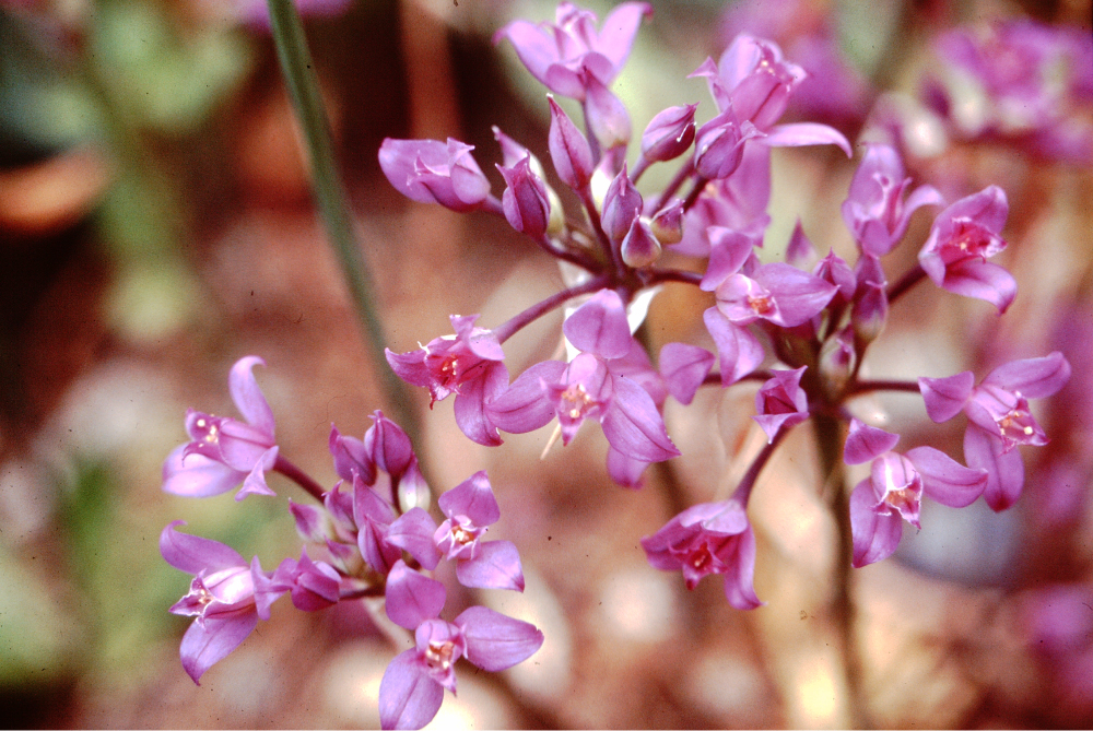
Hooker’s onion flower from bulbs grown in pot by Richard Hebda. Photo Dr. Richard Hebda.
Flowers are borne on a firm rounded stalk which ranges from 10-30 cm (4-12″) tall. Two papery bracts surround the bud which contains five to 30 flowers. The blooms sit upon more or less equally long stalklets (called pedicels by botanists), so that the head forms a loose umbel reaching about 7.5 cm (3″) across. Each flower consists of six perianth segments, three petal-like sepals and three petals. The lance-shaped petal-like sepals reach about 1 cm (0.4″) long. Their tips notably reflex especially with age. Six short anthers surround a slightly crested ovary which bears a clearly visible stigma. Mostly the sepals and petals are pink, but may vary from intense rosy purple to nearly white.
In mild coastal climates the first signs of life appear in early February as leaf tips emerge. In Victoria, this occurs well before the end of winter, and sometimes the snow and frost may freeze back young shoots. During April, leaves continue to get longer and reach their maximum length. By the end of the month the first flower stalks poke out of the ground reaching up to 30 cm (12″) tall in June when flowers open. Capsules split in July to reveal black seeds which are easy to harvest by sharply shaking seed heads into a bag.

By Matt Lavin from Bozeman, Montana, USA (Allium acuminatum). CC BY-SA 2.0, via Wikimedia Commons
Hooker’s onion ranges from southern British Columbia to northern California and eastward to Colorado and Wyoming then southward to Arizona. In BC its distribution includes dry parts of Vancouver Island and the adjacent mainland extending into the Fraser Canyon. In our region Hooker’s onion clearly favours dry rocky sites, typically growing in pockets of soil on rocky knolls and coastal headlands. Sometimes it survives in only about 5 cm (2″) of mossy crust cover over bedrock, yet it flowers reliably every year. Occasionally this onion thrives under Garry oaks (Quercus garryana), albeit in very shallow stony soil.
These bulbs are little cultivated and rarely available, yet they thrive under appropriate conditions and produce a pleasing display. The site must be in full sun, sharply drained and with a sandy soil. Avoid summer watering. Rock gardens, the front of dry perennial beds and pots of gritty soil suit Hooker’s onion well in the milder parts of southern B.C.
Plant bulbs about 5 cm (2″) deep about 5 – 7.5 cm (2-5″) apart so that the flower heads touch. Divide the clusters every five to ten years in late summer.
Order Hooker’s onions from specialist native plant suppliers or grow them from fall-sown seed. Do not dig this relatively rare plant in the wild.
First Nations of coastal British Columbia savoured various wild onion species including Hooker’s onion. Bulbs were eaten raw or steamed in great pits. In some areas the pits were lined with pine boughs and covered with lichens and alder boughs. Bulbs and shoots have a mild onion flavour and smell.
Hooker’s onion may be hardy to as low as zone 4 in BC, but its natural distribution suggests zone 5 or higher. We have several native onion species in the Native Plant Garden of the Royal B.C. Museum which flower mainly in June
Cow-parsnip post
Heracleum maximum
Flowerhead of cow-parsnip showing flat-topped form and typical huge leaf bases. Photo Dr. Richard Hebda.
Many of the vegetables we eat came originally from Europe, Asia and Latin America. The aboriginal peoples of British Columbia were unfamiliar with these food plants, nevertheless they feasted on several indigenous green vegetables. The most widely eaten among these was the cow-parsnip (now called Heracleum maximum, recently known as Heracelum lanatum), also referred to as Indian rhubarb or wild rhubarb.
Cow-parsnip belongs to the Parsley Family (Umbelliferae or Apiaceae) and grows in the form of a gigantic perennial herb. A thick hollow stem stands 1-3 meters (40-120”) tall and bears large broad leaves. Stems are lightly ridged and woolly. Each leaf is divided into three segments with coarse teeth. Leaves occur at the base of the stalk and along it. Sometimes you will see big swollen structures at the leaf bases. These are flower buds just waiting to emerge.
The stem top is crowned by several handsome, flat-topped flower heads. Each head consists of numerous umbrella-like clusters of small white blossoms that vary in diameter from 0.5 to 1 cm (0.2-0.4”) across. There are five creamy-white petals in each flower. The blooms circling the outside of each cluster are usually larger and often slightly irregular in form. Five spindly stamens bearing greenish anthers surround a greenish pistil. Cow-parsnip produces robust flattened seeds which remain on the stalk well into the summer.
Cow-parsnip thrives in rich moist soil along streams and rivers, roadsides and in meadows. You will often find it forming large colonies. It has a wide climatic tolerance, growing from sea level to the alpine zone. The Parsnip River in east central British Columbia is named after this plant. Cow-parsnip may be seen almost anywhere in North America in suitable habitats.

Damp alpine meadow habitat of cow-parsnip on the west side of Hudson Bay Mountain near Smithers, BC. Flower-topped stalks of cow-parsnip are visible in the middle of the image to the right of and above patches of purple lupine blooms. Photo Dr. Richard Hebda.
Almost every First Nations group in British Columbia ate cow-parsnip as a green vegetable. Before the flowers appeared in spring, young stalks and leaf stems (petioles) were peeled and eaten raw. Sometimes they were boiled, steamed or roasted. Bruised cow-parsnip plants emit a strong smell but the stems are sweet and juicy, somewhat like celery. Coastal people ate cow-parsnip with eulachon fish grease.
According to Saanich Elders Violet Williams and Elsie Claxton, the stalks had to be collected for eating before the flower buds opened. Otherwise they were tough to chew and tasted too strong.
Be aware that members of the parsley family, especially water hemlock (Cicuta douglasii) and poison hemlock (Conium maculatum) contain terribly strong poisons which can kill a human. You must be certain that the plant you intend to eat is a cow-parsnip.

Peeled young cow-parsnip shoots ready for eating. Photo Dr. Nancy Turner and Robert D. Turner. Used with permission.
Cow-parsnip plants can make a bold addition to your garden but you must give them room. They are best raised from seed, collected as soon as it is mature, and planted in a rich moist soil. You may be able to carefully transplant very young seedlings too, but I suspect that this technique is not often successful.
Cow-parsnip has one characteristic you should be wary of. Like its gigantic relative, giant cow-parsnip or hogweed (Heracleum mantegazzianum), cow-parsnip contains chemicals that may cause severe skin inflammation known as dermatitis. The sap of the plant has particularly strong activity. Ultraviolet rays from the sun activate the compound and may cause the skin to redden and even produce permanent discoloration. Not all people are so affected but be warned to handle the plant carefully especially on a hot sunny day.
The plant supposedly obtained its name after the Greek god Heracles (Hercules). The previously-used species name “lanatum” refers to the “woolly” leaves and parts of the stem.
As you see great stretches of cow- parsnip along our province’s highways, think of it not as a roadside weed but as a valuable food of British Columbia’s First Nations. Cow-parsnip is hardy to zones 2-3 in Canada.

By Dcrjsr – Own work, CC BY-SA 3.0, Link
Mountain Sorrel post
Oxyria dignya
Wild nibbles make a pleasant treat while hiking in the bush. Most often the tasty treat consists of berries of one sort or another, but the occasional green provides a refreshing chew. Mountain sorrel (Oxyria digyna) can spare a leaf or two for the adventurous alpine wanderer.
This delightful hardy herb grows from the top of a tenacious stout tap root. Fleshy, kidney-shaped leaves arise on leaf stalks attached to a short erect stem. Leaf blades range from 1-5 cm (0.4-2”) wide, their stalks 4-8 cm (1.6-3.2”) long. Normally they are coloured bright green but may turn greenish red as the season advances or in really tough sites. There is usually also a single leaf on the stem. The leaves have a sour, but refreshing, acid taste, hence the botanical name Oxyria derived from Greek the word “oxys” which means sharp.

A thriving Mountain sorrel plant showing typical leaves and reddish flowers and fruits. Photo Dr. Richard Hebda.
Like all members of the Buckwheat Family (Polygonaceae), mountain sorrel has small hard- to-see flowers. They cluster irregularly along a 10 to 60 cm (4-24”) tall, narrow flower stalk. Each green to reddish flower consists of four tiny “petals” joined at the base. Two of the petals are keeled, the other two are not. Inside the flowers reside six stamens and a two-parted pistil. Flowers appear from June to August according to elevation and latitude. At maturity, the fruit is broadly winged, turning a showy reddish purple. The fruit is mostly translucent and literally shines when the sun’s light passes through it.
Mountain sorrel ranges throughout the mountains of British Columbia and Alberta, south to New Mexico and California, and north through Alaska and the Yukon and across the Arctic. It also inhabits most of the mountains of Asia and Europe. In our province, mountain sorrel thrives in alpine scree and rock crevices and can be found in suitable habitats on almost every high mountain, to the elevation where no other plants can survive.
Surprisingly this delightful little mountain nibble will grow in lowland rock gardens. It needs a relatively moist gritty run for its root and full sun. In our coastal lowlands mountain sorrel probably needs to be sheltered from full scorching mid-day heat. Plants are best raised from seed sown carefully in the site where it is to grow. Sow the seeds in very stony and moist, but not rich, soil.

The typical harsh high mountain home of mountain sorrel at Shelagyote Peak north of Smithers BC with pink River beauty (Epilobium latifolium) dotting the slope. Photo Dr. Richard Hebda.
Okanagan First Peoples ate fresh raw leaves, but never too many at a time because the oxalic (sour) acid in the plant can be harmful if taken in large quantity. This sorrel contains abundant Vitamins A and C and was used against scurvy in Europe. Like other wild and cultivated sorrels it was widely cooked as a pot herb. A few leaves add a spritely bite when mixed into a salad.
This amazing plant has an incredible story to tell about the glacial history of our province. Studies of the chloroplast DNA by Royal BC Museum and University of Victoria reveal that the genetic makeup of the alpine herb in BC is surprisingly diverse. Within BC, the high diversity and the occurrence of ancient genetic forms suggest that high elevation mountains in the north escaped the last glaciation, contrary to widely accepted thinking.
Mountain sorrel is hardy to zone 0 in Canada. In fact,it is pretty much the hardiest of all plants in the world.
Click here to learn about using DNA to trace the migration of BC’s alpine species*
*Originally published in the Winter 2014 issue of What’s inSight Magazine.
Thimbleberry post
Rubus parviflorus

Highly ornamental flowers of British Columbia’s native thimbleberry. Photo by Dr. Richard Hebda. Saanich, Vancouver Island, British Columbia.
British Columbia is home to shrubs with many uses. For example our Oregon-grapes (Berberis or Mahonia species) make excellent year-round ornamentals, whose fruits produce tasty jelly. Few of our shrubs however can match the thimbleberry of the Rose Family (Rosaceae) for utility. Not only does it have tasty fruits, but this shrub produces edible shoots, soap from its stems, and is an attractive and widely-adapted subject for gardens.
Thimbleberry forms waist- to head-high thickets of numerous erect stems. The stems are thorn-free, unlike the closely related raspberries and blackberries. The bark is distinctively flaky and especially hairy on new growth. Maple-like leaves, 10-30 cm (4-12″) across occur at the ends of the stems. Each one has seven to nine lobes and a texture like soft sandpaper.
Open flower clusters, containing three to eleven blooms develop at the ends of the branches. Each bright white flower can be as wide as 7-8 cm (3″) across. Five long greenish sepals surround five clear white oval petals. A ring of many stamens encircles a central fleshy dome. This dome is the swollen end of the stem, and attached to its surface are numerous tiny greenish pistils. Once the egg in each pistil is fertilized, the pistil transforms into a tiny red fruit with a hard seed inside. The mass of little fruits forms a shallow “thimble” over the central dome, looking like a thin raspberry. The velvety thimbles are somewhat dry but usually taste very sweet.

Thimbleberry shrub blooms. Photo by Dr. Richard Hebda. Saanich, Vancouver Island, British Columbia.
Thimbleberry grows throughout much of British Columbia except the far north. On the continent you can encounter it from Alaska to northern Mexico and eastward to Ontario and Colorado. Typical haunts include open sites, often at the edge of woods, roadsides and shorelines. Surprisingly thimbleberry inhabits both moist and dry sites and occurs across a wide range of elevations from sea level to the high subalpine zone; a widely-adapted plant. Notably, it is one of the species to colonize early after disturbance particularly along highways.
Thimbleberries are excellent subjects for naturalizing in corners of suburban lots. They seem not to be choosy about soil conditions and will grow on raw unprepared surfaces. In fact, in some places they will appear on their own, presumably inoculated from bird droppings. They will grow in full sun to part shade. These shrubs quickly form thickets, generating wildlife cover and stabilize the soil. Butterflies love the flowers and birds relish the fruit.

Delicious fruit of thimbleberry. Photo by Robert D. Turner. Used with permission.
You can often purchase thimbleberries from the local nursery or garden centre by asking them to order it in. There are several suppliers in British Columbia. This native species has recently become available through mail-order from seed and nursery catalogues. Thimbleberries can be raised from seed sown in place in the garden in the fall for germination in the spring. Rooted offset stems will also transplant in a dormant state.
First Nations of British Columbia used thimbleberry for many purposes. Fruits were eaten fresh by most groups or pressed and dried into cakes for later. People of the west coast of Vancouver Island gathered canoe-loads of sweet and juicy spring shoots, peeled and ate them raw. Okanagan people lined their steam-cooking pits with the large leaves. Shuswap Carrier First Nations used the leaves to separate different types of berries in a picking basket. The Cowlitz of nearby Washington State boiled the bark for soap. Today hikers nibble on the wild fruit during their wanderings.
The technical name “Rubus” is based on an ancient Roman name for a related plant. The species name “parviflorus” means “small-flowered”, hardly appropriate for the large attractive blooms produced by thimbleberry.
Thimbleberry is a widely adapted native shrub for most gardens in the province; fruit, vegetable, ornamental and soil healer all rolled into one. It is hardy to Zone 3 in Canada.
Pacific Crab Apple post
Malus fusca
Photo by Gordon Leppig & Andrea J. Pickart. Public Domain.
Have you sometimes wondered what the wild ancestors of our highly-bred food plants may have looked like? The wild apples that spring up in hedgerows on Vancouver Island are often as large as our cultivated forms. Our cultivated crab apples, though they may seem closer to the wild than regular apples, are still the result of breeding. British Columbia’s native Pacific crab apple (Malus fusca or Pyrus fusca), however, may look very much as the ancestors of cultivated apples did many thousands of years ago. Bearing scented blooms, edible fruit and growing to a small stature, it has much potential as a garden and landscape plant.
Pacific crab apple, also known as Oregon crab apple, forms shrubs to small trees from 2 to 12 m (6½ to 40 ft.) tall. Plants branch widely and often form extensive thickets. Distinctive, spine-like, short shoots line the branches but are not nearly as vicious as those of black hawthorn (Crataegus douglasii) or English or common hawthorn (Crataegus monogyna). The grey bark becomes scaly or deeply fissured with age. Oval and pointed leaves look as if they are a cross between those of the domesticated pear and apple. These weakly-toothed leaves sometimes may be lobed near the base.
Delightful blooms have an apple-blossom scent and appear in flat-topped clusters in the spring. Most flowers are white or creamy, but sometimes they take on a warm pink blush and can be very showy. Each flower is about 2 cm (slightly less than an inch) across. The five petals extend well beyond the cluster of stamens in the centre. As in apples and pears, the ovary is inferior, meaning that it is located below, not on the inside of the petals and sepals. In late summer, bunches of oval to cylinder-shaped fruits dangle from long red stalks. Each fruit is about the size of the end of your little finger. An open-grown tree can be “dripping” in fruit similar to some cultivated crab apples. At first the fruits are green and shiny but within a few weeks they turn yellow, pinkish and sometimes even purplish-red. Ripe fruit clusters, especially those well exposed to sunlight, are very attractive. The fruit tastes pleasantly tart when coloured up. After frost it turns brown and mushy but sweet.

Ripening fruits of Pacific crab apple at Island View Beach, Saanich Peninsula, British Columbia. Photo by Dr. Richard J. Hebda.
Pacific crab apple occurs along the British Columbia coast well up many of the main river systems from Alaska to Vancouver Island and on the adjacent mainland to elevations as high as 800 m (2600 ft.). The full geographic range extends all the way from the Aleutian Islands to northern California. The natural habitat tends to the moist side and includes damp woods, stream sides and coastal bogs. These amazing bog trees resemble large gnarled and twisted “creatures” that seem to hail from some distant prehistoric times. They also occur frequently just inland of the ocean shoreline, especially behind beaches and at the edges of estuaries, which suggests that they tolerate salt spray. On some outer coast islets, exposed to the full influence of the sea, our native crab apples may be the only broad-leaved tree among a mass of Sitka spruce (Picea sitchensis) and other conifers.
The hard wood of the Pacific crab apple was widely used along the coast. From it, First Nations people fashioned tool handles, bows, sledgehammers and smaller items, such as spoons and fish hooks. The Nisga’a of northwest B.C. pegged their house boards in place with crab apple wood. The fruit was harvested in early fall and eaten fresh or stored in boxes under water. Apparently, this stored fruit sweetened and softened over time. Medicines, often in combination with other plants, were made from the bark. These medicines were used for a range of internal and external ailments such as stomach problems and skin complaints. The bark and other parts of the tree release hydrogen cyanide, so use only with caution. The flesh of the fruits apparently does not produce much cyanide.
In the garden, Pacific crab apple features best as a specimen tree in an open area. Slow growing, the crown eventually spreads farther than the tree reaches in height. Leaves turn gold and then even red in the fall and combine very attractively with the colours of the ripening fruit. The fruit makes excellent jelly and can be added to other jellies as a natural source of pectin. Wild birds enjoy the ripe fruit, too. Closely planted trees can from a fine dense hedge, and might be good candidates for hedges near the seashore. Plants are best raised from seed sown in the fall in pots and left outside. Seedlings normally take two years to become large enough to plant out.
Up to now the native plant literature has not given much attention to Pacific crab apple, but it has considerable possibilities. The attractive form, flowers and potential for heavy wild fruit production all point to a valuable native species for the garden landscape. Pacific crab apple is hardy to zones 5-6 in Canada.
Yarrow post
Achillea millefolium

Details of yarrow flowers, taken along a roadside in Colwood BC in December. The petals of the white ray florets have been twisted by frost. The brownish grey disk florets are visible in the centre of each little flower head. Photo by Dr. Richard J. Hebda.
Numerous plant species release strong scents when brushed. In the past, these smells were taken as a sign that the plant may have medicinal properties. Even today, some popular remedies still depend on aromatic compounds from plants. For example several brands of cough candies contain derivatives of the eucalyptus plant notable for its distinctly flavoured oil. Many strongly-scented plants thrive in British Columbia, including common or white yarrow (Achillea millefolium), a species well known around the world for its healing value.
Yarrow, a member of the Aster Family (Asteraceae), grows as a herbaceous perennial with leaves and flowers arising from creeping underground or near-surface root stocks. The aromatic fern- or feather-like leaves are finely divided and feel soft. Leaves cluster mostly at the base of the flowering stalk; these leaves are mainly 10-15 cm (4 – 6 inches) long. Many soft small hairs cover the plant making it appear greyish-green.
Tiny flowers crowd into small flower heads, that are further arranged into flat-topped clusters on stalks up to 100 cm (40 inches) tall. Each small flower head in the cluster consists of three to eight tiny ray flowers with a strap-shaped petal, and disk flowers with only reproductive parts. The flowers are white to pinkish and appear from May to October depending on the local climate. On south Vancouver Island they even bloom as late as December. The flower tops dry and turn brown by the end of summer, producing many one-seeded, smooth and flattened fruits.
Yarrow occurs from low to high elevations and often becomes weedy in disturbed settings. This herb thrives in coastal meadows and the arid sage brush steppe of the interior of BC. We also encounter it often in the lower part of the alpine zone during our studies of BC’s mountain flora. You can find yarrow throughout British Columbia and over much of North America. It also occurs across northern and central Europe and Asia.

Yarrow flower head. Photo from page 115 of Saanich Ethnobotany: Culturally Important Plants of the WSANEC People by Nancy J. Turner and Richard J. Hebda.
Yarrow has been valued as a garden plant for centuries. Various forms are available for you to purchase as plants from garden centres and through mail order. Seeds of many colourful selections, especially red and pink shades, are sold through seed catalogues. Plants are easily raised from seed sown into light seed compost or peat pellets in the fall or spring. Rhizome divisions transplant easily too.
Dwarf varieties thrive in rock gardens. Larger types are suitable for mixed borders, perennial beds and the cutting garden. When mowed regularly, yarrow forms a soft-scented ground cover especially valuable for dry lawns. Yarrow is also an excellent subject for the xeriscape garden. This tough plant has been suggested for erosion control on slopes too.

Finely-divided soft leaves of yarrow photographed in January in Saanich BC. Photo by Dr. Richard J. Hebda.
Many First Nations Elders of the B.C. interior value yarrow as a medicine, especially to treat sores. Ulkatcho people of the west Chilcotin soak the leaves in hot water, then apply them in a poultice to sore muscles. This same poultice can also be used to treat saddle sores on horses. Washed and crushed roots were recommended for toothaches. Various teas and concoctions were prepared for internal problems and as a general tonic. Fresh leaves crushed and rubbed on the skin or put to smoke away in a fire act to repel mosquitoes.
Herbal users should be aware that yarrow is “phototoxic.” Skin exposed to crushed or rubbed yarrow may become irritated when exposed to strong sun.
The name Achillea derives from the Greek hero, Achilles, who well knew the medicinal properties of the plant. The finely divided leaves are responsible for the species name “millefolium” meaning “thousands of leaves”. Yarrow is hardy to zone 2 in Canada.

